The Chalets of Ratière

The Briançonnais region is home to over twenty hamlets overlooking the valley, each as charming as the next. Here is Ratière, above the village of Prelles.

Details

169233
Creation:
Last update:
Last review:
  • Walking
    Activity: Walking
  • ↔
    Distance: 5.60 mi
  • ◔
    Average duration: 4h 15 
  • ▲
    Difficulty: Moderate

  • ⚐
    Back to start: Yes
  • ↗
    Ascent: + 1,962 ft
  • ↘
    Descent: - 1,962 ft

  • ▲
    Highest point: 5,840 ft
  • ▼
    Lowest point: 3,878 ft

Description of the walk

Coming from Briançon, turn left at the crossroads, pass the Aldi shop and park opposite the La Rochette housing estate.

(S/E) Continue along the road, following the sign for Sachas; this road forms part of theGR®653D(the route from Montgenèvre to Arles, known as the Way of St James via the Domitian Way). You will reach a crossroads.

(1) Leave theGR®653Don your left, stay on the road, and pass through junctions2 and 3, ignoring the footpaths. Continue along the road until you reach the junction just before the hamlet of Sachas.

(4) Leave the road to the left and rejoin it at a wooden hut.

(5) Walk past a wayside shrine, staying on the path running parallel to the road. You’ll reach the junction by the Piolier chalets.

(6) Continue to the right, then join a path on the left.

(7) Take this to cut across the bend and reach the green gate at a wide track.

(8) Turn right onto this track, which climbs steeply before joining a much flatter path through the forest. Cross the road again and walk past another wayside shrine.

(9) Continue along this path and, after a final gentle climb, reach the hamlet of Ratière.

(10) Begin the descent along the track, then join the path you took on the way up on the left, which leads back to the wayside shrine.

(9) Follow the route you took on the way up to the junction cutting across the bend.

(7) Take the path on the left which leads back to the road.

(5) Continue to the left, which allows you to cut across the road and rejoin it.

(4). Then take the path on the left rather than the road, rejoining it directly opposite the power line.

(3) Join the road again and follow it to the large meadow on the left.

(2) Cross this meadow – initially on open ground – then follow a clear path which leads back to the road.

(1) Continue to the left to return to the car park.
Waypoints

  1. S/E : mi 0 - alt. 3,878 ft - La Rochette car park
  2. 1 : mi 0.23 - alt. 3,970 ft - GR junction
  3. 2 : mi 0.54 - alt. 4,104 ft - Carrefour Pré
  4. 3 : mi 1.11 - alt. 4,304 ft - Power line junction
  5. 4 : mi 1.48 - alt. 4,485 ft - Sachas Crossroads
  6. 5 : mi 1.59 - alt. 4,570 ft - Crossroads with a wooden hut
  7. 6 : mi 1.84 - alt. 4,649 ft - Piollier Crossroads
  8. 7 : mi 2.1 - alt. 4,764 ft - Crossroads with a hairpin bend
  9. 8 : mi 2.25 - alt. 4,888 ft - Crossroads and barrier
  10. 9 : mi 2.63 - alt. 5,292 ft - Oratory
  11. 10 : mi 3.14 - alt. 5,840 ft - Ratière Chalets
  12. S/E : mi 5.6 - alt. 3,878 ft - La Rochette car park

Notes

This round-trip route to the chalets, which are accessible by road, offers numerous shortcuts. It is advisable to take these, using either the map extract and GPS track, or the 1:25,000 map, as a guide. However, there is no reason to get lost here. You will always find your way back to the road, so if in doubt, simply follow it all the way to the end.
Water is available from the chalets’ fountains.
Hiking equipment.
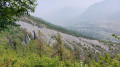
From Ratière, you’ll enjoy a remarkable view over the Durance valley and the nearby mountains to the east, dominated by the Pic de Peyre Eyraute.
Further to the north-east, the Chaberton, at an altitude of 3,131 metres, majestically overlooks this border region.

Worth a visit

The classic routes here:
Briançon.
Ski resorts: Serre Chevalier, Montgenèvre, Puy Saint Vincent, Vallouise, Pelvoux and Montgenèvre at the foot of the Chaberton.

Always be cautious and plan ahead when you're outdoors. Visorando and the author of this route cannot be held responsible for any accidents occurring on this route.

The GR® and PR® markings are the intellectual property of the Fédération Française de Randonnée Pédestre.

Reviews and comments

5 / 5
Based on 2 reviews

Reliability of the description
5 / 5
Ease of following the route
5 / 5
Route interest
5 / 5
skyppyy38360
skyppyy38360

Overall rating : 5 / 5

Date of your route : Apr 15, 2017
Reliability of the description : ★★★★★ Very good
Ease of following the route : ★★★★★ Very good
Route interest : ★★★★★ Very good

Brilliant! For those of you arriving in Briançon, it’s an easy warm-up.

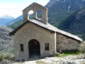
We missed the start (which is quite common for us), so we set off further down from Prelles, Les Andrieux, at the foot of the cemetery. We followed a section of the GR to catch up to the starting point (1) and chose to climb all the way up via the road and the forest track, which aren’t very steep, then head down via the shortcuts (watch out for mountain bikes – this is their playground). It’s a lovely walk. The hamlet of Sachas is typical; La Ratière is well worth a visit – don’t miss St Anne’s Chapel with its fire hoses on the side.
Some lovely views

Thanks to the author

Machine-translated

Chris3084
Chris3084

Overall rating : 5 / 5

Date of your route : Feb 23, 2017
Reliability of the description : ★★★★★ Very good
Ease of following the route : ★★★★★ Very good
Route interest : ★★★★★ Very good

We went for a walk in the afternoon. A pleasant, well-marked route. Half an hour from our destination, we came across patches of snow; this is to be expected at this time of year. There was a drinking fountain at the end of the walk. A lovely village with a 360-degree view.

Machine-translated

Other walks in the area

For more walks, use our search engine .

The GPS track and description are the property of this route's author. Please do not copy them without permission.