The Chalets du Mélézin, starting from Villar-Saint-Pancrace

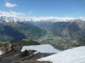
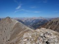
The Chalets du Mélézin overlook Briançon and therefore offer a remarkable view of the town as well as the valleys of the Durance and its tributary, the Guisane.

Details

38510088
Creation:
Last update:
Last review:
  • Walking
    Activity: Walking
  • ↔
    Distance: 4.10 mi
  • ◔
    Average duration: 3h 35 
  • ▲
    Difficulty: Moderate

  • ⚐
    Back to start: Yes
  • ↗
    Ascent: + 1,995 ft
  • ↘
    Descent: - 1,995 ft

  • ▲
    Highest point: 6,227 ft
  • ▼
    Lowest point: 4,209 ft

Description of the walk

Park in the car park at the Maison de la Montagne in Villar-Saint-Pancrace.

(S/E) Return to the road, then turn right onto the Route des Ayes and follow the red and white markings ofthe GR®5. When you reach a crossroads, take the left-hand road – this is still theGR® – and, after a bend, you’ll come to a junction with a footpath.

(1) Leave theGR® here; please note that on the IGN map it is still shown as theGR®, but the markings are no longer visible at this point. Continue uphill to reach the junction at the Lauzin clearing.

(2) Carry on to the left, uphill, and, after a few hairpin bends, you’ll reach the tarmac road to Les Ayes.

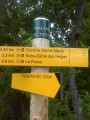
(3) Cross the road and, opposite (signposted ‘Mélézin’), take the path into the woods. Wind your way along this very pleasant route and, after a final, steeper climb, you’ll reach the Chalets du Mélézin.

(4) Retrace your steps along the route you took on the way there until you reach the crossroads at the Lauzin clearing.

(2) Turn left onto the wide path and rejoin the tarmac road.

(5) Cross it and take the yellow-marked path opposite. Continue until you rejoin the road and follow it for about a hundred metres to a hairpin bend protected by concrete blocks.

(6) Pass between two boulders and continue along the wide, descending path – this is the Botanical Trail. You’ll reach the Anciennes Mines crossroads.

(7) Turn right downhill and, at the rock-climbing site, turn left to reach the car park at the Maison de la Montagne in Villar-Saint-Pancrace (S/E).

Waypoints

  1. S/E : mi 0 - alt. 4,232 ft - Maison de la Montagne car park
  2. 1 : mi 0.65 - alt. 4,580 ft - Lauzin crossroads
  3. 2 : mi 0.93 - alt. 4,911 ft - Lauzin Clearing
  4. 3 : mi 1.06 - alt. 5,075 ft - Road junction
  5. 4 : mi 1.89 - alt. 6,227 ft - Melezin. Viewpoint over the valley of the - La Durance
  6. 5 : mi 3.11 - alt. 4,905 ft - Road junction
  7. 6 : mi 3.43 - alt. 4,777 ft - Hairpin bend
  8. 7 : mi 3.59 - alt. 4,672 ft - Old mines
  9. S/E : mi 4.1 - alt. 4,232 ft - Maison de la Montagne car park

Notes

(4) Chalets du Mélézin: there are two fountains here.

Worth a visit

(7) Old mines: found throughout the Briançon area and particularly here in Villar-Saint-Pancrace, where they are known as ‘mines paysannes’.

Always be cautious and plan ahead when you're outdoors. Visorando and the author of this route cannot be held responsible for any accidents occurring on this route.

The GR® and PR® markings are the intellectual property of the Fédération Française de Randonnée Pédestre.

Reviews and comments

4.8 / 5
Based on 2 reviews

Reliability of the description
5 / 5
Ease of following the route
5 / 5
Route interest
4.5 / 5
alain83400
alain83400

Overall rating : 5 / 5

Date of your route : Aug 25, 2025
Reliability of the description : ★★★★★ Very good
Ease of following the route : ★★★★★ Very good
Route interest : ★★★★★ Very good
Very busy route : No

A very beautiful hike through the larch forest, which I completed with the climb to the Chalets des Ayes and the descent via the GR trail.
This hike must be even more beautiful in autumn to enjoy the colours of the larch trees.

Machine-translated

F13140
F13140

Overall rating : 4.7 / 5

Date of your route : Aug 11, 2025
Reliability of the description : ★★★★★ Very good
Ease of following the route : ★★★★★ Very good
Route interest : ★★★★☆ Good
Very busy route : No

The climb is quite tough. The view from the chalets is beautiful. But if I were to do this hike again, I think I would descend via the village of Les Ayes to enjoy the heights a little more and vary the route, even if it means making it a little longer.

Machine-translated

Other walks in the area

For more walks, use our search engine .

The GPS track and description are the property of this route's author. Please do not copy them without permission.