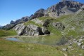
The Col de Vallouise

Discover this interesting pass, which links the Briançonnais and the Durance Valley to the Pays des Ecrins and the Gyronde Valley.

Details

131864
Creation:
Last update:
Last review:
  • Walking
    Activity: Walking
  • ↔
    Distance: 6.20 mi
  • ◔
    Average duration: 4h 55 
  • ▲
    Difficulty: Difficult

  • ⚐
    Back to start: Yes
  • ↗
    Ascent: + 2,402 ft
  • ↘
    Descent: - 2,402 ft

  • ▲
    Highest point: 8,484 ft
  • ▼
    Lowest point: 6,106 ft

Description of the walk

Park in the clearly signposted car park after the hamlet of Les Combes.
(S/E) Continue along the track heading north-west to reach the track junction.

(1) Take the track on the left; you’ll soon reach another junction.

(2) Take the left-hand path marked in yellow, which climbs steeply to the Col de la Trancoulette.

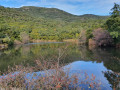
(3) Leave the paths on the left and take the path on the right, which initially runs along a ridge and leads to the two small, unnamed lakes in the mountain pasture.

(4) Continue across the mountain pasture to the left (cairns) and, after a gentle climb, join the path at Peyre du Fey.

(5) Take this path on the left and you’ll soon reach the Col de Vallouise.

(6) Return to the previous junction.

(5) Keep left on the yellow-marked path, which is the direct route to the pass. You’ll reach the junction by the lakes.

(4) Then follow the same route as on the way out to return to the car park (S/E).
Waypoints

  1. S/E : mi 0 - alt. 6,106 ft - Les Combes car park
  2. 1 : mi 0.26 - alt. 6,227 ft - Crossroads of the trails
  3. 2 : mi 0.66 - alt. 6,545 ft - Trail junction
  4. 3 : mi 1.44 - alt. 7,507 ft - Col de la Trancoulette (2332m)
  5. 4 : mi 2.02 - alt. 7,644 ft - Crossroads of Les Lakets
  6. 5 : mi 2.91 - alt. 8,415 ft - Trail junction
  7. 6 : mi 3.12 - alt. 8,474 ft - Col de Vallouise (2621m)
  8. S/E : mi 6.2 - alt. 6,106 ft - Les Combes car park

Notes

No springs along the route. A fountain at the crossroads at point (1).
No shelter.
Hiking kit required.

This route passes through a protected area, which may be subject to special regulations:

Worth a visit

Above the pass (a further 300m climb) lies the beautiful summit of La Condamine, which offers an exceptional view of the surrounding area.
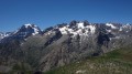
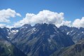
From the pass itself, the view of the high peaks of the Ecrins is particularly pleasing: La Barre, Le Pelvoux, Les Bœufs Rouges and Le Sirac.
And finally, the Gyronde river, mentioned in the Introduction, takes its name from the confluence of its two headwater rivers: the Gyr and the Onde. As you will have realised, it has nothing to do with its Aquitaine counterpart, the Gironde.

Reviews and comments

4.4 / 5
Based on 3 reviews

Reliability of the description
4.3 / 5
Ease of following the route
4.3 / 5
Route interest
4.7 / 5
lougris
lougris

Overall rating : 4 / 5

Date of your route : Jul 18, 2024
Reliability of the description : ★★★★☆ Good
Ease of following the route : ★★★☆☆ Average
Route interest : ★★★★★ Very good
Very busy route : No

Hello,
Thank you for suggesting this route. I set off at 7.30 am. During the ascent, I was all alone in the world; only the marmots, in great numbers, kept me company. On the way back, there were very few walkers but a few climbers.
The first section is full of flowers and lush vegetation.
At the junction (4), there was no cairn. I followed the trail, but at one point I lost it. After going round in circles for quite a while, I decided to follow the route back. When I have more time, I’ll go back to take the right path.
Otherwise, a lovely walk.

Machine-translated

beaber
beaber

Overall rating : 5 / 5

Date of your route : Aug 11, 2021
Reliability of the description : ★★★★★ Very good
Ease of following the route : ★★★★★ Very good
Route interest : ★★★★★ Very good
Very busy route : No

A very pleasant walk, with meadows, cows and a bit of mountain scenery. Not many people about. At the very top, a lovely view.
No difficulty at all.

Machine-translated

pasleb
pasleb

Overall rating : 4.3 / 5

Date of your route : Aug 22, 2020
Reliability of the description : ★★★★☆ Good
Ease of following the route : ★★★★★ Very good
Route interest : ★★★★☆ Good
Very busy route : No

When we reached the junction, the cairn wasn’t there. We rebuilt it. However, there are trail signs for a running route at this point. Don’t follow them; make sure you turn left.

Machine-translated

Other walks in the area

For more walks, use our search engine .

The GPS track and description are the property of this route's author. Please do not copy them without permission.