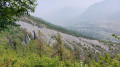
The Croix d’Aquila

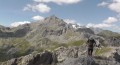
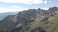
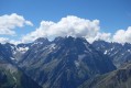
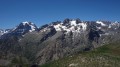
A climb to a summit offering a stunning panoramic view of the surrounding mountains of the Briançonnais and some of the peaks of the Écrins.

Details

276303
Creation:
Last update:
Last review:
  • Walking
    Activity: Walking
  • ↔
    Distance: 4.16 mi
  • ◔
    Average duration: 3h 40 
  • ▲
    Difficulty: Moderate

  • ⚐
    Back to start: Yes
  • ↗
    Ascent: + 1,998 ft
  • ↘
    Descent: - 1,995 ft

  • ▲
    Highest point: 8,077 ft
  • ▼
    Lowest point: 6,122 ft

Photos

Description of the walk

From the southern crossroads in Briançon (on the Route des Grandes Alpes, between the petrol station and the ski lift access point), take the D35 towards Puy-Saint-André and then Puy Chalvin. The road turns into a track. Head to the hamlet of Les Combes, pass through it, and park 1 km further on at the car park at the end of the track.
It is possible to reach this car park in a standard car, but, as with any track, an SUV is obviously more suitable.

(S/E) From the car park, take the lane that continues from the track, then head for the junction at a hairpin bend (barrier, sign).

Leave the track, head uphill to the left and, after the picnic area (benches, tables), follow the track to the right until you come to a sign 300 metres further on.

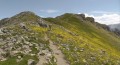
(1) At the sign, turn left towards the Col de la Trancoulette. The well-marked path climbs through the larch trees, emerging to the west into a valley. Our path curves widely to the left, heading south.

Follow a winding ascent in this direction to reach the Col de la Trancoulette.
Look out for the summit on the left.

(2) Take the path on the left and follow it south-east to the summit bastion.

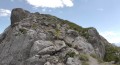
A very easy scramble over a few metres takes you to the summit, marked by the Croix d’Aquila.

(3) After a moment to take in the view, retrace your steps along the same route back to the starting point. (S/E).

Waypoints

  1. S/E : mi 0 - alt. 6,122 ft - Car park at the end of the track
  2. 1 : mi 0.69 - alt. 6,542 ft - Crossroads, path
  3. 2 : mi 1.37 - alt. 7,523 ft - Col de la Trancoulette (2332m)
  4. 3 : mi 2.08 - alt. 8,035 ft - Croix d’Aquila
  5. S/E : mi 4.16 - alt. 6,122 ft - Car park at the end of the track

Notes

I’ve made a video, including the names of the peaks, which shows the route and the atmosphere of the walk.

There’s nothing out of the ordinary about this half-day trail walk.
I should point out, however, that there is a short, slightly exposed section near the summit.

Reviews and comments

4.7 / 5
Based on 2 reviews

Reliability of the description
4.5 / 5
Ease of following the route
4.5 / 5
Route interest
5 / 5
grand-nord17
grand-nord17

Overall rating : 5 / 5

Date of your route : Aug 08, 2021
Reliability of the description : ★★★★★ Very good
Ease of following the route : ★★★★★ Very good
Route interest : ★★★★★ Very good
Very busy route : Yes

A really rubbish track all the way to the signposted car park: it really puts you off doing it again, or parking your car in the small car park just before the road turns into a track. Set off early to be able to park there. It takes an hour and a half to reach the summit; the climb is quite steep at the start, but the scenery is well worth the effort. A splendid view of the ski lifts at Serre Chevalier on the Grand Serre, Prorel and Briançon sides.

Machine-translated

Britanicus100
Britanicus100
• Edited:

Hello, and thank you for your comment. The climb up to the Col de la Trancoulette is indeed quite steep, as are most mountain passes.
It’s worth noting that this climb is used to reach La Condamine, the Tête des Lauzières or the Rocher Bouchard
which are much more challenging.
Yes, you can do this hike as a circular route, but it’s longer as it involves going round the Croix d’Aquila.
I wanted to keep this route brief.
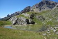
I can confirm that the Lac des Partias is virtually non-existent and is sometimes completely dry, but the valley is full of flowers in spring and is well worth a detour at that time of year.

Machine-translated

pasleb
pasleb

Overall rating : 4.3 / 5

Date of your route : Jul 29, 2016
Reliability of the description : ★★★★☆ Good
Ease of following the route : ★★★★☆ Good
Route interest : ★★★★★ Very good

Stunning scenery. The climb up to the pass is quite steep. Be careful if you want to visit Lake Partias – we only found a small pond. You can return in a circular fashion via a less steep path, going round the rock.

Machine-translated

Other walks in the area

For more walks, use our search engine .

The GPS track and description are the property of this route's author. Please do not copy them without permission.