Gaillard Canal from Briançon to Cité Vauban in Saint-Chaffrey

A pleasant path along the canal with little change in elevation. The canal is for pedestrians only and mountain bikes are prohibited. Wooden barriers are currently being installed.
The canal path isn’t always well-maintained or easy to follow – it’s a bit of a treasure hunt.

Details

4162985
Creation:
Last update:
Last review:
  • Walking
    Activity: Walking
  • ↔
    Distance: 5.89 mi
  • ◔
    Average duration: 2h 45 
  • ▲
    Difficulty: Easy

  • ⚐
    Back to start: Yes
  • ↗
    Ascent: + 75 ft
  • ↘
    Descent: - 75 ft

  • ▲
    Highest point: 4,491 ft
  • ▼
    Lowest point: 4,400 ft

Photos

Description of the walk

The walk starts at the top of the Cité Vauban cemetery. From the Route de Grenoble, take the Traverse Paul Caire and park in the car park on the right between the two cemeteries.

(S/E) Turn left at the top of Traverse Paul Caire and head along the Gaillard Canal (wooden chicane). Continue straight on along the canal. The banks are currently being renovated and the canal is either open to the air or buried in places.

After crossing a tarmac dead-end road (leading to private homes), carry on straight ahead past the chicanes. A few hundred metres further on, just before the Centre des Acacias, cross over the canal and walk up the small path for a few metres. Take the path on the left and continue behind the Acacias buildings.

(1) At the end of the path (bend), cross the road leading to the Montjoy Clinic and take the path opposite. Turn right, then immediately left, and follow the path between the old UGECAM buildings.

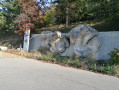
(2) Head down to the left onto the tarmac internal road until you reach the Route de Grenoble (up to the human-shaped stone sculpture).
Head up the internal road leading to the former Rhône Azur buildings (rocks on the ground prevent vehicle access).

(3) At the top of the road (concrete shelter), turn left into the woods onto a fairly steep path, and head down behind the Seltzer Foundation’s central kitchen building. Cross the road and continue along the canal opposite.

(4) When you reach the Seltzer Foundation, turn left onto the tarmac internal road, cross the bridge and turn right, heading back up the road. A few metres further up, turn left between the buildings and go through the tunnel beneath them. Continue along the forest track, then follow the tarmac road ‘Chemin des Mésanges’ to the church at Saint-Chaffrey.

(5) At the church, head up Rue de la Villette to the right, then cross a small footbridge on the left. Head down towards the garden below. On leaving the public garden, cross Rue de la Rua and walk alongside the Canal Gaillard once more.

(6) At the end of the path, turn back at Chemin des Neyzets in Saint-Chaffrey (tarmac road) and follow the path back the way you came to reach the cemetery at the top of the Cité Vauban (S/E).


Waypoints

  1. S/E : mi 0 - alt. 4,416 ft - Top of the Vauban estate cemetery
  2. 1 : mi 0.94 - alt. 4,429 ft - Below the Montjoy Clinic
  3. 2 : mi 1.09 - alt. 4,432 ft - Former UGECAM/Rhône Azur establishments
  4. 3 : mi 1.26 - alt. 4,452 ft - Towards the Seltzer Foundation Central Kitchen
  5. 4 : mi 1.76 - alt. 4,436 ft - Chantoiseau Centre
  6. 5 : mi 2.63 - alt. 4,482 ft - Small bridge after the church at Saint-Chaffrey
  7. 6 : mi 2.94 - alt. 4,469 ft - Chemin des Neyzets
  8. S/E : mi 5.89 - alt. 4,416 ft - Top of the Vauban estate cemetery

Notes

Alternative route:
(3) Another option, avoiding the slope through the woods, is to follow the Route de Grenoble as far as the central kitchen, take the D232 for a few metres towards Chant’Ours, and rejoin the canal path on the left.

(6) Unfortunately, the canal path is no longer accessible (private property, fenced off)! It’s a shame, as the Gaillard Canal continues all the way to La Salle-les-Alpes.

Worth a visit

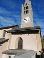
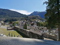
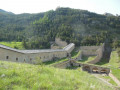
Church, cemetery and Pont Levis in Saint-Chaffrey.

Reviews and comments

4.8 / 5
Based on 3 reviews

Reliability of the description
5 / 5
Ease of following the route
5 / 5
Route interest
4.3 / 5
VCANET
VCANET

Overall rating : 5 / 5

Date of your route : Aug 08, 2026
Reliability of the description : ★★★★★ Very good
Ease of following the route : ★★★★★ Very good
Route interest : ★★★★★ Very good
Very busy route : No

An easy and very enjoyable walk.
Thank you for the very helpful guidance as we passed the various buildings;
Very little road noise: the curtain of trees and the houses between the path and the road act as a barrier to the noise.

Machine-translated

Dionisi
Dionisi

Overall rating : 4.7 / 5

Date of your route : Mar 17, 2025
Reliability of the description : ★★★★★ Very good
Ease of following the route : ★★★★★ Very good
Route interest : ★★★★☆ Good
Very busy route : No

If you’re looking to go for a walk around Briançon in winter, this flat route allows you to explore the area without needing equipment such as snowshoes or crampons.

Machine-translated

Jzxcluc1
Jzxcluc1

A lovely walk – only a 300-metre climb – so it’s perfect for families. The scenery is magnificent, especially in autumn.

Machine-translated

sabineballand
sabineballand

Overall rating : 4.7 / 5

Date of your route : Aug 22, 2022
Reliability of the description : ★★★★★ Very good
Ease of following the route : ★★★★★ Very good
Route interest : ★★★★☆ Good
Very busy route : No

That old canal is quite something. We didn’t go all the way to the end; we turned back once we’d passed the derelict buildings.
The start of the route is lovely. Well worth a visit!

Machine-translated

Other walks in the area

For more walks, use our search engine .

The GPS track and description are the property of this route's author. Please do not copy them without permission.