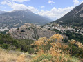
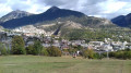
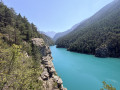
The Fort du Randouillet at the start of the route from Briançon

The Fort du Randouillet overlooks Briançon, and a visit offers a wonderful insight into this former garrison on the Franco-Italian border. Listed as a UNESCO World Heritage Site in 2008, along with the other forts in the Briançon area, it was once used to transport goods between Briançon and the forts of L’Infernet and La Cochette via several cableways.

Details

34018619
Creation:
Last update:
Last review:
  • Walking
    Activity: Walking
  • ↔
    Distance: 5.28 mi
  • ◔
    Average duration: 3h 40 
  • ▲
    Difficulty: Moderate

  • ⚐
    Back to start: Yes
  • ↗
    Ascent: + 1,430 ft
  • ↘
    Descent: - 1,427 ft

  • ▲
    Highest point: 5,151 ft
  • ▼
    Lowest point: 3,973 ft

Photos

Description of the walk

Park in the centre of Briançon in the car park opposite the Cosmo cinema.

(S/E) Set off to the left to go round the cinema and the media centre. Continue along the streets of Briançon until you reach the Parc de la Schappe. At the park entrance, turn right and head towards the arcades.

(1) Walk underneath them and, immediately afterwards, take the Fort des Têtes path. Follow the ‘Fort des Têtes’ signposts on the various signs and, via a gentle climb, reach the road junction near the Y communications building.

(2) Turn left onto the road and head towards the crossroads by the shooting range below Fort des Têtes.

(3) Turn right, cross the shooting range and join the military road to Fort du Randouillet. At the next junction, keep right and continue uphill to reach Fort du Randouillet.

(4) Follow the same route back in the opposite direction to return to the shooting range junction.

(3) Turn right onto the track and go round Fort des Têtes to the east. Continue downhill and, after a few hairpin bends, you’ll reach the Pont d’Asfeld.

(5) Start a short climb here, passing under the Porte de la Durance. Continue straight on downhill, skirting the town hall, then reach the Porte d’Embrun.

(6) Turn left to go down La Chaussée, turn right onto Avenue du Lautaret, then left onto Chemin de la Tour, before returning to the car park opposite the Cosmo cinema (S/E).

Waypoints

  1. S/E : mi 0 - alt. 4,019 ft - Car park opposite the Cosmo cinema
  2. 1 : mi 0.69 - alt. 4,026 ft - Park entrance - Lac de la Schappe
  3. 2 : mi 1.36 - alt. 4,587 ft - Communication Y
  4. 3 : mi 1.72 - alt. 4,728 ft - Crossroads at the circular loop - Fort des Têtes
  5. 4 : mi 2.52 - alt. 5,128 ft - Fort du Randouillet
  6. 5 : mi 4.35 - alt. 4,081 ft - La Durance
  7. 6 : mi 4.73 - alt. 4,203 ft - Durance Gate
  8. S/E : mi 5.28 - alt. 4,022 ft - Car park opposite the Cosmo cinema

Notes

No water on this route.

Worth a visit

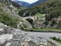
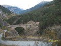
(5) The Asfeld Bridge: Information displayed on the sign above the bridge at the Porte de la Durance
“In order to link the town to the Fort des Têtes, the decision to build a bridge was taken in 1720 by the Marquis d’Asfeld, Director-General of Fortifications. Ever since, the boldness of the structure has never failed to amaze: ‘One cannot help but admire this bridge for its grandeur, its height (55 metres at the centre) and its construction on wooden arches in one of the most difficult locations, without a single accident having occurred,’ said Engineer Heuriance of it.”

Reviews and comments

4.2 / 5
Based on 4 reviews

Reliability of the description
4.5 / 5
Ease of following the route
4 / 5
Route interest
4 / 5
User 4748618

Overall rating : 5 / 5

Date of your route : Jul 25, 2026
Reliability of the description : ★★★★★ Very good
Ease of following the route : ★★★★★ Very good
Route interest : ★★★★★ Very good
Very busy route : No

A really lovely route, with no difficulties. It takes you through the Cité Vauban, over the Asfeld Bridge and past Lake Schappe – all magnificent sights. The clay pigeon shooting range is less of an attraction. The whole route forms a lovely circular route with interesting views of Briançon and its forts.

Machine-translated

PH7
PH7

Overall rating : 3.3 / 5

Date of your route : Sep 22, 2025
Reliability of the description : ★★★★☆ Good
Ease of following the route : ★★★☆☆ Average
Route interest : ★★★☆☆ Average
Very busy route : No

Beautiful view of the stronghold of Briançon.
The start of the route is a little polluted with various tracks (trailers going straight downhill).
The road to Fort Randouillet is moderately interesting.

The clay pigeon shooting range provides shelter in case of bad weather.
The return via the Vauban citadel is interesting, with a passage over the Durance river

Machine-translated

jmgorce
jmgorce

Overall rating : 4.7 / 5

Date of your route : Jul 24, 2023
Reliability of the description : ★★★★★ Very good
Ease of following the route : ★★★★★ Very good
Route interest : ★★★★☆ Good
Very busy route : No

An easy path to follow, with no difficulties.
It offers superb views of Briançon and is a great way to explore the town and its surroundings.
You’ll need a good pair of shoes all the same.

Machine-translated

8chasles
8chasles

Overall rating : 3.7 / 5

Date of your route : Jul 23, 2023
Reliability of the description : ★★★★☆ Good
Ease of following the route : ★★★☆☆ Average
Route interest : ★★★★☆ Good
Very busy route : No

Thank you for the route

Machine-translated

Other walks in the area

For more walks, use our search engine .

The GPS track and description are the property of this route's author. Please do not copy them without permission.