


Refine your search for walks in Pelouse
Pelouse walks


 Around Les Salces
 Visorando Member
 8.96 mi
 +1,201 ft
 -1,201 ft
 1.5 hrs
 Moderate
 Departure from Pelouse (Lozère)
Near Mende, a mountain bike ride around Les Salces joins aGR® route and can be adapted to suit your level of confidence.
 Tour of Lake Charpal
 5.32 mi
+52 ft
-52 ft
2h 30
5.32 mi
+52 ft
-52 ft
2h 30
 Easy
Departure from Rieutort-de-Randon (Lozère)
Easy
Departure from Rieutort-de-Randon (Lozère)
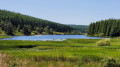
Hike around Lake Charpal in a completely unspoilt protected natural site. The path does not stray far from the lake, so the elevation gain is very low and the route is easy. Much of the route is through woodland, ideal in summer when it is hot.
Lac de Charpal and Truc de Fortunio
 16.02 mi
+1,286 ft
-1,299 ft
2.5 hrs
Moderate
Departure from Rieutort-de-Randon (Lozère)
16.02 mi
+1,286 ft
-1,299 ft
2.5 hrs
Moderate
Departure from Rieutort-de-Randon (Lozère)
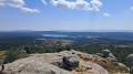
A very smooth mountain bike ride that follows the route around Lac de Charpal, then climbs to reach the peaks of the Margeride. No technical difficulties, no sections where you need to carry your bike, but a good climb on a tarmac track before reaching the Truc de Fortunio.
Tour of Truc de Fortunio
10.48 mi
+1,335 ft
-1,332 ft
6h 00
Moderate
Departure from Rieutort-de-Randon (Lozère)
The Truc de Fortunio loop is a hike of moderate difficulty due to its limited elevation gain. The scenery is varied: wild and unspoilt.A breathtaking view upon reaching the highest point.
Tour of Lake Charpal
 5.70 mi
+141 ft
-131 ft
2h 45
Easy
Departure from Rieutort-de-Randon (Lozère)
5.70 mi
+141 ft
-131 ft
2h 45
Easy
Departure from Rieutort-de-Randon (Lozère)
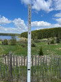
Tour of Lake Charpal in Lozère. An easy route on a relatively flat path, despite being at an altitude of over 1,300 metres. Beautiful views of the lake along the entire route, alternating between forest, meadows and peat bogs.
Circular route around Étang de Barrandon starting from Brajon
8.36 mi
+1,729 ft
-1,722 ft
5h 20
Moderate
Departure from Lanuéjols (Lozère) (Lozère)
A lovely day’s walk alternating between woodland and meadows in the foothills of Mont Lozère, with some stunning views. Two alternative routes are available to enhance your enjoyment and discovery. Depending on the season, you’ll be treated to the colours of broom in spring and heather in autumn, not to mention the chance to pick blueberries in the height of summer.
Around the hamlets of Asprettes and La Fagette
 4.14 mi
+423 ft
-440 ft
2h 15
Easy
Departure from Chastel-Nouvel (Lozère)
4.14 mi
+423 ft
-440 ft
2h 15
Easy
Departure from Chastel-Nouvel (Lozère)
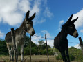
A pleasant hike through oak and beech forests to discover the Fagette waterfall and the hamlets of Asprettes and La Fagette, with their superb granite houses and old ovens.
Clochers de Tourmente circular route starting from Les Sagnes
 5.39 mi
+1,047 ft
-1,050 ft
3h 25
Moderate
Departure from Saint-Julien-du-Tournel (Lozère)
5.39 mi
+1,047 ft
-1,050 ft
3h 25
Moderate
Departure from Saint-Julien-du-Tournel (Lozère)
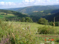
A circular route starting from Les Sagnes, passing through the hamlet of Auriac, across meadows and through woods.You can also see the two Clochers de Tourmente and, in the distance, the Château du Tournel.
Clocher de Tourmente: from the hamlet of Les Sagnes to the Étang de Barandon
 8.80 mi
+1,017 ft
-1,014 ft
4h 55
Moderate
Departure from Saint-Julien-du-Tournel (Lozère)
8.80 mi
+1,017 ft
-1,014 ft
4h 55
Moderate
Departure from Saint-Julien-du-Tournel (Lozère)
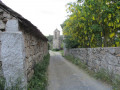
Route starting from the Clocher de Tourmente in the hamlet of Les Sagnes. Hike in the Cévennes National Park. Former Étang du Peschio, Croix de Maitre Vidal, panoramic view of the Monts Lozère, Étang de Barrandon.
Le Moure de la Gardille and the sources of the Allier
 7.17 mi
+817 ft
-810 ft
4h 00
Moderate
Departure from Saint-Frézal-d'Albuges (Lozère)
7.17 mi
+817 ft
-810 ft
4h 00
Moderate
Departure from Saint-Frézal-d'Albuges (Lozère)
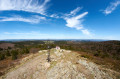
A beautiful route around the little-known sources of the Allier.
Le Bleymard - Pont-de-Montvert
 10.59 mi
+1,821 ft
-2,523 ft
6h 25
10.59 mi
+1,821 ft
-2,523 ft
6h 25
 Difficult
Departure from Le Bleymard (Lozère)
Difficult
Departure from Le Bleymard (Lozère)
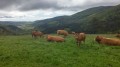
Eighth stage of a complete journey on the Chemin de Stevenson between Le Puy-en-Velay and Alès. This stage may involve significant changes from the GR®70 signposting, and corresponds to the North-South crossing of the Mont Lozère massif.
Tour of Rieutort via Les Fangettes
2.87 mi
+348 ft
-348 ft
1h 35
Easy
Departure from Rieutort-de-Randon (Lozère)
A short walk suitable for the whole family (suitable for pushchairs).
Circular route from Coulagnes Basses to Rieutort-de-Randon
3.04 mi
+377 ft
-374 ft
1h 45
Easy
Departure from Rieutort-de-Randon (Lozère)
A short, one-hour walk through fields and stone-built villages.
Around Rieutort-de-Randon via Malassagne
5.16 mi
+531 ft
-561 ft
2h 50
Easy
Departure from Rieutort-de-Randon (Lozère)
A short, easy walk around Rieutort-de-Randon
The Bramont Gorges, La Fage and Bassy
 5.66 mi
+1,122 ft
-1,102 ft
3h 35
Moderate
Departure from Saint-Étienne-du-Valdonnez (Lozère)
5.66 mi
+1,122 ft
-1,102 ft
3h 35
Moderate
Departure from Saint-Étienne-du-Valdonnez (Lozère)
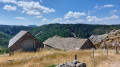
An alternative route to walkno. 2842225:the Bramont Gorges and the hamlet of La Borie. Explore the Bramont Gorges starting from Saint-Étienne-du-Valdonnez, passing through the hamlet of La Fage and returning via Bassy. Most of the route runs through woodland. Beautiful views over the Cham des Bondons, the Echino d’Aze and one of the puechs, as well as the Truc de Balduc.
Around Rieutort-de-Randon
5.31 mi
+817 ft
-814 ft
3h 10
Easy
Departure from Rieutort-de-Randon (Lozère)
Walk around Rieutort-de-Randon with a view of the Randon signal.
The Truc de Fortunio circular loop via Lake Charpal
 13.17 mi
+2,005 ft
-2,018 ft
7h 50
Difficult
Departure from Rieutort-de-Randon (Lozère)
13.17 mi
+2,005 ft
-2,018 ft
7h 50
Difficult
Departure from Rieutort-de-Randon (Lozère)
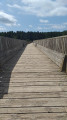
A circular route starting from Rieutort-de-Randon along forest paths that will take you to the Truc de Fortunio orientation point. It offers a 360° panorama (views of the Aubrac, Lozère, Lake Charpal, etc.)
You will then head back down to the Charpal Dam before following the Colagne river back to your starting point.
The sources of the Lot
 4.54 mi
+571 ft
-568 ft
2h 35
Easy
Departure from Cubières (Lozère)
4.54 mi
+571 ft
-568 ft
2h 35
Easy
Departure from Cubières (Lozère)
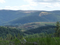
Walk along the first few kilometres of the Lot to its source, between forests and meadows.
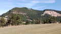
Montialoux Castle as seen from Rouffiac
 3.58 mi
+1,093 ft
-1,070 ft
2h 35
Moderate
Departure from Saint-Bauzile (Lozère) (Lozère)
3.58 mi
+1,093 ft
-1,070 ft
2h 35
Moderate
Departure from Saint-Bauzile (Lozère) (Lozère)
A walk to explore the ruins of Montialoux Castle through the Mende State Forest. The castle is situated in the commune of Saint-Bauzile, in Lozère, right in the heart of the Valdonnez valley, in the former province of Gévaudan. Please note: this short walk involves a significant elevation gain.
Bramont Gorges and the hamlet of La Borie
 7.99 mi
+1,306 ft
-1,283 ft
4h 50
Moderate
Departure from Saint-Étienne-du-Valdonnez (Lozère)
7.99 mi
+1,306 ft
-1,283 ft
4h 50
Moderate
Departure from Saint-Étienne-du-Valdonnez (Lozère)
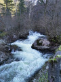
Walk up the Bramont Gorges and explore a magnificent and picturesque area with its steep cliffs and turbulent river. This unusual landscape offers a pleasant cool spot in summer.
Pass through the small village of drystone shelter, with its typical Causse houses, located in the foothills of the Mont Lozère massif.
The troglodytic chapel and hermitage of San-Chaousou
 3.34 mi
+712 ft
-696 ft
2h 10
Moderate
Departure from Balsièges (Lozère)
3.34 mi
+712 ft
-696 ft
2h 10
Moderate
Departure from Balsièges (Lozère)
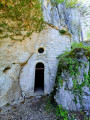
Discover the troglodytic chapel and hermitage of San-Chaousou (Saint-Joseph in the local dialect) on the slopes of the Causse de Changefège.
Rocher du Lion de Balsièges and Fonts route
 4.59 mi
+1,050 ft
-1,066 ft
3h 00
Moderate
Departure from Balsièges (Lozère)
4.59 mi
+1,050 ft
-1,066 ft
3h 00
Moderate
Departure from Balsièges (Lozère)
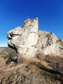
This route allows you to discover the unusual "Lion" that dominates Balsièges. From its rocky outcrop, it watches over the valley. The hiking trail that runs along the Ravin du Choizal and the slopes of the Causse de Sauveterre will take you to the village of Les Fonts.
Mont Lozère from the ski resort
5.75 mi
+938 ft
-935 ft
3h 30
Moderate
Departure from Cubières (Lozère)
A pleasant hike accessible to all on the roof of the Cévennes with exceptional landscapes throughout the route.
Menhirs and the hamlet of La Fage
 7.08 mi
+1,066 ft
-1,060 ft
4h 10
Moderate
Departure from Saint-Étienne-du-Valdonnez (Lozère)
7.08 mi
+1,066 ft
-1,060 ft
4h 10
Moderate
Departure from Saint-Étienne-du-Valdonnez (Lozère)
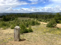
The first part of the hike follows the Balade au pays des Menhirs discovery trail. The rest of the route continues to the hamlet of La Fage. In addition to the Clocher des Tourmentes bell tower marked on the IGN map, you can admire beautiful granite houses covered with slate tiles. Unfortunately, while some have been restored, others are partly abandoned.
The peaks of Mont Lozère at the Col de Finiels
 8.92 mi
+942 ft
-945 ft
4h 55
Moderate
Departure from Mas-d'Orcières (Lozère)
8.92 mi
+942 ft
-945 ft
4h 55
Moderate
Departure from Mas-d'Orcières (Lozère)
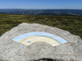
First and foremost, this is the Cévennes panorama walk starting from Mont Lozère. Indeed, the walk follows the ridges of Mont Lozère for over 5 km and offers magnificent 360° views, the most remarkable of which is from the Sommet de Finiels, complete with its three orientation tables.It is also the walk taking in the main peaks that make up the granite dome of Mont Lozère. This is because it takes in six of the mountain’s highest peaks, passing by cairns and historic boundary crosses or Maltese crosses along the way.
The Patus Forest
 Tourist office
 9.31 mi
+755 ft
-745 ft
4h 55
Moderate
Departure from Saint-Jean-la-Fouillouse (Lozère)
9.31 mi
+755 ft
-745 ft
4h 55
Moderate
Departure from Saint-Jean-la-Fouillouse (Lozère)
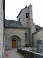
This route takes you through several typical villages of the Margeride region with their rich and varied heritage, as well as the wonderful Patus Forest where you can enjoy unspoilt nature.
Exploring the area around La Fouillouse
 7.22 mi
+781 ft
-761 ft
4h 00
Moderate
Departure from Saint-Jean-la-Fouillouse (Lozère)
7.22 mi
+781 ft
-761 ft
4h 00
Moderate
Departure from Saint-Jean-la-Fouillouse (Lozère)
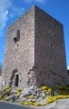
This route will take you on a journey of discovery through the local heritage (the Cellier Tower, the bread oven, the cross) and the wild, unspoilt landscapes around the Ruisseau de la Fouillouse.
Mont Lozère from the Col de Finiels
5.24 mi
+961 ft
-958 ft
3h 15
Moderate
Departure from Le Pont-de-Montvert (Lozère)
Discover Mont Lozère on a very pleasant circular route through alpine pastures and then forest. This is a very enjoyable walk that is sure to delight young and old alike.
 The Col de Finiels
 Association / Club / Walk leader
 4.51 mi
+423 ft
-423 ft
4 hrs
Easy
Departure from Le Pont-de-Montvert (Lozère)
4.51 mi
+423 ft
-423 ft
4 hrs
Easy
Departure from Le Pont-de-Montvert (Lozère)
The Col de Finiels is the road crossing over Mont Lozère, between its two peaks, Finiels and Pic Cassini. This means that, once out of the woods, on the moors and peaks, the views are extraordinary, sometimes to the south over the Cévennes, to the north over the chain of volcanoes, and to the east, further away, when the weather is clear, over the Alps.
The Tarn: source of a great river at the Col de Finiels
 11.27 mi
+837 ft
-823 ft
5h 55
Difficult
Departure from Le Pont-de-Montvert (Lozère)
11.27 mi
+837 ft
-823 ft
5h 55
Difficult
Departure from Le Pont-de-Montvert (Lozère)
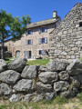
This hike, starting from the Col de Finiels in the heart of Mont Lozère, takes us along the ridge of Mont Lozère, where the magnificent views allow us to look out over the Cévennes National Park. We then witness the very source of a great river, from the very first stream known as ‘Le Tarn’, right up to the first stone bridge spanning it. The route passes through Mas Camargues, a farming village in the Causses des Cévennes, which may date back to the Knights Hospitaller of Saint John of Jerusalem. Returning via the ancient Roman road ensures we have completed a magnificent journey that brings together nature, history and geography.