Around Les Salces

Near Mende, a mountain bike ride around Les Salces joins aGR® route and can be adapted to suit your level of confidence.

Details

n°2704435
Creation:
Last update:
Last review:
  • Mountain biking
    Activity: Mountain biking
  • ↔
    Distance: 8.96 mi
  • ◔
    Duration according to the author: 1.5 hrs 
  • ▲
    Difficulty: Moderate

  • ⚐
    Back to start: Yes
  • ↗
    Ascent: + 1,201 ft
  • ↘
    Descent: - 1,201 ft

  • ▲
    Highest point: 4,006 ft
  • ▼
    Lowest point: 3,087 ft
  • ⚐ Country: France
  • ⚐
  • ⚐ City: Pelouse (48000)
  • ⚑
    Start/End: N 44.539329° / E 3.608155°
  • ❏
    IGN map(s): Ref. 2638E, 2738O

  • ◶
    Type of surface: Not specified
  • ⇧
    Bike carrying: Not specified
  • ▲
    Difficulty: Not specified
  • Hour-by-hour weather

Photos

Description of the route

Start from the village of Les Salces. There’s a car park on the side of the N88 where you can park.

(S/E) Cross the N88 and take the path towards La Rouvière, which climbs up near the school bus stop. Stay on the path and ignore the turnings to the right.

(1) At the entrance to La Rouvière, at a Fork in the road, take the right-hand road and walk past the cemetery and then the church. Continue straight on.

(2) At the three-way junction, turn right uphill. Pass a large wooden cross. Reach the junction signposting the walking trails: turn right towards Pelouse.

(3) At the crossroads, go straight on. Stay on the main path, heading north-east. Pass the Croix de l’Azuel. You’ll reach a junction with another large wooden cross.

(4) Leave the road and take the forest track on the right. Follow the main track. Ignore a turn-off to the right and, at the next Fork in the road, turn left. Curve to the right and reach a junction.

(5) Turn left and head straight on, due south.

(6) You’ll come out onto a forest track; follow it to the left.

(7) Cross the N88, taking great care, and follow the small road towards Eygas. At the successive junctions, keep turning left.

(8) At the fork in the road that appears shortly afterwards, take the path on the right which leads uphill.

(9) Join theGR®43and follow it to the right (south), marked with red and white signs.

(10) At the junction, carry on straight ahead (south) downhill (let theGR® head off to the left).

(11) At the junction about 250 metres further on, just before a climb, turn right, continuing downhill. Stay on the main path, heading downhill.

(12) At a level crossing, take the sharp right-hand bend (do not cross the railway line).

(13) Just after crossing the River Esclancide, at a Fork in the road, take the path on the right. Join the road further on and follow it to the right (north). Take the hairpin bend with the road and return to Les Salces and the starting car park (S/E).


Waypoints

  1. S/E : mi 0 - alt. 3,386 ft - The village of Les Salces
  2. 1 : mi 1.13 - alt. 3,517 ft - Entrance to La Rouvière
  3. 2 : mi 1.31 - alt. 3,609 ft - Three-Way Junction
  4. 3 : mi 1.5 - alt. 3,737 ft - Crossroads
  5. 4 : mi 3.48 - alt. 3,780 ft - Junction – Wooden cross
  6. 5 : mi 4.37 - alt. 3,786 ft - Crossroads
  7. 6 : mi 4.64 - alt. 3,734 ft - Forest track
  8. 7 : mi 4.88 - alt. 3,648 ft - N88 road
  9. 8 : mi 4.96 - alt. 3,645 ft - Eygas
  10. 9 : mi 5.35 - alt. 3,806 ft - Junction with the GR43
  11. 10 : mi 6.28 - alt. 3,507 ft - Junction
  12. 11 : mi 6.43 - alt. 3,468 ft - Junction
  13. 12 : mi 7.27 - alt. 3,087 ft - Level crossing
  14. 13 : mi 7.8 - alt. 3,094 ft - Fork
  15. S/E : mi 8.96 - alt. 3,386 ft - The village of Les Salces

Notes

(S/E) Car park and water point to cool off.

La Rouvière (1) offers shelter.

Worth a visit

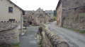
During the walk, you can discover the heritage of the Lozère region with its traditional villages.

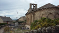
Do take the time to pop into the churches.

Always be cautious and plan ahead when you're outdoors. Visorando and the author of this route cannot be held responsible for any accidents occurring on this route.

The GR® and PR® markings are the intellectual property of the Fédération Française de Randonnée Pédestre.

Reviews and comments

5 / 5
Based on 1 review

Reliability of the description
5 / 5
Ease of following the route
5 / 5
Route interest
5 / 5
pyrene12
pyrene12

Overall rating : 5 / 5

Date of your route : Jul 19, 2025
Reliability of the description : ★★★★★ Very good
Ease of following the route : ★★★★★ Very good
Route interest : ★★★★★ Very good
Very busy route : No

A beautiful loop (done on foot) offering lovely views and allowing you to visit typical villages.
The only downside: after Pelouse, the spring snowfalls of 2025 broke many trees, which are now cluttering the path.
Many thanks to the author for their advice.
Marie-Clotildehttps ://www.visorando.com/page-pyrene12/

Machine-translated

pyrene12
pyrene12

Thank you very much!

Machine-translated

GRENOUILLET
GRENOUILLET

Good evening
Remember to bring water and sunscreen
It's easy to do.
You'll get some great views.
Enjoy your walk!

Machine-translated

pyrene12
pyrene12

Good evening, Grenouillet,
Tomorrow, I’ll be in Lozère, very close to Les Salces and La Rouvière. What do you think about the possibility of walking the circular route you described?
Please do let me know.
Kind regards
Marie-Clotilde RAYMOND https://www.visorando.com/page-pyrene12/

Machine-translated

For more walks, use our search engine .

The GPS track and description are the property of this route's author. Please do not copy them without permission.