


 Country:

 City:
City:


Start from the Lac de Charpal car park.
(S/E) Head towards the dam and, just before reaching it, turn right. Follow the path until you reach a wide track.
(1) Follow this track to the left until you reach the junction of two valleys (elevation 1338).
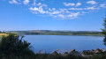
(2) Leave the track and take the path on the left, towards the Charpal Lake Tower. Walk as close as possible to the lake and return to the level of the dam on the opposite side.
(3) At the dam, turn right and follow the Route Forestière de l’Ermitage until you reach a four-way junction.
(4) Carry on to the right and continue until you reach a junction with a barrier opposite.
(5) Just before the barrier, turn left onto the Piste Forestière Lou Salès and follow this path until you reach another four-way junction and the GR®43 markings
(6) Turn left and follow the GR®43 signposting.
(7) At the three-way junction, keep to the right and continue along the track (GR®43) until you reach a road.
(8) Follow it to the left, keeping to the left-hand edge of the woodland, until you reach the edge of the forest at the top of the climb.
(9) Take the wide track that climbs to the left, towards the Fortunio site, continuing on the GR®43. Pass the access road leading to a building higher up on the left and an electricity substation on the right, and reach the start of a forest track on the left.
(10) Continue along the road to the summit of the Truc de Fortunio and its radio relay station.
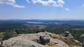
(11) Leave your bike for a few minutes to walk up to the orientation table and enjoy the extraordinary view. Turn back and head down to the start of the forest track on the right, which you spotted on the way up.
(10) Leave the road and follow this track until you reach the four-way junction you passed earlier.
(4) Turn right onto the Route Forestière de l’Ermitage and follow the path back the way you came until you reach the dam.
(3) Cross the dam and head for the Lac de Charpal car park (S/E).

