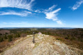
Exploring the area around La Fouillouse

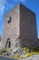
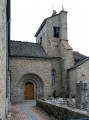
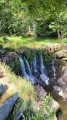
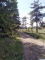
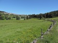
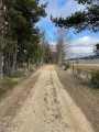
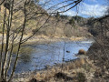
This route will take you on a journey of discovery through the local heritage (the Cellier Tower, the bread oven, the cross) and the wild, unspoilt landscapes around the Ruisseau de la Fouillouse.

Details

599596
Creation:
Last update:
Last review:
  • Walking
    Activity: Walking
  • ↔
    Distance: 7.22 mi
  • ◔
    Average duration: 4h 00 
  • ▲
    Difficulty: Moderate

  • ⚐
    Back to start: Yes
  • ↗
    Ascent: + 781 ft
  • ↘
    Descent: - 761 ft

  • ▲
    Highest point: 4,137 ft
  • ▼
    Lowest point: 3,727 ft

Photos

Description of the walk

Car park at the Cellier village hall.

(S/E) Take the D60 towards Le Villeret for 600 metres, pass the Square Tower and turn left onto a track. Continue straight on until you reach the junction of a road and tracks, where you’ll find the signposts for the walks.

(1) Turn right and continue to the tarmac D60 road.

(2) Turn left onto it and follow it for about 500 metres until you reach a left-hand bend.

(3) At the bend just before you reach Le Villeret (signposted), head down to the right. At the next junction, after the ponds, take the grassy track on the left and cross the Ruisseau de la Fouillouse. Join a wide path before the village and follow it to the left. Cross the village street and the D226.

(4) Almost directly opposite, at the corner by the bread oven, take a small tarmac road and follow it.

(5) Cross the D60 and the bridge, then continue straight ahead along the dirt track – which is tarmacked in places – until you reach the fork in the path (with signposts for the walking routes).

(6) Take the track on the left, which winds its way through pastures and woods.

(7) At the fork, turn left and carry on to the next fork.

(8) Turn left to cross the River Fouillouse, then continue along the track until you reach the tarmac D34 road.

(9) Take the road on the left, passing through the village of Gibert and then Le Tribe.

(10) After the last farm building, leave the D34 and take the track on the left until you reach the junction with the signpost for the walking routes.

(1) Turn right and continue along the track, following the blue markings, to the Cellier car park (S/E).

Waypoints

  1. S/E : mi 0 - alt. 3,727 ft - Car park at the Cellier village hall
  2. 1 : mi 1.02 - alt. 3,924 ft - Hiking signposts
  3. 2 : mi 1.62 - alt. 3,888 ft - Junction with the D60
  4. 3 : mi 1.99 - alt. 3,852 ft - Path on the right
  5. 4 : mi 2.56 - alt. 3,894 ft - Crossing the D226
  6. 5 : mi 2.9 - alt. 3,888 ft - Crossing the D60
  7. 6 : mi 3.18 - alt. 3,891 ft - Hiking signposts
  8. 7 : mi 3.67 - alt. 4,042 ft - Junction to the left
  9. 8 : mi 4.09 - alt. 4,108 ft - Turn left towards the river
  10. 9 : mi 4.78 - alt. 4,137 ft - D34 on the left
  11. 10 : mi 5.7 - alt. 4,006 ft - Le Tribe village
  12. S/E : mi 7.22 - alt. 3,727 ft - Car park at the Cellier village hall

Notes

Blue markings.

Worth a visit

The Cellier Tower
Bread oven at Le Villeret
La Toison d’Or in Meyrilles

Reviews and comments

3.8 / 5
Based on 4 reviews

Reliability of the description
4.3 / 5
Ease of following the route
4.3 / 5
Route interest
2.8 / 5
nadinejut
nadinejut

Overall rating : 2.7 / 5

Date of your route : Aug 23, 2022
Reliability of the description : ★★★☆☆ Average
Ease of following the route : ★★★☆☆ Average
Route interest : ★★☆☆☆ Disappointing
Very busy route : No

Too many roads... A particularly unpleasant stretch between No. 2, km 2.61
alt. 1187m Junction with the D60 and No. 3 at km 3.2, alt. 1174m Turn right onto the track. This road runs alongside a site designated for uranium waste...

Machine-translated

Starkouney
Starkouney

Overall rating : 4 / 5

Date of your route : Aug 19, 2020
Reliability of the description : ★★★★★ Very good
Ease of following the route : ★★★★★ Very good
Route interest : ★★☆☆☆ Disappointing
Very busy route : Yes

Far too much tarmac!!
The scenery isn’t very varied, despite a few sections through woodland.
This is just my personal opinion, but I didn’t enjoy this walk, which, incidentally, we completed in 2 hours 30 minutes instead of the advertised 3 hours 55 minutes.
We tried to improve the route by taking paths to avoid the tarmac sections.
I think there are better options in the area.

Machine-translated

rahierchristian
rahierchristian

Overall rating : 4.7 / 5

Date of your route : Jun 19, 2020
Reliability of the description : ★★★★★ Very good
Ease of following the route : ★★★★★ Very good
Route interest : ★★★★☆ Good
Very busy route : No

At point 4, take a small, unpaved track , almost directly opposite the corner by the bread oven
This wide track has never been tarmacked
Best regards

Machine-translated

jL3412
jL3412

I didn’t go for a walk along that route.

Machine-translated

neljac
neljac

Overall rating : 3.7 / 5

Date of your route : Oct 16, 2017
Reliability of the description : ★★★★☆ Good
Ease of following the route : ★★★★☆ Good
Route interest : ★★★☆☆ Average

A lovely walk, but far too much tarmac or concrete – it’s a shame.

Machine-translated

Other walks in the area

For more walks, use our search engine .

The GPS track and description are the property of this route's author. Please do not copy them without permission.