Circular route around Étang de Barrandon starting from Brajon

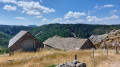
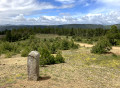
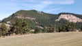
A lovely day’s walk alternating between woodland and meadows in the foothills of Mont Lozère, with some stunning views. Two alternative routes are available to enhance your enjoyment and discovery. Depending on the season, you’ll be treated to the colours of broom in spring and heather in autumn, not to mention the chance to pick blueberries in the height of summer.

Details

n°109242263
Creation:
Last update:
Last review:
–
  • Walking
    Activity: Walking
  • ↔
    Distance: 8.36 mi
  • ◔
    Average duration: 5h 20 
  • ▲
    Difficulty: Moderate

  • ⚐
    Back to start: Yes
  • ↗
    Ascent: + 1,729 ft
  • ↘
    Descent: - 1,722 ft

  • ▲
    Highest point: 4,646 ft
  • ▼
    Lowest point: 2,982 ft

Description of the walk

Head to Brajon in the commune of Lanuéjols. Between Langlade and Lanuéjols, at a place called Les Terres Bleues, head towards Brajon / Vareilles, follow the road for 1 km, then turn sharply left towards Brajon and continue for 4 km. Drive through the hamlet. At the fountain, take the road on the right and park on the threshing floor on the left, at the end of the road: ask the owner of the house on the left. If they are not at home, leave a note on the windscreen explaining why your vehicle is there.

(S/E) Follow the path on your left which continues from the road and climbs into the forest.

(1) At the three-way junction, by the Cévennes National Park sign, take the track leading uphill to the right. You’ll reach a T-junction.

(2) Follow the track that climbs up to your left. Turn right at a 90° angle along the track and arrive at the edge of the forest.

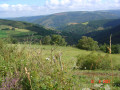
(3) Take the path opposite: there are some lovely views of the Aubrac in the distance, and the Valdonnez valley in the foreground with the Truc de Balduc on your left. You’ll come to a small ford.

(4) Cross the ford and continue straight on along the main track. Follow the edge of the woodland until you reach a junction.

(5) Take the path on the right; you’ll come within sight of the Étang de Barrandon and reach the car park on the right: there are picnic tables available for your use.

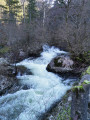
(6) With your back to the pond, follow the path that descends below the embankment, on the right bank of the Ruisseau de Vareilles. Ford the stream and head back up the opposite side.

(7) Take the path leading down to the right: further on, you can admire the Sapet farm, which was fully restored about fifteen years ago. You’ll reach a three-way junction.

(8) Take the track that heads off to the right, due north, at right angles to the main path. Ignore the track that descends below the path you have just taken. You’ll reach another junction.

(9) Take a sharp right-hand bend to continue downhill. Navigate a left-hand bend followed by a right-hand bend.

(10) At the fork, carry straight on along the track until you reach a cross-track.

(11) Take this track to the left and head for the hamlet of Vareilles: you can fill your water bottles at the fountain.

(12) Head back up onto the road on the right. Carry on straight ahead, passing the old village school, then turn left, staying on the road.

(13) Follow the track which climbs to the right onto the plateau and joins a junction.

(14) Carry on straight ahead. You’ll come to the tarmac road further on, near Brajon.

(15) Head straight on to reach the centre of the hamlet, then the threshing floor on the way out (S/E).

Waypoints

  1. S/E : mi 0 - alt. 3,310 ft - Brajon – Threshing area
  2. 1 : mi 0.46 - alt. 3,504 ft - National Park sign
  3. 2 : mi 0.78 - alt. 3,806 ft - T-junction
  4. 3 : mi 1.94 - alt. 4,383 ft - Edge of the woods
  5. 4 : mi 2.66 - alt. 4,482 ft - Fording
  6. 5 : mi 3.42 - alt. 4,610 ft - Junction
  7. 6 : mi 3.65 - alt. 4,511 ft - Car park - Étang de Barrandon
  8. 7 : mi 4.57 - alt. 4,291 ft - Junction
  9. 8 : mi 5.74 - alt. 3,635 ft - Track
  10. 9 : mi 5.97 - alt. 3,527 ft - Junction
  11. 10 : mi 6.4 - alt. 3,235 ft - Junction
  12. 11 : mi 6.64 - alt. 3,068 ft - Junction
  13. 12 : mi 6.89 - alt. 2,982 ft - T-junction – Fountain
  14. 13 : mi 7.28 - alt. 3,169 ft - Fork
  15. 14 : mi 7.67 - alt. 3,346 ft - Junction of trails
  16. 15 : mi 8.17 - alt. 3,294 ft - Road junction
  17. S/E : mi 8.36 - alt. 3,310 ft - Brajon – Threshing area

Notes

(S/E) At the start of the walk, near the car park, you’ll find excellent-quality drinking water at the Brajon spring, opposite the bread oven and the cross. The same applies at Vareille (12).

Much of the walk is through woodland (in the shade). However, the return leg between Vareilles and Brajon involves climbing up to a plateau amidst fields: make sure you wear a hat and fill your water bottles in Vareilles.

Most of the walk takes place within the Cévennes National Park, so dogs must be kept on a lead; no fires and no camping.

Alternatives

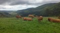
(4) At this point, you can take an alternative route by turning left onto a path: there is a barbed-wire fence to cross, and cows may be present during the summer. You will rejoin the GR® 43 (marked in white and red), which you should follow to the right until the next junction. You’ll then continue to the right again towards the Étang de Barrandon (yellow markings), rejoining the main route at (6). Allow an extra hour for this alternative route.

(6) Walk around the lake: you can take a detour by heading down to the left towards the interpretive trail around Étang de Barrandon: allow an extra 45 minutes for this flat section of the trail, with no elevation gain.

Worth a visit

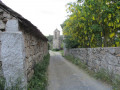
During this walk, you’ll pass through two very pretty hamlets and encounter a wide variety of landscapes, vegetation and geological formations. The climb between points (2) and (3) will take you from limestone through schist and on to granite.

In all the forest sections, you may come across wild boar, roe deer and other deer: peace and quiet will be your best allies.

The view on arrival at the Étang de Barrandon is superb; you’ll find picnic tables there.

Always be cautious and plan ahead when you're outdoors. Visorando and the author of this route cannot be held responsible for any accidents occurring on this route.

The GR® and PR® markings are the intellectual property of the Fédération Française de Randonnée Pédestre.

Other walks in the area

For more walks, use our search engine .

The GPS track and description are the property of this route's author. Please do not copy them without permission.