Refine your search for walks in Paliseul
Paliseul walks


 From Carlsbourg to Paliseul (long version via Our)
 Visorando Member
 13.85 mi
 +1,001 ft
 -935 ft
 7h 15
7h 15
 Difficult
 Departure from Paliseul (Province de Luxembourg)
The walk starts at Carlsbourg station and winds its way between the provinces of Namur and Luxembourg, through pastures, farmland and forests. Passing through Our, Wallonia’s most beautiful village, it ends at Paliseul station.
Walk to the source of the Ruisseau du Defoi
 5.48 mi
+367 ft
-381 ft
2h 50
5.48 mi
+367 ft
-381 ft
2h 50
 Easy
Departure from Paliseul (Province de Luxembourg)
Easy
Departure from Paliseul (Province de Luxembourg)
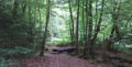
A magnificent walk through the Bois du Defoi, a mix of footpaths and forest tracks… a mix of streams, characteristic trees and sculptures.
In the heart of the southern Ardennes towards Naomé
 9.50 mi
+853 ft
-840 ft
5h 05
9.50 mi
+853 ft
-840 ft
5h 05
 Moderate
Departure from Bièvre (Province de Namur)
Moderate
Departure from Bièvre (Province de Namur)
The village of Naomé is located in the heart of the Southern Ardennes Nature Park, which covers nine Belgian municipalities in southern Wallonia: Bertrix, Bièvre, Bouillon, Daverdisse, Gedinne, Herbeumont, Paliseul, Vresse-sur-Semois and Wellin. This walk, which takes you through both countryside and forest, starts in Naomé.
Circular walk from Naomé via Baimont, Francs-Bois, Roda and Perlefontaine
 6.46 mi
+686 ft
-902 ft
3h 35
Moderate
Departure from Bièvre (Province de Namur)
6.46 mi
+686 ft
-902 ft
3h 35
Moderate
Departure from Bièvre (Province de Namur)
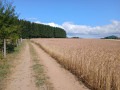
A circular walk starting from Naomé, which can easily be completed in 2 hours. The walk starts near the church, heading towards Opont. On reaching the pond, the route follows the GR®14 and takes the path that climbs to the right of the Douaire pond. The walk then continues along the GR®14 before leaving it shortly afterwards.
The Bois Defoi from Carlsbourg
 4.90 mi
+364 ft
-335 ft
2h 35
Easy
Departure from Paliseul (Province de Luxembourg)
4.90 mi
+364 ft
-335 ft
2h 35
Easy
Departure from Paliseul (Province de Luxembourg)
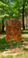
A short, easy family walk. Suitable for pushchairs.
Defoy educational trail
 0.90 mi
+95 ft
-95 ft
0h 30
Easy
Departure from Paliseul (Province de Luxembourg)
0.90 mi
+95 ft
-95 ft
0h 30
Easy
Departure from Paliseul (Province de Luxembourg)
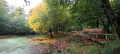
A very easy family walk with footbridges, pontoons, springs, a pond and different species of trees. Twelve stages to discover mark this circular loop, which is as beautiful in autumn as it is in summer. Mobile app "Luna and the Guardians" for an interactive experience.
Around Jehonville
 10.68 mi
+705 ft
-705 ft
5h 30
Moderate
Departure from Bertrix (Province de Luxembourg)
10.68 mi
+705 ft
-705 ft
5h 30
Moderate
Departure from Bertrix (Province de Luxembourg)
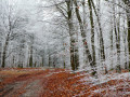
Head to Jehonville, where, in winter, nature – frosted by the morning mist, with no snow and no sun – has been transformed into a vast spider’s web woven from white threads. What a sight! What a delight! This walk is, of course, suitable for all seasons… the view will simply be different!
Along the Our
 11.62 mi
+817 ft
-843 ft
6h 05
Moderate
Departure from Paliseul (Province de Luxembourg)
11.62 mi
+817 ft
-843 ft
6h 05
Moderate
Departure from Paliseul (Province de Luxembourg)
This beautiful hike will take you into the heart of the Ardennes forest to explore the whole of Our, one of the most beautiful villages in Wallonia, following the course of the river of the same name and tributary of the Lesse. Discover undergrowth made up of rocky outcrops, scree slopes and streams running alongside or crossing the paths.
Forest walk in Jéhonville
 11.21 mi
+682 ft
-666 ft
5h 45
Moderate
Departure from Bertrix (Province de Luxembourg)
11.21 mi
+682 ft
-666 ft
5h 45
Moderate
Departure from Bertrix (Province de Luxembourg)
This region of the southern Ardennes is particularly active in forestry: the small village of Jéhonville alone has two sawmills.
The forest is omnipresent, even though the route crosses a few areas of pasture and crops.
The hike is a free combination of sections of local walking trails, GR® trails, the "Between Lesse and Lomme" route that circles the municipality of Libin, and unmarked but publicly accessible paths.
The route crosses a didactic route called "Sur les traces de 14-18" (In the footsteps of 14-18) and passes through the Vieille Rochette Nature Reserve.
You may or may not like the unusual shape of the bell tower of the church in Jéhonville.
Idyllic Ardennes from Graide
 12.16 mi
+919 ft
-945 ft
6h 25
Difficult
Departure from Bièvre (Province de Namur)
12.16 mi
+919 ft
-945 ft
6h 25
Difficult
Departure from Bièvre (Province de Namur)
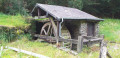
The walk starts at Graide-station in the province of Namur and winds its way through pastures, Christmas tree plantations and forests. You’ll pass by the Étangs des Tranlets, the old mill on the Ruisseau du Ruaumoulin and the Notre-Dame de Bon-Secours Chapel in Oizy, before finally ending at Carlsbourg station in the province of Luxembourg.
Baillamont Circular
 4.39 mi
+371 ft
-364 ft
2h 20
Easy
Departure from Bièvre (Province de Namur)
4.39 mi
+371 ft
-364 ft
2h 20
Easy
Departure from Bièvre (Province de Namur)
An easy, peaceful walk with very few roads.
Crosses the Bois de Flèrifoi and the Bois Les Tranlets, passing not far from the hamlet of "Les Waibes" before finishing with the return through the Bois du Ro.
Exploring the Graide Maquis
 11.79 mi
+948 ft
-938 ft
6h 15
Moderate
Departure from Bièvre (Province de Namur)
11.79 mi
+948 ft
-938 ft
6h 15
Moderate
Departure from Bièvre (Province de Namur)
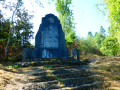
Like many other Ardennes woodlands, the one between Graide and Haut-Fays was home to a Maquis camp in 1944. This walk takes you to discover this camp and part of the woodland to the north of the route of the old tram line that once linked Graide to Wellin.
Graide, Gedinne and Gaide
16.20 mi
+1,421 ft
-1,401 ft
8h 40
 Very difficult
Departure from Bièvre (Province de Namur)
Very difficult
Departure from Bièvre (Province de Namur)
Set off from Graide on a circular walk to Gedinne. Stop for a bite to eat at L'Hôtel de la Poste, a high-quality restaurant. Enjoy the varied landscapes before returning to Graide via a different path. Remember to check the restaurant's opening hours.
The Our and the Five-Trunk Oak
 6.46 mi
+738 ft
-738 ft
3h 35
Moderate
Departure from Paliseul (Province de Luxembourg)
6.46 mi
+738 ft
-738 ft
3h 35
Moderate
Departure from Paliseul (Province de Luxembourg)
Starting from one of Wallonia’s most beautiful villages, this is a leisurely walk to discover the five-trunk oak.
Let’s take a stroll through the woods towards Vivy
 12.85 mi
+1,486 ft
-1,499 ft
7h 10
Moderate
Departure from Bouillon (Belgique) (Province de Luxembourg)
12.85 mi
+1,486 ft
-1,499 ft
7h 10
Moderate
Departure from Bouillon (Belgique) (Province de Luxembourg)
Let’s take a stroll through the woods whilst the wolf and the hunter are not there…This woodland walk offers lovely views of the countryside, not of the meandering Semois river nearby, but of the surrounding countryside and a few villages: Gros-Fays and Rochehaut, to name but two.The mix of deciduous and coniferous trees, grassy and stony paths, and forest and countryside trails makes for a well-balanced walk that never becomes monotonous.With a 460-metre elevation gain, it is not particularly difficult. Only the final climb from the Moulin de Liresse is a bit of a slog.Away from the beaten track and tourist hotspots, this walk is ideal for recharging your batteries in the forest and making the most of the natural surroundings.
Chapels and old mills starting from Oizy
 7.75 mi
+994 ft
-994 ft
4h 25
Moderate
Departure from Bièvre (Province de Namur)
7.75 mi
+994 ft
-994 ft
4h 25
Moderate
Departure from Bièvre (Province de Namur)
This circular walk, starting from the Oizy Chapel, takes you through the woods to discover fishing ponds, chapels and old mills.The return route takes you through the countryside and areas of intensive Christmas tree plantations.A superb walk to enjoy in autumn, when the trees change colour at different rates and mushrooms abound in the undergrowth.Unfortunately, the Mitauge Mill isn’t very visible… hidden by vegetation on either side.A key site of the Resistance during the Second World War, the Gros-Fays Mill is much better showcased.
In the footsteps of the First World War in Anloy
 8.63 mi
+630 ft
-633 ft
4h 30
Moderate
Departure from Libin (Province de Luxembourg)
8.63 mi
+630 ft
-633 ft
4h 30
Moderate
Departure from Libin (Province de Luxembourg)
The title of this walk is a nod to – and a plug for – the signposted walk entitled ‘Sur les traces de 14-18’ (In the footsteps of 14-18), which starts in Anloy and traces the history of the First World War in the Ardennes village of Anloy through a multitude of very well-made information panels.Of these information panels, this particular route only takes you past two: one at a place called Franc-Bois and the other, just before the finish, at the Franco-German cemetery in Anloy-Bruyères.Largely through woodland with a good mix of deciduous and coniferous trees, the walk will also take you past the Pont de la Justice and, nearby, the developed wetland area of the Ri de Chêne.
Chamont Woods
 7.69 mi
+719 ft
-745 ft
4h 10
Moderate
Departure from Libin (Province de Luxembourg)
7.69 mi
+719 ft
-745 ft
4h 10
Moderate
Departure from Libin (Province de Luxembourg)
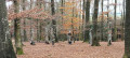
In the Centre Ardenne region, explore the forest paths of the Bois de Chamont, the farm tracks of Transinne, the Pont de la Justice, the Roche des Nutons, LandArt and much more...
A bit of history in the woods around Maissin
 8.17 mi
+719 ft
-738 ft
4h 25
Moderate
Departure from Libin (Province de Luxembourg)
8.17 mi
+719 ft
-738 ft
4h 25
Moderate
Departure from Libin (Province de Luxembourg)
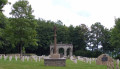
Maissin, a village forming part of the very new Southern Ardennes Nature Park, was the scene of a bloody battle between the German and French armies on 22 and 23 August 1914. It was the only engagement won by the French in Belgium. Starting from the Pierre Massé military cemetery, discover the sites of the old, original cemeteries, as well as La Mambore and its llamas, the Pont de la Justice, the Roche des Nutons and the Pont Marie-Thérèse.
Circular route between Maissin and Redu
 8.27 mi
+932 ft
-922 ft
4h 35
Moderate
Departure from Libin (Province de Luxembourg)
8.27 mi
+932 ft
-922 ft
4h 35
Moderate
Departure from Libin (Province de Luxembourg)
A forest route from Maissin, an Ardennes village situated on a bend in the Haute Lesse, to the outskirts of Redu, passing through the village of Lesse.
Les Maquisards as seen from the road from Gembes to Graide
 9.13 mi
+758 ft
-748 ft
4h 50
Moderate
Departure from Bièvre (Province de Namur)
9.13 mi
+758 ft
-748 ft
4h 50
Moderate
Departure from Bièvre (Province de Namur)
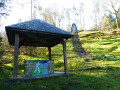
Starting from the walking trail signpost located along the Gembes–Graide road, this walk through lush woodland takes you past the Agrainchenet stud farm to the Maquisards site, a key centre of the local Resistance.Apart from the Maquisards site and the few works of art that highlight it, this walk offers lovely views of the countryside and the (distant) villages of Gembes and Haut-Fays.
Between Lesse and Our
 13.31 mi
+1,165 ft
-1,168 ft
7h 10
Difficult
Departure from Daverdisse (Province de Luxembourg)
13.31 mi
+1,165 ft
-1,168 ft
7h 10
Difficult
Departure from Daverdisse (Province de Luxembourg)
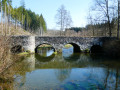
Starting from the Notre-Dame de Beauraing Chapel, situated on the edge of the woods to the east of Porcheresse, the walk takes you mainly through woodland to discover the confluence of the Our and the Lesse before following the course of the Lesse upstream via two pretty stone bridges: the Pont Marie-Thérèse and the Pont de la Justice.On the return journey, the route leaves the Lesse, passes through Maissin and crosses the Our at Our via another pretty stone bridge before returning to the starting point.
Le Tombeau du Géant, exceptional viewpoint over the Semois
 8.49 mi
+1,211 ft
-1,227 ft
4h 55
Moderate
Departure from Bouillon (Belgique) (Province de Luxembourg)
8.49 mi
+1,211 ft
-1,227 ft
4h 55
Moderate
Departure from Bouillon (Belgique) (Province de Luxembourg)
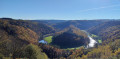
Set off to explore the Tombeau du Géant viewpoint in Botassart, passing by the ruins of Château le Duc, the Chapel of the Immaculate Conception in Botassart and returning via the Rocher des Gattes viewpoint, the Lyru viewpoint, the Gué des Invasions, also known as the Gué du Loquet, and the two small museums in Ucimont.
The Semois near Cornimont
 13.35 mi
+2,365 ft
-2,365 ft
8h 10
Difficult
Departure from Bièvre (Province de Namur)
13.35 mi
+2,365 ft
-2,365 ft
8h 10
Difficult
Departure from Bièvre (Province de Namur)
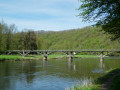
Quite a physical challenge due to its length and cumulative elevation gain, this lovely walk, set in magnificent surroundings, also requires a bit of off-trail walking at times to cross certain streams. Nothing too daunting, but you may occasionally need to stray from the paths and climb or descend a little through the countryside. The most challenging part is reaching the banks of the Semois from Rochehaut. The steep path, which is very poorly marked at km 8.5, is more like a trail run route than a hiking trail. Otherwise, it’s simply splendid. You pass the old mills at Liresse and (near) Gros-Fays, next to the footbridge at Frahan and across the one at Mouzaive. There’s just a short stretch of tarmac between Alle and Mouzaive and on the hillside before Gros-Fays.
From Cornimont to Rochehaut
 9.98 mi
+1,355 ft
-1,355 ft
5h 45
Moderate
Departure from Bièvre (Province de Namur)
9.98 mi
+1,355 ft
-1,355 ft
5h 45
Moderate
Departure from Bièvre (Province de Namur)
Starting from the pretty chapel at Cornimont, the walk soon enters the forest, skirting the pastures of the hamlet known as ‘Le Give’, before reaching Rochehaut near the brewery (brewing & tasting), the agricultural museum and the wildlife park.The route continues towards the centre of Rochehaut and its viewpoints over the circular Semois loop, Frahan and the footbridge dating from 1926. This is followed by a lovely descent towards the Semois and the old slate quarry beneath the Rocher des Corbeaux. The walk continues along the river (note the tobacco drying shed on the opposite bank) to Ban de Laviot and its campsites, before heading back up into the forest to bypass them on the way to Hour.After 100 metres on tarmac, the walk turns onto a narrow path and climbs up to the Mont d’Aule via forest tracks, before descending gently to the Hamai viewpoint overlooking the Semois valley. From there, the return journey to Cornimont follows a forest track through the countryside to the south-west of the village.
Serenity in the woods around Cornimont.
 5.91 mi
+745 ft
-722 ft
3h 20
Moderate
Departure from Bièvre (Province de Namur)
5.91 mi
+745 ft
-722 ft
3h 20
Moderate
Departure from Bièvre (Province de Namur)
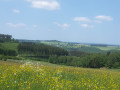
Cornimont is the smallest village in the Bièvre area (46 inhabitants). It is every bit as charming as Gros-Fays, which is on the list of Belgium's most beautiful villages, with its schist stone houses and beech forest.
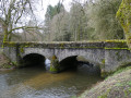
Between Lesse and Lesse
 11.42 mi
+1,194 ft
-1,191 ft
6h 15
Moderate
Departure from Libin (Province de Luxembourg)
11.42 mi
+1,194 ft
-1,191 ft
6h 15
Moderate
Departure from Libin (Province de Luxembourg)
Mainly through woodland but with two long stretches in the countryside, this walk takes you on a journey of discovery through the upper Lesse and its hamlet of the same name. Mostly along wide paths, the route is fairly easy, though some sections may be a little muddy following seasonal forestry work.
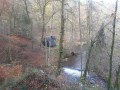
Les Hayons, one of the villages in the Bouillon area
 8.28 mi
+1,391 ft
-1,391 ft
5h 00
Moderate
Departure from Bouillon (Belgique) (Province de Luxembourg)
8.28 mi
+1,391 ft
-1,391 ft
5h 00
Moderate
Departure from Bouillon (Belgique) (Province de Luxembourg)
Roche Levée, Saut des Sorcières, Mont Zatrou viewpoint, Roche Percée: these are just some of the places you will discover on this hike.
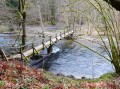
The two waters from Lesse
 11.69 mi
+1,027 ft
-1,024 ft
6h 15
Moderate
Departure from Libin (Province de Luxembourg)
11.69 mi
+1,027 ft
-1,024 ft
6h 15
Moderate
Departure from Libin (Province de Luxembourg)
Set off on a walk themed around water and the forest from the hamlet of Lesse.The two main rivers in the region are the Our and the Lesse, which converge less than 2 km from the starting point.
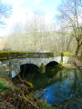
Walk between the Lesse and the Our
 10.53 mi
+1,033 ft
-1,024 ft
5h 45
Moderate
Departure from Libin (Province de Luxembourg)
10.53 mi
+1,033 ft
-1,024 ft
5h 45
Moderate
Departure from Libin (Province de Luxembourg)
Starting from the hamlet of Lesse, the walk begins by following the river of the same name upstream on the left bank, crosses it at the Moulin de Molhan and then heads along the right bank towards Villance.Shortly after the 4-kilometre mark, the route branches off due south towards the Pont de la Justice before reaching the centre of Maissin. On leaving Maissin, the walk heads out into the countryside before entering the forest and descending gently towards the Our, which you follow almost to its confluence with the Lesse. No difficulties apart from a bit of mud here and there.
Legendary site of Rocher du Cuy
 3.44 mi
+377 ft
-381 ft
1h 55
Easy
Departure from Libin (Province de Luxembourg)
3.44 mi
+377 ft
-381 ft
1h 55
Easy
Departure from Libin (Province de Luxembourg)
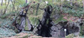
An eight-shaped route to the legendary site of Rocher du Cuy, also known as Roche aux Nutons, and the Villance forest. Nutons are creatures from Belgian and Ardennes folklore, often described as small, skilful beings living in caves and near waterways.
Circular of the great REX from Botassart
7.23 mi
+1,434 ft
-1,854 ft
4h 35
Moderate
Departure from Bouillon (Belgique) (Province de Luxembourg)
Circular passing by the resting place of the great L.D.
A route with elevation changes and beautiful scenery, but not too difficult. You can even avoid getting your feet wet. About 4½ hours of walking at a good pace.
Forest paths and country roads in Villance
 4.46 mi
+377 ft
-381 ft
2h 25
Easy
Departure from Libin (Province de Luxembourg)
4.46 mi
+377 ft
-381 ft
2h 25
Easy
Departure from Libin (Province de Luxembourg)
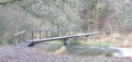
Circular route in the Ardennes forest in the Libin region, combining forest paths, trails and quiet country roads for the last two kilometres. Set off to discover the Devil's Stone, the Haute Lesse, the Pont de la Justice and Notre-Dame de Taillevent.
Two days between Lesse and Lomme around Libin
 32.33 mi
+2,740 ft
-2,749 ft
2 days
Difficult
Departure from Libin (Province de Luxembourg)
32.33 mi
+2,740 ft
-2,749 ft
2 days
Difficult
Departure from Libin (Province de Luxembourg)
A wooded walk through the Grande Forêt de Saint-Hubert, amongst rivers and streams.
The route takes you on a journey of discovery to the source of the Lesse, the old truffle grounds of Libin and its former kaolin quarry. Explore the valleys of this magnificent region at your own pace.
Villance – Bané Bivouac
 17.24 mi
+1,381 ft
-1,033 ft
9h 10
Difficult
Departure from Libin (Province de Luxembourg)
17.24 mi
+1,381 ft
-1,033 ft
9h 10
Difficult
Departure from Libin (Province de Luxembourg)
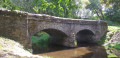
This first section runs along the western and southern boundaries of the municipality of Libin. Discover the Anloy military cemetery and the First World War memorial steles in Ochamps. Pass close to the Source de la Lesse and finish at the Bané campsite.
Rochehaut – Bouillon
 7.89 mi
+1,168 ft
-1,270 ft
4h 40
Moderate
Departure from Bouillon (Belgique) (Province de Luxembourg)
7.89 mi
+1,168 ft
-1,270 ft
4h 40
Moderate
Departure from Bouillon (Belgique) (Province de Luxembourg)
The starting point, the Rochehaut viewpoint, is one of the region’s most beautiful spots, offering a bird’s-eye view of a circular bend in the River Semois and the little village of Frahant. As for the finishing point, it is one of the most popular tourist attractions, with its superb fortified castle perched above the town. In between, along the way, there are forests, steep ascents and descents, and magnificent scenery. Accommodation at the Youth Hostel.
A walk towards the Arboretum and the Château des Fées
 10.80 mi
+1,762 ft
-1,752 ft
6h 30
Difficult
Departure from Bertrix (Province de Luxembourg)
10.80 mi
+1,762 ft
-1,752 ft
6h 30
Difficult
Departure from Bertrix (Province de Luxembourg)
Set off to explore the Château des Fées, a rocky outcrop secured by a few low stone walls, as well as the Bertrix Arboretum, where you can discover numerous specimens of trees from all corners of the world.This beautiful, exclusively woodland walk, which is very quiet, should be considered difficult not only because of its cumulative elevation gain but also due to a few sections on steeply sloping paths or paths that are virtually non-existent on the ground. It’s not the Alps or the Vosges... just Wallonia on the Semois side!