


Picnic tables at the starting point and at (8).
A few benches here and there along the signposted sections.
Exploring the Graide Maquis


Like many other Ardennes woodlands, the one between Graide and Haut-Fays was home to a Maquis camp in 1944. This walk takes you to discover this camp and part of the woodland to the north of the route of the old tram line that once linked Graide to Wellin.
Details
Creation:
Last update:
Last review:
–
–
-
 Activity: Walking
 -
 Distance: 11.79 mi
 -
 Average duration: 6h 15
 -
 Difficulty: Moderate
 -
-
 Back to start: Yes
 -
 Ascent: + 948 ft
 -
 Descent: - 938 ft
 -
-
 Highest point: 1,385 ft
 -
 Lowest point: 1,043 ft
-
 Country:
Belgium
Country:
Belgium
-
 Area: Massif des Ardennes
 -
 City:
Bièvre
City:
Bièvre -
 Start/End: N 49.950248° / E 5.065202°
 -


 Hour-by-hour weather
Photos
Waypoints
- S/E : mi 0 - alt. 1,145 ft - Salle Graidelle car park
- 1 : mi 0.38 - alt. 1,188 ft - Chapel and wayside cross
- 2 : mi 0.74 - alt. 1,204 ft - Jardin des Hiboux
- 3 : mi 0.89 - alt. 1,230 ft - Symbiosa
- 4 : mi 1.55 - alt. 1,270 ft - Givet Walk
- 5 : mi 2.87 - alt. 1,135 ft - Ruisseau des Rives
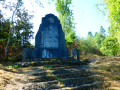
- 6 : mi 3.6 - alt. 1,263 ft - Maquis Camp memorial
- 7 : mi 4.54 - alt. 1,119 ft - Maquis Memorial
- 8 : mi 5.06 - alt. 1,142 ft - Maquis parachute drop zone
- 9 : mi 5.74 - alt. 1,171 ft - Picnic area and tables
- 10 : mi 5.94 - alt. 1,191 ft - The Vieille Église stream
- 11 : mi 7.73 - alt. 1,191 ft - A fork in the road near the wind turbines
- 12 : mi 9.22 - alt. 1,171 ft - Ruisseau des Rives
- 13 : mi 10.87 - alt. 1,240 ft - Former Graide–Wellin local road
- S/E : mi 11.79 - alt. 1,145 ft - Salle Graidelle car park
Notes
Other walks in the area
Graide, Gedinne and Gaide
 Visorando Member16.20 mi
+1,421 ft
-1,401 ft
8h 40
Visorando Member16.20 mi
+1,421 ft
-1,401 ft
8h 40
 Very difficult
 Departure from Bièvre (Province de Namur)
Set off from Graide on a circular walk to Gedinne. Stop for a bite to eat at L'Hôtel de la Poste, a high-quality restaurant. Enjoy the varied landscapes before returning to Graide via a different path. Remember to check the restaurant's opening hours.
Idyllic Ardennes from Graide
 12.16 mi
+919 ft
-945 ft
6h 25
12.16 mi
+919 ft
-945 ft
6h 25
 Difficult
Departure from Bièvre (Province de Namur)
Difficult
Departure from Bièvre (Province de Namur)
The walk starts at Graide-station in the province of Namur and winds its way through pastures, Christmas tree plantations and forests. You’ll pass by the Étangs des Tranlets, the old mill on the Ruisseau du Ruaumoulin and the Notre-Dame de Bon-Secours Chapel in Oizy, before finally ending at Carlsbourg station in the province of Luxembourg.
Les Maquisards as seen from the road from Gembes to Graide
 9.13 mi
+758 ft
-748 ft
4h 50
Moderate
Departure from Bièvre (Province de Namur)
9.13 mi
+758 ft
-748 ft
4h 50
Moderate
Departure from Bièvre (Province de Namur)
Starting from the walking trail signpost located along the Gembes–Graide road, this walk through lush woodland takes you past the Agrainchenet stud farm to the Maquisards site, a key centre of the local Resistance.Apart from the Maquisards site and the few works of art that highlight it, this walk offers lovely views of the countryside and the (distant) villages of Gembes and Haut-Fays.
Circular walk from Naomé via Baimont, Francs-Bois, Roda and Perlefontaine
 6.46 mi
+686 ft
-902 ft
3h 35
Moderate
Departure from Bièvre (Province de Namur)
6.46 mi
+686 ft
-902 ft
3h 35
Moderate
Departure from Bièvre (Province de Namur)
A circular walk starting from Naomé, which can easily be completed in 2 hours. The walk starts near the church, heading towards Opont. On reaching the pond, the route follows the GR®14 and takes the path that climbs to the right of the Douaire pond. The walk then continues along the GR®14 before leaving it shortly afterwards.
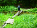
In the heart of the southern Ardennes towards Naomé
 9.50 mi
+853 ft
-840 ft
5h 05
Moderate
Departure from Bièvre (Province de Namur)
9.50 mi
+853 ft
-840 ft
5h 05
Moderate
Departure from Bièvre (Province de Namur)
The village of Naomé is located in the heart of the Southern Ardennes Nature Park, which covers nine Belgian municipalities in southern Wallonia: Bertrix, Bièvre, Bouillon, Daverdisse, Gedinne, Herbeumont, Paliseul, Vresse-sur-Semois and Wellin. This walk, which takes you through both countryside and forest, starts in Naomé.
Along the Our
 11.62 mi
+817 ft
-843 ft
6h 05
Moderate
Departure from Paliseul (Province de Luxembourg)
11.62 mi
+817 ft
-843 ft
6h 05
Moderate
Departure from Paliseul (Province de Luxembourg)
This beautiful hike will take you into the heart of the Ardennes forest to explore the whole of Our, one of the most beautiful villages in Wallonia, following the course of the river of the same name and tributary of the Lesse. Discover undergrowth made up of rocky outcrops, scree slopes and streams running alongside or crossing the paths.
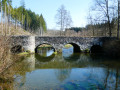
Between Lesse and Our
 13.31 mi
+1,165 ft
-1,168 ft
7h 10
Difficult
Departure from Daverdisse (Province de Luxembourg)
13.31 mi
+1,165 ft
-1,168 ft
7h 10
Difficult
Departure from Daverdisse (Province de Luxembourg)
Starting from the Notre-Dame de Beauraing Chapel, situated on the edge of the woods to the east of Porcheresse, the walk takes you mainly through woodland to discover the confluence of the Our and the Lesse before following the course of the Lesse upstream via two pretty stone bridges: the Pont Marie-Thérèse and the Pont de la Justice.On the return journey, the route leaves the Lesse, passes through Maissin and crosses the Our at Our via another pretty stone bridge before returning to the starting point.
For more walks, use our search engine .
The GPS track and description are the property of this route's author. Please do not copy them without permission.

