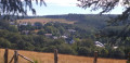
Idyllic Ardennes from Graide

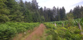
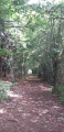
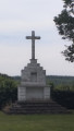
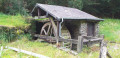
The walk starts at Graide-station in the province of Namur and winds its way through pastures, Christmas tree plantations and forests. You’ll pass by the Étangs des Tranlets, the old mill on the Ruisseau du Ruaumoulin and the Notre-Dame de Bon-Secours Chapel in Oizy, before finally ending at Carlsbourg station in the province of Luxembourg.

Details

3623393
Creation:
Last update:
Last review:
  • Walking
    Activity: Walking
  • ↔
    Distance: 12.16 mi
  • ◔
    Average duration: 6h 25 
  • ▲
    Difficulty: Difficult

  • ⚐
    Back to start: No
  • ↗
    Ascent: + 919 ft
  • ↘
    Descent: - 945 ft

  • ▲
    Highest point: 1,447 ft
  • ▼
    Lowest point: 1,014 ft

Photos

Description of the walk

(S) Graide-station railway station.

No signposting

From the station building, head towards the road. Opposite you, diagonally to your left, you’ll see hiking signposts and the playground. Turn left and head up Rue de Baillamont towards Vresse. At the junction, continue right onto Rue des Misères towards Vresse. Ignore the road on your right and leave the built-up area. Take care as there is no longer a hard shoulder.

Green Rectangle Triangle

(1) Turn left onto the farm track. Follow it to the N95. Turn left and walk carefully alongside the busy N95. Turn immediately right onto the road near the house. At the next house, turn left onto the farm track.

Unmarked

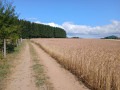
Walk alongside fields and Christmas trees. At thefirst junction, carry on straight ahead.

(2) At the second junction, turn right and walk for 500 m, ignoring the paths branching off to your left; the track curves sharply to the right. Then walk for 750 m; the track curves sharply to the left halfway along.

(3) At the junction, carry on straight ahead for 600 m, staying on the main path until you reach the road and the hamlet known as Ruisseau et Étangs des Tranlets.

Red Diamond signposting

Continue along the road until you reach the crossroads.

(4) At the crossroads, turn left and walk for 450 m. Ignore the path on your left and continue along the forest track.

No markings

A path joins from your right.

(5) At the junction with the fenced-off plot, turn right. Walk alongside the private game reserve on your left. Pass some properties with ponds. At the T-junction, turn left onto the road. Follow the Route de la Rochette uphill and, further on, pass the football pitch.

(6) At the junction, turn left. Head down the road and enter Monceau-en-Ardenne. At the end of the road, turn right. Keep to the left until you reach the junction with the N914.

(7) Turn left towards Vresse. Follow the A914 until you reach the cemetery.

Yellow Rectangle Signposting

(8) Turn left onto the farm track running alongside the cemetery and keep to the left. Follow the track downhill and then enter the woodland. Stay on the main forest track, which curves sharply to the left.

(9) At a place called Le Ban, carry on straight ahead.

No signposting

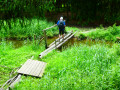
Walk down to the Ruaumoulin mill. Walk past the house and then past the small building with the waterwheel. Walk back up the track. Ignore thefirst track on your left and continue uphill until you reach the second track.

(10) Turn left. The path is clearly marked and turns right further on. Carry on, rejoin another path and continue straight ahead.

(11) At the T-junction, turn left. At the clear-cut area, carry on straight ahead. The path turns right and goes downhill. Ignore the paths on your left.

(12) At the road, carry on to the left until you reach the N945. You can visit the listed church in Oizy. ( see § Practical information)

Blue Rectangle Triangle signposting

(13) When you reach the road, cross it and set off along Rue de la Chapelle. At the Fork in the road with the chestnut tree and its bench, take the left-hand road. Leave Oizy behind and walk past the Christmas trees. Ignore the road branching off to the right at the hamlet of Chapelle Notre-Dame de Bon Secours.

(14) At the fork in the road, take the road on the right and head downhill.

Green Rectangle Triangle signposting

(15) After the hunter’s bench, turn left onto the forest track. At the junction, carry on straight ahead. When you reach the road, turn left and head back up to the crossroads.

GR® signposting: white and red stripes

(16) At the crossroads in the hamlet of La Côre, turn right and pass an open area.

(17) At the hamlet of Gon du Sarté, take the path on the left. You will enter the province of Luxembourg. At the hairpin bend, carry on straight ahead until you reach the N95. Cross with care and continue along the path opposite. Ignore the path on your right and carry on straight ahead until you reach the other main road. Cross with care and carry on straight ahead. Ignore thefirst path on your left.

(18) At the fork in the road just after this, take the path on the left. Walk alongside meadows with electric fences for 1.2 km.

(19) At the junction (not shown on the map), turn right. At the crossroads just after, carry on straight ahead.

Unmarked

Follow the main path, ignoring all the paths on your right. The path approaches the railway line. Go through the barrier and head downhill. At the road, heading back the way you came, turn right and then immediately left to reach the platform for Dinant-Namur, or go under the bridge to reach the platform for Libramont (E).

Waypoints

  1. S : mi 0 - alt. 1,283 ft - Graide Station
  2. 1 : mi 0.29 - alt. 1,335 ft - Farm track on the left
  3. 2 : mi 1.51 - alt. 1,329 ft - At the second set of junctions, turn right
  4. 3 : mi 2.29 - alt. 1,371 ft - At the crossroads, go straight on
  5. 4 : mi 2.82 - alt. 1,227 ft - At the crossroads, take the path on the left
  6. 5 : mi 3.17 - alt. 1,240 ft - At the junction with the fence, turn right
  7. 6 : mi 3.99 - alt. 1,319 ft - Junction after the football pitch, on the left
  8. 7 : mi 4.42 - alt. 1,263 ft - Turn left onto the N914, towards Vresse
  9. 8 : mi 4.65 - alt. 1,250 ft - At the cemetery, turn left
  10. 9 : mi 5.79 - alt. 1,063 ft - Le Ban, straight ahead
  11. 10 : mi 6.11 - alt. 1,115 ft - After the mill, take the second turning on the left
  12. 11 : mi 6.6 - alt. 1,201 ft - Turn left at the T-junction
  13. 12 : mi 7.16 - alt. 1,171 ft - On the road, turn left
  14. 13 : mi 7.45 - alt. 1,220 ft - On the N945, carry straight on
  15. 14 : mi 8.22 - alt. 1,312 ft - At the fork in the road after the chapel, turn right
  16. 15 : mi 8.46 - alt. 1,312 ft - After the hunter’s chair, turn left
  17. 16 : mi 9.26 - alt. 1,325 ft - At the crossroads in the hamlet of La Côre, turn right
  18. 17 : mi 9.71 - alt. 1,355 ft - At a place called Gon du Sarté, take the path on the left
  19. 18 : mi 10.64 - alt. 1,414 ft - At the fork in the road, take the path on the left
  20. 19 : mi 11.38 - alt. 1,362 ft - At the junction, turn right
  21. E : mi 12.16 - alt. 1,266 ft - Carlsbourg station

Notes

At (13), you can take a detour to see the Church of Saint-Hubert, a listed 17th-century monument. Head left and turn at thefourth road on your left. Retrace your steps back to the N945. Cross the road and take Rue Clément Brasseur opposite. At the junction, turn right. Ignore Rue des Juifs and keep to the right until you reach the small square with the chestnut tree. Turn left and rejoin the route.

A lovely climb starting from the Moulin de Ruaumoulin after the (10).

Drinks available in Oizy: Terroirs des Ardennes, Rue de la Chapelle (shop selling local, regional and artisanal products from the Ardennes)
Opening hours: Friday: 2 pm to 7 pm / Saturday: 8.15 am to 7 pm / Sunday: 8.15 am to 12 noon (closed on Mondays). School holidays: every day from 8.15 am to 7 pm.
On weekdays: please book in advance by email: info@terroirdesardennes.eu or by telephone: +32(0)61 51 23 99 – mobile: +32(0)472 916 347.

For the return journey:
Graide and Carlsbourg stations are served hourly (every two hours at weekends and on public holidays) by the L train from Libramont to Bertrix to Dinant. There are also a few buses, but services are very infrequent and few buses run at weekends, during school holidays or on public holidays. So please be careful and plan your journey well in advance!

Worth a visit

During your visit:

Ruaumoulin Mill.
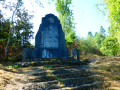
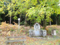
Notre-Dame de Bon-Secours Chapel in Oizy.

Nearby:

Saint-Hubert’s Church in Oizy: a listed 17th-century monument.

Always be cautious and plan ahead when you're outdoors. Visorando and the author of this route cannot be held responsible for any accidents occurring on this route.

The GR® and PR® markings are the intellectual property of the Fédération Française de Randonnée Pédestre.

Reviews and comments

4.7 / 5
Based on 2 reviews

Reliability of the description
5 / 5
Ease of following the route
4.5 / 5
Route interest
4.5 / 5
pa va
pa va
• Edited:

Overall rating : 4 / 5

Date of your route : Mar 21, 2021
Reliability of the description : Not used / Not applicable
Ease of following the route : ★★★★☆ Good
Route interest : ★★★★☆ Good
Very busy route : No

Thanks for the great ideas; the mill along the route really is an unusual find.
We set off towards Carlsbourg, heading for Graide station

Machine-translated

MichelFoisset
MichelFoisset

Overall rating : 5 / 5

Date of your route : Jan 31, 2021
Reliability of the description : ★★★★★ Very good
Ease of following the route : ★★★★★ Very good
Route interest : ★★★★★ Very good
Very busy route : No

A magnificent hike in cold weather on snow-covered ground.
There was a minor difficulty between points 8 and 9, where broom bushes over 2 metres tall and laden with snow were blocking the path. Between these two points, swollen streams were flooding the path, making it necessary to walk alongside it through the fir forest.
Point 10: “A tree trunk across the path… etc.” The path had been completely cleared all the way to point 11. The stretch between these two points was particularly beautiful.

Machine-translated

Other walks in the area

For more walks, use our search engine .

The GPS track and description are the property of this route's author. Please do not copy them without permission.