A bit of history in the woods around Maissin

Maissin, a village forming part of the very new Southern Ardennes Nature Park, was the scene of a bloody battle between the German and French armies on 22 and 23 August 1914. It was the only engagement won by the French in Belgium. Starting from the Pierre Massé military cemetery, discover the sites of the old, original cemeteries, as well as La Mambore and its llamas, the Pont de la Justice, the Roche des Nutons and the Pont Marie-Thérèse.

Details

3373902
Creation:
Last update:
Last review:
  • Walking
    Activity: Walking
  • ↔
    Distance: 8.17 mi
  • ◔
    Average duration: 4h 25 
  • ▲
    Difficulty: Moderate

  • ⚐
    Back to start: Yes
  • ↗
    Ascent: + 719 ft
  • ↘
    Descent: - 738 ft

  • ▲
    Highest point: 1,355 ft
  • ▼
    Lowest point: 1,060 ft

Photos

Description of the walk

Car park at the Pierre Massé cemetery on Rue Commandant Henri Calvez.

(S/E) With the cemetery on your left – an early, so-called ‘circular’ cemetery – head down towards the village centre. Ignore the road on the left and then the one on the right. At the N899, turn left towards the church. Head to the right of the church. Turn right towards Jéhonville onto Rue du19e régiment d’infanterie de Brest. Walk down the road and, at the crossroads, turn right. Turn left at thefirst road and walk up it.

(1) At the 1964 war memorial, turn left onto the farm track. At the Fork in the road (not shown on the OSM map), keep to the left. Walk alongside the meadow on your left and the forest on your right. The track climbs.

(2) When you reach the embankment of the tram line and the pond that you can just make out through the branches on your left, take a sharp left-hand bend. Follow the old tram track, which is a bit overgrown for just under 200 m.

(3) Take a sharp right-hand bend onto the path below.

(4) The path bends left at the pond you have just passed. At the second bend, take the path straight ahead. Follow the fence of the meadow on your left; as the area has been clear-cut, the path is barely visible. At the forest track, turn left. At the road, turn left. Walk carefully along the road for 100 m.

(5) Turn right at the hairpin bend and walk towards the campsite. Cross through the campsite; as it is on public land, there are no gates to stop you. Pass the main building and follow the road uphill to a crossroads, known as ‘Trois Fontaines’, where a forest track joins. Turn left.

Green Rectangle signpost

The path turns right.

(6) At the fork in the road, take the left-hand path. At the crossroads, keep to the left.

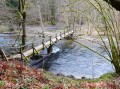
(7) At the next junction, first turn right then left. Stay on the main path, ignoring the paths running at right angles to it. As you pass a clearing in a field on your left, you’ll catch a glimpse of Maissin in the distance. At the junction, turn left and head downhill to the road. Cross carefully and take the steps opposite. Set off along the footpath. Walk through La Mambore and, depending on the time of year, spot its llamas. Follow the fenced-off path until you come to a track, which you take to the right. Cross the Pont de la Justice.

(8) At the crossroads, turn left; 500 metres further on, you’ll pass the Roche des Nutons. Continue until you reach the road.

(9) Turn left and follow the road for 700 metres, ignoring the road on your right and the subsequent dirt track. Change of signposting.

Red Diamond markings

(10) Turn onto the road on your left. Cross the Marie-Thérèse bridge and head up to the N899. Cross the road and continue along the road opposite.

(11) At the junction, take the left-hand hairpin bend. Discover the memorial erected by the commune of Maissin in honour of the Breton and Vendéen soldiers of the 11th Army Corps who fell in 1914. Continue to the right along the N899 until you reach the entrance to the hotel, then cross the road carefully to see the site of the old ‘terrace’ cemetery. Retrace your steps.

(11) Continue along the road opposite. Turn right at thefirst road. Walk for 1 km along the road, which becomes a dirt track as you enter the forest. Follow the main forest track to a crossroads. The signposting ends here.

No signposting

(12) Turn left. At the crossroads, carry straight on along the barely marked path opposite. Turn right at the next junction. Walk to the T-junction.

(13) Turn left and continue to the road. Discover thethird site of the old ‘primitive’ cemetery, known as the ‘elongated’ cemetery. Turn right onto the road and turn left at thefirst track.

Yellow Rectangle Signposting

(14) At the T-junction, turn left. Keep left at the next junction and follow the road uphill. Ignore the road coming from your right. Continue to the junction with another road. Turn right and continue to the Pierre Massé cemetery and its car park (S/E).


Waypoints

  1. S/E : mi 0 - alt. 1,293 ft - Car park at the Pierre Massé cemetery - Nécropole franco-allemande (Maissin) - Belgique
  2. 1 : mi 0.81 - alt. 1,234 ft - Dirt track on the left
  3. 2 : mi 1.37 - alt. 1,227 ft - At the hairpin bend by the pond, turn left
  4. 3 : mi 1.49 - alt. 1,178 ft - Sharp bend to the right
  5. 4 : mi 1.61 - alt. 1,198 ft - Path on the left
  6. 5 : mi 1.88 - alt. 1,178 ft - Hairpin bend
  7. 6 : mi 2.36 - alt. 1,302 ft - Turn left at the fork in the road
  8. 7 : mi 2.52 - alt. 1,283 ft - Turn right or left at the junction
  9. 8 : mi 3.31 - alt. 1,109 ft - At the crossroads, turn left after the bridge over the - lesse (rivière) - Belgique
  10. 9 : mi 3.8 - alt. 1,102 ft - Turn left onto the road
  11. 10 : mi 4.26 - alt. 1,099 ft - Turn left onto the road
  12. 11 : mi 4.76 - alt. 1,188 ft - Junction. Return trip to the old, original cemetery
  13. 12 : mi 6.06 - alt. 1,214 ft - At the fork in the road, turn left
  14. 13 : mi 6.44 - alt. 1,342 ft - T-junction: turn left
  15. 14 : mi 7.25 - alt. 1,257 ft - At the T-junction, turn left
  16. S/E : mi 8.17 - alt. 1,293 ft - Car park at the Pierre Massé cemetery

Notes

Information boards can be found at each cemetery and memorial.

La Mambore estate: we are granted permission to use the path. Please take particular care to respect the area (livestock, fences, vegetation, cleanliness, etc.). The well-fenced path is for pedestrians only and is open during daylight hours.

There is a mini-market and a bakery/sandwich shop in Maissin.

From October to December, please be aware of hunting dates.

Worth a visit

During

Pierre Massé Military Cemetery: this is the final resting place of 282 French and 513 German soldiers, buried in individual graves. Two ossuaries hold the remains of a further 3,001 French soldiers, whilst a third, mixed ossuary contains the remains of 643 French and 343 German soldiers.

Breton granite Calvary: serves as a reminder that many of the French soldiers who fell in battle came from Brittany and the Vendée. It was donated by the village of Tréhou in France to commemorate the sacrifice of the Breton soldiers of the 11th Corps on 22 and 23 August 1914.

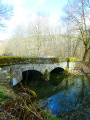
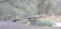
The Pont de la Justice, built of schist rubble, comprises two arches joined by a spout upstream and downstream. The parapet is topped with schist stones set on edge and cut into a half-moon shape. Both entrances are widened. Situated near the hamlet known as ‘La Justice’, this bridge dates from the 19th century and likely replaces an older structure. It enabled travellers to cross the River Lesse, between Villance and Maissin, on a major road linking Saint-Hubert to France.

The Nutons rocks: as with any good spot in the Ardennes, there are ‘nutons’ in the forest between the Pont de la Justice and the Pont Marie-Thérèse.

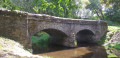
The Marie-Thérèse Bridge: dating from the 18th century, it stands on the border between Maissin and Villance. It is a remarkable, listed schist structure comprising four unequal arches, the parapet of which is topped with half-moon-shaped cut stones. The widened entrances allowed the herdsman to channel the animals before they crossed the bridge. Upstream, three spouts between the arches channelled the water towards the four openings. Tradition has it that Empress Maria Theresa had the bridge built following an accident she suffered whilst crossing the river on horseback. The reality is quite different: this four-arched bridge was built over the Lesse to modernise the old Bouillon–Liège road.

Three sites of early cemeteries (circular, elongated and terraced) with information panels, as well as two memorials.

Reviews and comments

4.8 / 5
Based on 2 reviews

Reliability of the description
5 / 5
Ease of following the route
5 / 5
Route interest
4.5 / 5
Papou etienne
Papou etienne
• Edited:

Overall rating : 4.7 / 5

Date of your route : Feb 01, 2021
Reliability of the description : ★★★★★ Very good
Ease of following the route : ★★★★★ Very good
Route interest : ★★★★☆ Good
Very busy route : Yes

Just like the previous routes, it was brilliant – the paths and trails were very accessible. I’d definitely recommend it, and I can’t wait to go on some new hikes using your app. Well done.

Etienne

Machine-translated

Louis Anne
Louis Anne

Hello,

I haven’t done this walk yet, but I’ll be doing it next week.

Kind regards.

Louis

Machine-translated

petijosi
petijosi

No problem. Your website allows us to link up various existing walks and, above all, some exceptional sites. Many thanks

Machine-translated

lazzerini
lazzerini

Hello petijosi,

when I say ‘follow the fence’, I don’t mean actually touching the posts, but simply indicating a direction. I did the walk in early June and it’s possible the vegetation has grown over it since then. I’ll pop back there when I get the chance, but thank you for already providing an alternative for the next person.

Enjoy your next hike
Kind regards

Machine-translated

petijosi
petijosi

Overall rating : 5 / 5

Date of your route : Aug 01, 2020
Reliability of the description : ★★★★★ Very good
Ease of following the route : ★★★★★ Very good
Route interest : ★★★★★ Very good
Very busy route : No

A lovely walk combining remembrance, geology and history. Please note, there is an issue with the route description: “Follow the fence around the meadow on your left; as the area has been clear-cut, the path is barely visible”: it is IMPOSSIBLE to follow this fence, which is overgrown with brambles and ferns. The alternative: simply continue along the path for 75 metres, turn left onto a firebreak, then left again at the top of the hill. At this point, you’ll rejoin the path described in your guide.
Some very beautiful views.

Machine-translated

Other walks in the area

For more walks, use our search engine .

The GPS track and description are the property of this route's author. Please do not copy them without permission.