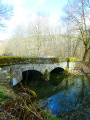
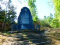
The Our and the Five-Trunk Oak

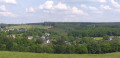
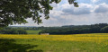
Starting from one of Wallonia’s most beautiful villages, this is a leisurely walk to discover the five-trunk oak.

Details

10372837
Creation:
Last update:
Last review:
  • Walking
    Activity: Walking
  • ↔
    Distance: 6.46 mi
  • ◔
    Average duration: 3h 35 
  • ▲
    Difficulty: Moderate

  • ⚐
    Back to start: Yes
  • ↗
    Ascent: + 738 ft
  • ↘
    Descent: - 738 ft

  • ▲
    Highest point: 1,434 ft
  • ▼
    Lowest point: 1,001 ft

Photos

Description of the walk

Car park near the River Our, on the path leading to the Moulin d’Our from Rue de Porcheresse.

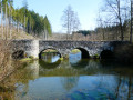
(S/E) With the River Our on your left, return to the road. Turn left onto theGR® and cross the bridge over the River Our. Continue left onto Rue de Lesse. Walk past the Hôtel-Restaurant Les Terrasses de L’Our. Follow the road uphill, leave the built-up area and walk to a junction. Leave the GR®.

(1) Carry on straight ahead. The road becomes a stony track. Stay on the main track, pass through a cattle grid and, at the Fork in the road, turn right. Walk alongside the fir woods and ignore the tracks on your left after the bend.

(2) At the fork in the road, take the grassy path, which is less clearly marked, slightly to the left. The path becomes a track and leads to a road. Cross diagonally to the left and continue along the forest track towards the Hêtre Ollivier. At the fork, turn right. Walk past the marker post for the Hêtre Ollivier. Continue along the wide forest track until you reach a path that is half tarmac, half dirt.

(3) Turn left and, before the hunter’s bench on your right, turn left onto the forest track leading back into the woods. Follow this forest track as it turns right.

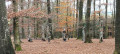
(4) Discover the Five-Trunk Oak, at the hamlet of the same name, along the path. Continue along the forest track. Join a path and carry on to the right. Another track joins from your left. Carry on straight ahead and leave the woods. Join a road and follow it downhill for 740 m until you reach the junction at the hamlet of Rond Chenet. Follow the yellow-white-yellow flag markings for a short while.

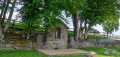
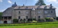
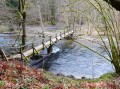
(5) Carry on straight ahead. On your right, you’ll see the ponds. Follow the path and pass through a cattle grid. On your right, there’s a view of the hamlet of Beth. Carry on and ignore the path branching off sharply to your left. Leave the signposting behind. Cross over the River Our. Enter the village of Beth and walk past the Château-ferme. You’ll see a Green Diamond sign for a short while.

(6) At the road, turn right. At the end of the pond, in front of the chapel, turn left. Leave the signposting behind. The path turns right. Walk uphill and rejoin the road and the Green Diamond signposting. Turn left after the building. Walk for 600 m until you reach a path on your left. Leave the signposting behind.

(7) Turn left. To your left, in the distance, you can see Paliseul Church. Go through a cattle grid. Enter the forest, ignoring the less clearly marked paths on your left. The path turns right.

(8) Keep to your right and take the path leading off between the conifers. Head downhill and rejoin a wide path, which you follow until you reach the road. Follow the Green Diamond markings. At the road, at a place called Fond de Saussy, cross carefully and take the forest track opposite. Ignore a track branching off to your left. Further up, ignore the track on your right.

(9) Carry on straight ahead. Ignore all paths on your right for just over 200 m and, when theGR® sign indicates you should turn left (marking on a tree trunk on your left), turn right onto the path markedwith aGR® cross. Leave the markings behind. Walk across open ground alongside a patch of land that has been reclaimed by young birch trees and broom; ignore the path on the right and head under the trees. Follow the track until you rejoin an open path.

(10) View of the village of Our. Head down the dirt track opposite. GR® signposting. The track turns left. Continue downhill to the road and turn right to return to your car park (S/E).


Waypoints

  1. S/E : mi 0 - alt. 1,001 ft - Car park near the
  2. 1 : mi 0.38 - alt. 1,066 ft - Junction (end of signposted route)
  3. 2 : mi 1.14 - alt. 1,260 ft - Grassy path
  4. 3 : mi 1.93 - alt. 1,322 ft - Road
  5. 4 : mi 2.41 - alt. 1,414 ft - Five-trunk oak
  6. 5 : mi 3.27 - alt. 1,145 ft - Junction at the hamlet of Rond Chenet
  7. 6 : mi 4.04 - alt. 1,122 ft - Beth Road and Pond
  8. 7 : mi 4.56 - alt. 1,280 ft - Path
  9. 8 : mi 4.88 - alt. 1,335 ft - Junction
  10. 9 : mi 5.48 - alt. 1,286 ft - Path
  11. 10 : mi 6.13 - alt. 1,158 ft - View of Our
  12. S/E : mi 6.46 - alt. 1,001 ft - Car park near the Our

Notes

Partially exposed, so make sure you protect yourself.
Bench at (S/E)
No drinking water along the route.
From October to December, please be aware of hunting dates.

Worth a visit

Along
The Our, the river
Beech and Olive
Five-trunk oak
Beth, hamlet
Our, the village

Always be cautious and plan ahead when you're outdoors. Visorando and the author of this route cannot be held responsible for any accidents occurring on this route.

The GR® and PR® markings are the intellectual property of the Fédération Française de Randonnée Pédestre.

Reviews and comments

4.1 / 5
Based on 3 reviews

Reliability of the description
3.5 / 5
Ease of following the route
4.7 / 5
Route interest
4 / 5
Figaro
Figaro

Overall rating : 4.3 / 5

Date of your route : Nov 11, 2024
Reliability of the description : ★★★★☆ Good
Ease of following the route : ★★★★★ Very good
Route interest : ★★★★☆ Good
Very busy route : No

A beautiful Ardennes forest all along the walk. And our majestic five-trunked oak.

Machine-translated

gfeller
gfeller

Overall rating : 4 / 5

Date of your route : Feb 09, 2022
Reliability of the description : Not used / Not applicable
Ease of following the route : ★★★★★ Very good
Route interest : ★★★☆☆ Average
Very busy route : No

A pleasant walk through generally light, airy woods and open countryside. The whole route follows good forest tracks.
You won’t have any trouble finding your way if you follow the route on the Visorando app.
The route took 2 hours 40 minutes to complete, in lovely winter sunshine.

Machine-translated

lazzerini
lazzerini

What a shame! That doesn’t suit me

So you had some trouble just from the description alone.
Was it because I mentioned certain tags that confused you?

Machine-translated

Pierre Maniquet
Pierre Maniquet

Hello,

We should have marked the tricky bits along the route… that wasn’t done, and I’m finding it difficult to locate them now…
I usually follow the route saved on my GPS… which is currently faulty (I can’t save this route at all!)…
Kind regards and many thanks for suggesting this walk, which we (two couples) really enjoyed despite a few difficulties.
Pierre Maniquet

Machine-translated

lazzerini
lazzerini

Hello Pierre Maniquet,

Please could you specify the areas where you’re having trouble finding your way so that I can narrow it down...
As for the oak tree… there’s a sign… so I can assume you didn’t take the right forest track.

Kind regards

Machine-translated

Pierre Maniquet
Pierre Maniquet

Overall rating : 4 / 5

Date of your route : Aug 01, 2021
Reliability of the description : ★★★☆☆ Average
Ease of following the route : ★★★★☆ Good
Route interest : ★★★★★ Very good
Very busy route : No

-Difficulty finding one’s way in many places
-Didn’t see the five-trunk oak
-Lost my way at number 8, but found my way back whilst walking down Rue de Graide thanks to the GPS...

Machine-translated

Other walks in the area

For more walks, use our search engine .

The GPS track and description are the property of this route's author. Please do not copy them without permission.