


Refine your search for walks in Montpont-en-Bresse
Montpont-en-Bresse walks


 The Fougères Route in Montpont-en-Bresse
 Tourist office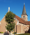
 5.17 mi
 +66 ft
 -66 ft
 2h 25
2h 25
 Easy
Easy
 Departure from Montpont-en-Bresse (Saône-et-Loire)
Before being renamed Montpont-en-Bresse in 1961, the town was first known as “Mons Pavonis” and then “Montpaon”.
Dotted with ponds, streams and rivers, it also boasts a large area of woodland. The charm of this countryside lies in the diversity of its heritage, fine examples of which can be found in the village centre, with its brick church, its town hall housed in a former manor house, and its library set in a traditional Bresse-style building.
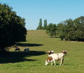
Montpont-en-Bresse Forest Route
 8.21 mi
+164 ft
-138 ft
3h 55
8.21 mi
+164 ft
-138 ft
3h 55
 Moderate
Departure from Montpont-en-Bresse (Saône-et-Loire)
Moderate
Departure from Montpont-en-Bresse (Saône-et-Loire)
Before being named Montpont-en-Bresse in 1961, the village was first known as “Mons Pavonis” and then “Montpaon”.
Dotted with ponds, streams and rivers, it also boasts a large area of woodland. The charm of this countryside lies in the diversity of its heritage, fine examples of which can be found in the village centre, with its brick church, its town hall housed in a former manor house, and its library situated in a traditional Bresse-style building.
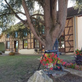
The Montpont-en-Bresse Ponds Route
 6.09 mi
+138 ft
-135 ft
2h 55
Easy
Departure from Montpont-en-Bresse (Saône-et-Loire)
6.09 mi
+138 ft
-135 ft
2h 55
Easy
Departure from Montpont-en-Bresse (Saône-et-Loire)
Before being renamed Montpont-en-Bresse in 1961, the village was first known as Mons Pavonis and then Montpaon.
Dotted with ponds, streams and rivers, it also boasts a large area of woodland. The charm of this countryside lies in the diversity of its heritage, fine examples of which can be found in the village centre, with its brick church, its town hall housed in a former manor house, and its library set in a traditional Bresse-style building.
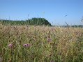
Through the Sornay hedgerows
 9.15 mi
+72 ft
-72 ft
4h 15
Moderate
Departure from Sornay (Saône-et-Loire) (Saône-et-Loire)
9.15 mi
+72 ft
-72 ft
4h 15
Moderate
Departure from Sornay (Saône-et-Loire) (Saône-et-Loire)
Sornay, a rural village with a population of 2,000, is situated near Louhans-Châteaurenaud and Branges and is bordered by two rivers: the Sâne Morte and the Seille. The latter, popular with anglers and boaters, features a towpath ideal for exploring the wetlands and their characteristic flora and fauna.
The meadow and banks of the Seille at Sornay
 4.60 mi
+20 ft
-20 ft
2h 10
Easy
Departure from Sornay (Saône-et-Loire) (Saône-et-Loire)
4.60 mi
+20 ft
-20 ft
2h 10
Easy
Departure from Sornay (Saône-et-Loire) (Saône-et-Loire)
Sornay, a rural village of 2,000 inhabitants situated near Louhans-Châteaurenaud and Branges, is bordered by two rivers: the Sâne Morte and the Seille. The latter, popular with anglers and boaters, features a towpath perfect for exploring the wetlands and their characteristic flora and fauna.
History and nature themed trail in Sornay
 3.03 mi
+16 ft
-16 ft
1h 25
Easy
Departure from Sornay (Saône-et-Loire) (Saône-et-Loire)
3.03 mi
+16 ft
-16 ft
1h 25
Easy
Departure from Sornay (Saône-et-Loire) (Saône-et-Loire)
Sornay, a village situated near Louhans-Châteaurenaud and Branges, is bordered by two rivers: the Sâne-Morte and the Seille. The latter, popular with anglers and boaters, features a towpath that’s perfect for exploring the wetlands and their characteristic flora and fauna.
The Galette Route in Bruailles
 5.88 mi
+151 ft
-154 ft
2h 50
Easy
Departure from Bruailles (Saône-et-Loire)
5.88 mi
+151 ft
-154 ft
2h 50
Easy
Departure from Bruailles (Saône-et-Loire)
Bruailles boasts a well-preserved heritage: the bishop’s house, the vicarage, the church and the bakehouse. The bakehouse was once used by the villagers to bake their bread. Situated in the heart of the village and close to the town hall, it is brought back to life several times a year during various village events.
Two rivers wind their way through the village, flowing between floodplains and wooded countryside: the Vallière and the Solnan.
The Ponds Trail in Louhans
 1.31 mi
+7 ft
-7 ft
0h 35
Easy
Departure from Louhans (Saône-et-Loire)
1.31 mi
+7 ft
-7 ft
0h 35
Easy
Departure from Louhans (Saône-et-Loire)
This walk in the heart of the town offers a real breath of fresh air and allows you to discover the flora and fauna that have found a suitable environment in which to thrive. It’s the perfect family walk to enjoy after exploring the old medieval town and its main street, lined with 157 arcades – one of the longest in France. On Monday mornings, there’s a large market, including a poultry market, situated just on the other side of the railway line.
Route du patrimoine à Louhans
 0.77 mi
+7 ft
-7 ft
0h 20
Easy
Departure from Louhans (Saône-et-Loire)
0.77 mi
+7 ft
-7 ft
0h 20
Easy
Departure from Louhans (Saône-et-Loire)
Surrounded by waterways, Louhans, of Burgundian origin, means ‘pleasant spot by the water’. The medieval town has preserved its main street, featuring 157 arcades – one of the longest in France. Several of the arcaded houses, half-timbered houses, the loggia and the Maison du Bailly are well worth a visit, as are the ancient defensive towers of Saint-Paul and Saint-Pierre. Don’t miss the Hôtel-Dieu and its apothecary’s shop either. A large poultry market is held on Monday mornings.
Romenay's ponds
 Visorando Member6.30 mi
+102 ft
-118 ft
3h 00
Easy
Departure from Romenay (Saône-et-Loire)
Visorando Member6.30 mi
+102 ft
-118 ft
3h 00
Easy
Departure from Romenay (Saône-et-Loire)
A route along easy paths in the Bresse region, starting from the traditional village of Romenay.
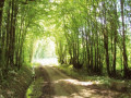
Sentier des Grands Bois in Louhans
 5.17 mi
+105 ft
-98 ft
2h 30
Easy
Departure from Louhans (Saône-et-Loire)
5.17 mi
+105 ft
-98 ft
2h 30
Easy
Departure from Louhans (Saône-et-Loire)
Surrounded by waterways, Louhans, of Burgundian origin, means "pleasant place by the water". Over the centuries, the town has developed thanks to trade. The medieval town has preserved its main street with 157 arcades, one of the longest in France. On Monday mornings, there is a large market, including a poultry market.
From Cuisery to Loisy along the banks of the Seille
5.38 mi
+13 ft
-13 ft
2h 30
Easy
Departure from Cuisery (Saône-et-Loire)
A path linking the Cuisery Water Sports Centre to the Loisy Water Sports Centre along the banks of the Seille. It’s a very pleasant round trip through the countryside and along the riverbank.
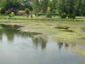
Through the woods, fields and meadows of Vincelles
 4.20 mi
+171 ft
-167 ft
2h 05
Easy
Departure from Vincelles (Saône-et-Loire) (Saône-et-Loire)
4.20 mi
+171 ft
-167 ft
2h 05
Easy
Departure from Vincelles (Saône-et-Loire) (Saône-et-Loire)
In the heart of the Burgundian Bresse region, Vincelles is bordered by the non-navigable stretch of the River Seille, which is a delight for anglers. Close to Louhans-Châteaurenaud, the trails are easily accessible and will take you on a journey through nature, passing through woods, fields and meadows.
Route de Fontaine Couverte via the aerodrome
5.11 mi
+66 ft
-69 ft
2h 25
Easy
Departure from Cuisery (Saône-et-Loire)
This circular route allows you to discover all that Cuisery has to offer: the village centre, the aerodrome, the countryside (pond, woods, fields), including wildlife: Bresse poultry farms, horses in the meadows or at the riding school, birds by the pond, and occasionally hares or roe deer in the fields.
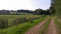
The Cuckoo Route in Vincelles
 1.99 mi
+66 ft
-72 ft
1h 00
Easy
Departure from Vincelles (Saône-et-Loire) (Saône-et-Loire)
1.99 mi
+66 ft
-72 ft
1h 00
Easy
Departure from Vincelles (Saône-et-Loire) (Saône-et-Loire)
In the heart of the Burgundian Bresse region, Vincelles is bordered by the non-navigable stretch of the River Seille, which is a delight for anglers. Close to Louhans-Châteaurenaud, the trails are easily accessible and will take you on a journey through woods and meadows to discover the natural surroundings. In the village, you can admire the private mills that dot the Bresse countryside.
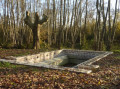
Simandre's three washhouses
 3.94 mi
+43 ft
-43 ft
1h 50
Easy
Departure from Simandre (Saône-et-Loire)
3.94 mi
+43 ft
-43 ft
1h 50
Easy
Departure from Simandre (Saône-et-Loire)
Simandre, on the banks of the Saône and close to Cuisery, is a lively village with many shops. Its Romanesque church and lava stone roof are listed in the Bâtiments de France inventory. You can observe the flora and fauna at the various ponds along the way.
Moulin du Roy trail at Simandre
 3.99 mi
+36 ft
-36 ft
1h 50
Easy
Departure from Simandre (Saône-et-Loire)
3.99 mi
+36 ft
-36 ft
1h 50
Easy
Departure from Simandre (Saône-et-Loire)
Simandre, on the banks of the Saône and close to Cuisery, is a lively village with many shops. Its Romanesque church and lava stone roof are listed in the Bâtiments de France inventory. You can observe the flora and fauna at the various ponds along the route.
The mill and ponds as seen from Vescours
 8.75 mi
+43 ft
-43 ft
4h 05
Moderate
Departure from Vescours (Ain)
8.75 mi
+43 ft
-43 ft
4h 05
Moderate
Departure from Vescours (Ain)
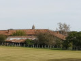
A lovely walk that allows you to discover the farm with its Saracen chimney in the hamlet of Montalibord, with its pond, by taking a short detour of 1 km there and back.
Along the route, there are other ponds and a sign mentioning an old mill on Étang Morel.
In the countryside around Terreferme
 4.53 mi
+148 ft
-171 ft
2h 15
Easy
Departure from Beaupont (Ain)
4.53 mi
+148 ft
-171 ft
2h 15
Easy
Departure from Beaupont (Ain)
An easy walk to discover the peaceful countryside of the Bresse Bourguignonne. The route passes through farmland, a beautiful lake, meadows and woods, finally following a small river. Here and there are scattered Bresse farms, some still in operation.PR®® (yellow) signposts all along the route.
Route nature and lake in Lescheroux
 8.40 mi
+36 ft
-36 ft
3h 55
Moderate
Departure from Lescheroux (Ain)
8.40 mi
+36 ft
-36 ft
3h 55
Moderate
Departure from Lescheroux (Ain)
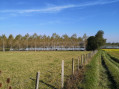
A 14 km walk that will take you to Pontremble Pond, which alone is worth the trip, but you’ll also discover pretty half-timbered houses and plenty more.
Baudrières Route
 12.28 mi
+243 ft
-262 ft
5h 50
Moderate
Departure from Baudrières (Saône-et-Loire)
12.28 mi
+243 ft
-262 ft
5h 50
Moderate
Departure from Baudrières (Saône-et-Loire)
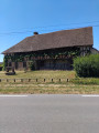
Baudrières is a charming village in the heart of the Natura 2000 area. During your walk, you’ll pass through picturesque landscapes comprising woods, meadows, streams and ponds, and you’ll come across several beautiful Bresse-style houses, including the ‘Maison Forte’ in the hamlet of Tenarre. You can admire the11th-century church with its stone bell tower, and also stop off at La Verne, a lake equipped for fishing and leisure activities.
The Three Mills Route, starting from the church at Chavannes-sur-Reyssouze
8.82 mi
+190 ft
-190 ft
4h 15
Moderate
Departure from Chavannes-sur-Reyssouze (Ain)
A route with little elevation gain, offering the chance to explore part of the Reyssouze Valley near Chavannes.
A lush cattle-rearing region in the heart of the Bresse.
Les Platières de Saint-Étienne-sur-Reyssouze
5.54 mi
+131 ft
-138 ft
2h 40
Easy
Departure from Saint-Étienne-sur-Reyssouze (Ain)
A short, pleasant route with no particular difficulties, offering some lovely views and a variety of paths.
Take the time to admire the views across the Platières (fields or pastures).