The Prairie du Solnan to Condal Route

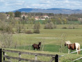
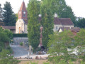
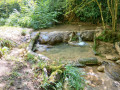
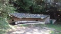
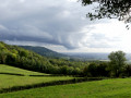
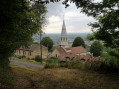
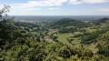
On the edge of the Jura and the Ain, the village of Condal as it stands today is the result of its merger with the commune of Saint-Sulpice in 1809. Although it is crossed by the A39, known as the ‘Green Motorway’, Condal has retained its landscape of green hills overlooking the River Solnan. Watermills, wash houses and Bresse-style farmhouses – whose architecture resembles that of the Ain region due to the village’s location – come into view as the paths wind their way through the countryside.

Details

4756905
Creation:
Last update:
Last review:
  • Walking
    Activity: Walking
  • ↔
    Distance: 8.66 mi
  • ◔
    Average duration: 4h 10 
  • ▲
    Difficulty: Moderate

  • ⚐
    Back to start: Yes
  • ↗
    Ascent: + 203 ft
  • ↘
    Descent: - 217 ft

  • ▲
    Highest point: 735 ft
  • ▼
    Lowest point: 620 ft
  • ⚐ Country: France
  • ⚐ City: Condal (71480)
  • ⚑
    Start/End: N 46.46168° / E 5.28219°
  • ❏
    IGN map(s): Ref. 3127E
  • Hour-by-hour weather

Photos

Description of the walk

Free car park at the City Stade, behind the town hall and the school. A sign for the local “Balade Verte” marks the starting point of the walk.

(S/E) From the car park, take the Route de Saint-Sulpice (D40), leaving the Church of Saint-Laurent and the village hall behind you.

(1) Take thefirst road on the right, the Champ du Moulin, and continue along the Route de Montgardon until you reach the A39 motorway.

(2) Cross the A39 via the bridge over the motorway and continue along the road, which passes through a wood and then a field, until you reach thefirst road on the right in the hamlet of Grosset.

(3) Carry on along this road; after passing a farm, ignore thefirst track on the right, then, 300 metres further on, turn right onto a dirt track which leads, once again, across fields to the A39.

(4) Go under the motorway and continue along the dirt track through the meadows to the Solnan. (The meadows may be flooded when the Solnan is in flood, making the track impassable).

(5) Cross the Solnan and carry on to the next junction, the Route de Croppet. You are now in the heart of the countryside.

(6) Turn right onto the Route de Croppet, then carry on straight ahead onto the Route de Petit Condal. About 600 metres further on, at a bend in the road, you’ll come to a Fork in the road with a wide track.

(7) Turn right off the Route de Petit Condal onto this dirt track until you reach the Route de Varennes Saint-Sauveur (D40).

(8) Turn right onto the Route de Varennes Saint-Sauveur (watch out for traffic) and turn left onto the dirt track just after the bridge over the Solnan.

(9) Continue along the dirt track through the meadows running alongside the Solnan. The meadows may be flooded when the Solnan is in flood, making the track impassable. After about 2 km, the track bends to the right to join the Route de Dommartin (D412).

(10) Turn right off the Route de Dommartin and take thefirst left after a left-hand bend, onto the Chemin des Rétis.

(11) Continue along this track, then follow the dirt track that winds through fields and woods. Pass under the A39 again.

(12) At the next junction, keep right. It’s about 1 km along the edge of fields and woods to the junction with the Route de la Noblesse.

(13) Turn right onto this road, go over the A39 and take thefirst road on the right, Chemin de la Pinède Bressane. Walk through the small woodland until you reach the Route de la Commune. From there, turn left, walk for about 150 m and take the Chemin de la Poissière on the right.

(14) Continue for a few dozen metres along this track and turn onto a track on the left. Follow the edge of the woodland, rejoin the Chemin des Pins and continue to the Route du Bourg (D40). Turn right and continue to the village and the City Stade car park (S/E).


Waypoints

  1. S/E : mi 0 - alt. 682 ft - City Stadium car park
  2. 1 : mi 0.14 - alt. 679 ft - Route Le Champ du Moulin
  3. 2 : mi 1.03 - alt. 682 ft - Green Motorway – A39
  4. 3 : mi 1.43 - alt. 715 ft - Grosset
  5. 4 : mi 2.25 - alt. 636 ft - A39 – Green Motorway
  6. 5 : mi 2.55 - alt. 633 ft - The - Solnan (rivière)
  7. 6 : mi 2.92 - alt. 705 ft - Croppet
  8. 7 : mi 3.63 - alt. 702 ft - Petit Condal
  9. 8 : mi 4.02 - alt. 646 ft - Route de Varennes Saint Sauveur
  10. 9 : mi 4.18 - alt. 640 ft - Bridge over the Solnan
  11. 10 : mi 5.67 - alt. 656 ft - Route de Dommartin
  12. 11 : mi 5.81 - alt. 682 ft - Chemin des Rétis
  13. 12 : mi 6.56 - alt. 666 ft - Passage under the A39
  14. 13 : mi 7.05 - alt. 728 ft - Route de la Noblesse
  15. 14 : mi 8.09 - alt. 725 ft - Chemin de la Poissière
  16. S/E : mi 8.66 - alt. 682 ft - City Stadium car park

Notes

Trainers or light walking shoes are sufficient.

This route runs alongside the Solnan in places. The meadows here may be flooded at certain times of year or very wet. The route will not be passable in such circumstances.

The path is signposted with directional signs (C01) and yellow arrow markings.

Worth a visit

There are also two castles in the commune: one in the village centre and the other in Saint-Sulpice, which once belonged to the Puvis de Chavannes family.

Cuiseaux, a village a few kilometres away, is well worth a detour for its wealth of heritage dating from the Renaissance period.

You are also not far from Louvarel and its lake, where you can go for a swim in the summer.

Reviews and comments

3.9 / 5
Based on 4 reviews

Reliability of the description
4.3 / 5
Ease of following the route
4 / 5
Route interest
3.5 / 5
OT Bresse Bourguignonne

Hello Thvdriet,
thank you for taking the time to leave a comment and bring the issue in Point 14 to our attention.
We will pass this information on to Condal Town Hall.
We hope you still enjoyed the walk.

Have a good afternoon

Mélise
Bresse Bourguignonne Tourist Office

Machine-translated

thvdriet
thvdriet

Overall rating : 4 / 5

Date of your route : Jul 26, 2023
Reliability of the description : ★★★★☆ Good
Ease of following the route : ★★★★☆ Good
Route interest : ★★★★☆ Good
Very busy route : No

A lovely route, but tricky towards the end. After marker 14 in the forest, it’s really impossible to continue. The path through the forest is blocked by brambles and lots of large thorns. We had to turn back on foot and find a detour along the road. It’s a shame to have to close the road like that.

Machine-translated

OT Bresse Bourguignonne

Hello Nerophis39,

Thank you for taking the time to leave a comment. We have identified the issue in point 14 and will report it.
We hope you enjoyed the walk all the same.

Have a lovely rest of the day

Mélise
Bresse Bourguignonne Tourist Office

Machine-translated

nerophis39
nerophis39

Overall rating : 4 / 5

Date of your route : Apr 19, 2021
Reliability of the description : ★★★★★ Very good
Ease of following the route : ★★★★☆ Good
Route interest : ★★★☆☆ Average
Very busy route : No

There are plenty of tarmac roads too, so it’s a pleasant walk without any major difficulties, except at point 14, where the path disappears.

Machine-translated

OT Bresse Bourguignonne

Hello Terreferme

Thank you for taking the time to leave a review. We’re delighted that you enjoyed this walk. We’ll report the issue encountered at WPT 14 to Condal Town Hall.
We’ll try to enhance the Burgundian Bresse area by posting more routes on Visorando to help people explore the region.

Have a lovely day

Mélise
Bresse Bourguignonne Tourist Office

Machine-translated

OT Bresse Bourguignonne
• Edited:

Hello 5val,

Thank you for taking the time to leave a review. We’re delighted that you enjoyed this walk despite a few hiccups along the way. We’ll try to expand our coverage of the Burgundian Bresse area by posting more routes on Visorando to help you explore the region.

Have a lovely day

Mélise
Bresse Bourguignonne Tourist Office

Machine-translated

terreferme
terreferme

Overall rating : 4 / 5

Date of your route : Apr 04, 2021
Reliability of the description : ★★★★☆ Good
Ease of following the route : ★★★★☆ Good
Route interest : ★★★★☆ Good
Very busy route : No

The description and route do not always match the signposts: please refer to the signposts and comments in the 5val review.

It is possible to split the walk into two sections by linking (9) with the starting point. The route takes you along a county road, but it is fairly quiet.

You can park and have a picnic at WPT (9); there’s also a café in the village.

WPT (14): the path has disappeared. You’ll need to find your own way through the clear-cut areas using your GPS, but it’s not very long; after about 200 metres, you’ll come across a path again. Alternatively, follow the meadow on the right.

I didn’t mind the sections under the motorway, but it was very quiet during my walk.

Machine-translated

5val
5val

Overall rating : 3.7 / 5

Date of your route : Mar 31, 2021
Reliability of the description : ★★★★☆ Good
Ease of following the route : ★★★★☆ Good
Route interest : ★★★☆☆ Average
Very busy route : No

An easy, fairly pleasant walk, very well signposted with plenty of signs, but the four times you have to cross the motorway are a bit of a nuisance.

The route has very little elevation gain, but it is undulating and varied.

At the start, from the car park behind the town hall, you can avoid taking the D40 road by heading down a steep path in the south-east corner of the Agorespace.

Please note that at point (5), 400 m after the bridge, you can reach point (7) across the meadows as indicated by a sign, thus avoiding point (6).

At point (14) on the Chemin de la Poissière, it really is a bit of a hassle, as the start of the Chemin des Pins is hidden from view; you can find it by following the edge of the woods southwards for about 400 m;

Machine-translated

Other walks in the area

For more walks, use our search engine .

The GPS track and description are the property of this route's author. Please do not copy them without permission.