Country:
 City:
City:


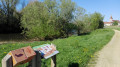
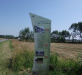
The car park is located at 370 Chemin de l’Ambutelière, next to the distillery. A sign showing the commune’s ‘Balades Vertes’ route indicates the starting point of the walk.
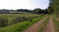
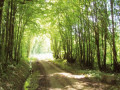
(S/E) From the car park, take Chemin de la Marsaize. The tarmac road quickly turns into a stony track. Continue for 1.2 km. You’ll pass through many wooded sections and a few meadows along the way. You’ll arrive at a large rock in front of a small bridge spanning the Servonne.
(1) Do not cross the bridge but turn left and follow the stony track until you reach thefirst track on the left.
(2) Turn and continue for 1.5 km. The route alternates between woodland and meadows until you reach a tarmac road.
(3) Turn left onto the Chemin de l’Ambutelière and continue to the starting point (S/E).



 A real shame about the ending, which concludes on the road
 Tourist office


 Moderate