Country:
 City:
City:


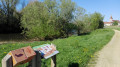
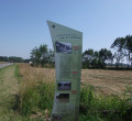
The walk starts at Place du Breuil. A large free car park is available. A large sign showing the three ‘Balades Vertes’ routes in the town marks the starting point of the walk, near the boat launch.
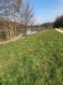
(S/E) Facing the starting sign, follow the path on the left which runs alongside the river, bordering the meadow and the riverbank.
(1) Afirst themed sign invites you to identify the animals corresponding to the tracks left on the ‘beach’. Asecond sign explains the tracks that can be found on the riverbanks, with a particular focus on the beaver, which colonised this river in the 19th century. A few specimens have recently been spotted upstream of this section of the Solnan.
Continue along the route to the next themed stop, La Chapellerie, the building for which is situated on the opposite bank. The information board outlines the history of this neighbourhood and all the activities associated with it over the centuries.
Continue along the route to the next themed stop, the hornet’s nest. Here you’ll find information about this migratory bird, which comes to breed by digging into the banks of the Solnan. A tip for spotting it: sit quietly and be patient!
Turn right towards the football pitch closest to the river until you reach the next themed stop, the spawning ground. Afirst themed sign explains the role and function of a spawning ground, and a marker helps you identify some of the fish found in our rivers.
Continue along the route to the next themed stop, the bathing area. Here you’ll find an introduction to this leisure spot, which was developed in the 1930s.
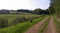
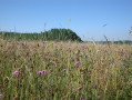
Walk round the football pitch to the next themed stop, the wet meadow. You are now between two natural habitats: on the left, the wet meadow, and on the right, the poplar grove. The sign shows you some examples of birds and plants that you may encounter here, depending on the season.
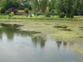
Walk a few metres to the next themed stop: the ponds. Two information boards and an interactive display help you discover this habitat and how it works. You’ll come to a junction.
(2) You now have two options. If you turn left, you’ll head deeper into the vegetation, skirting the football pitch on your left, and come straight out at a picnic table. If you turn right, you’ll reach the Allée des Jardins (route option).
This path, situated alongside the railway line, runs alongside the allotment gardens. A themed sign explains this.
Walk alongside the railway line, which should be on your right, until you reach the picnic table.
(3) You’ll see your starting point at the far end of the square. Walk along the left-hand side of the car park, i.e. the side facing the meadow. A final themed sign tells you about these oddly shaped trees, the ‘pollarded’ willows.
Carry on for a few more metres, taking care to watch out for traffic in the car park, to reach your starting point (S/E).


 Tourist office

 Moderate