The Galette Route in Bruailles

Bruailles boasts a well-preserved heritage: the bishop’s house, the vicarage, the church and the bakehouse. The bakehouse was once used by the villagers to bake their bread. Situated in the heart of the village and close to the town hall, it is brought back to life several times a year during various village events.
Two rivers wind their way through the village, flowing between floodplains and wooded countryside: the Vallière and the Solnan.

Details

4649036
Creation:
Last update:
Last review:
  • Walking
    Activity: Walking
  • ↔
    Distance: 5.88 mi
  • ◔
    Average duration: 2h 50 
  • ▲
    Difficulty: Easy

  • ⚐
    Back to start: Yes
  • ↗
    Ascent: + 151 ft
  • ↘
    Descent: - 154 ft

  • ▲
    Highest point: 669 ft
  • ▼
    Lowest point: 597 ft
  • ⚐ Country: France
  • ⚐ City: Bruailles (71500)
  • ⚑
    Start/End: N 46.59997° / E 5.25341°
  • ❏
    IGN map(s): Ref. 3127E
  • Hour-by-hour weather

Photos

Description of the walk

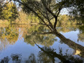
The walk starts from the car park at the Galette lake. A large sign showing the two ‘Balades Vertes’ routes in the area marks the starting point of the walk.

(S/E) Turn right as you cross the car park towards the lake.

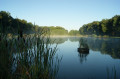
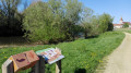
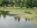
(1) An information board about the lake and its fish is located near a picnic area. Walk round the Plan d’eau de la Galette on the right-hand side.

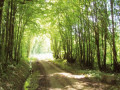
(2) At the end of the lake, turn onto the path on the right. Walk alongside the field (on your right) and the woodland (on your left).

(3) Turn onto thefirst path on the left, near the heritage orchard, which you can visit to learn more about heritage varieties of fruit trees. Walk through thefirst andsecond woods in their entirety until you reach the road running perpendicular to La Chichevière.

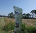
Efirst information board brings to life the events of 28 November 1980 and the history of the pipeline. A little further on, asecond information board provides details about local agriculture.

(4) Turn right onto Route de Chichevière and continue for nearly 1 km before turning left onto Route de Marby.

(5) Take the track on the left through the woods and continue to the junction with Route d’Aiseray.

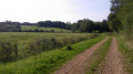
(6) Turn right onto this road for about a hundred metres and take thefirst path on the right. Continue along this path, which runs between woodland and fields, for 1.5 km until you reach Route de Chichevière.
''An information board explains the use of the woodland and its distinctive features.''

(7) Turn right onto this road and continue to the next crossroads, which is at right angles to Route de Marcilly, which you have already passed.

(5) Carry on straight ahead along the same road.

(4) Leave the route you have already taken and carry on straight ahead, still on Route de Chichevière, until you reach another road.

(8) Turn left onto Route de Marcilly, follow it for 1.3 km, taking thefirst left. Return to the starting car park (S/E).


Waypoints

  1. S/E : mi 0 - alt. 666 ft - Car park at Plan d’eau de la Galette
  2. 1 : mi 0.29 - alt. 623 ft - Information board about the pond and the fish.
  3. 2 : mi 0.75 - alt. 630 ft - La Galette lake – Towards Verger
  4. 3 : mi 0.83 - alt. 656 ft - Conservation orchard
  5. 4 : mi 1.53 - alt. 620 ft - Chichevière
  6. 5 : mi 2.14 - alt. 659 ft - Le Petit Taillis
  7. 6 : mi 2.9 - alt. 656 ft - Aiseray
  8. 7 : mi 3.92 - alt. 640 ft - Grand Bois Rebouton
  9. 8 : mi 5.07 - alt. 600 ft - Marcilly
  10. S/E : mi 5.88 - alt. 666 ft - Car park at Plan d’eau de la Galette

Notes

Free car park available at the start. Toilets and picnic tables. Fitness trail.

Worth a visit

Trainers or light walking shoes are sufficient. The trail is signposted with directional signs (BRU2) and yellow arrow markings.
You can spend some time with your family by the lake. Fishing is also permitted with a day permit.

Reviews and comments

4.4 / 5
Based on 3 reviews

Reliability of the description
4.7 / 5
Ease of following the route
4.7 / 5
Route interest
4 / 5
OT Bresse Bourguignonne

Hello,

Thank you for taking the time to leave a review for the circuit.

Have a nice day

OT Bresse Bourguignonne
Mélise

Machine-translated

User 4007575

Overall rating : 4 / 5

Date of your route : Jun 16, 2025
Reliability of the description : ★★★★☆ Good
Ease of following the route : ★★★★☆ Good
Route interest : ★★★★☆ Good
Very busy route : Yes

Machine-translated

OT Bresse Bourguignonne

Hello Mum71

Thank you for taking the time to leave a review. We’re delighted that you enjoyed this walk. Thank you also for your advice for future walkers on this route.
We’ll try to expand the Burgundian Bresse area by posting more routes on Visorando to help people explore the region.

Have a lovely day

Mélise
Bresse Bourguignonne Tourist Office

Machine-translated

OT Bresse Bourguignonne

Hello Charly,

Thank you for taking the time to leave a review. We’re delighted that you enjoyed this walk, even if there were a few too many tarmac roads.
We’ll try to expand the Burgundian Bresse area by posting more routes on Visorando to help people explore the region.

Have a lovely day

Mélise
Bresse Bourguignonne Tourist Office

Machine-translated

Mum71
Mum71

Overall rating : 4.7 / 5

Date of your route : Mar 28, 2021
Reliability of the description : ★★★★★ Very good
Ease of following the route : ★★★★★ Very good
Route interest : ★★★★☆ Good
Very busy route : No

An easy and enjoyable walk, with lovely houses, paths through the woods and some sections along the road. That’s why, on the way back, we turned off at point 4 to return via the footpath rather than completing a circular route along the road.
A tip for parking: it’s best to park by the lake – there’s more space there.
The route took about 2 hours

Machine-translated

Meyer Charly
Meyer Charly

Overall rating : 4.7 / 5

Date of your route : Mar 09, 2021
Reliability of the description : ★★★★★ Very good
Ease of following the route : ★★★★★ Very good
Route interest : ★★★★☆ Good
Very busy route : No

Hello,
A lovely walk despite the tarmac paths (2 hours 10 minutes)

Machine-translated

Other walks in the area

For more walks, use our search engine .

The GPS track and description are the property of this route's author. Please do not copy them without permission.