Country:
 City:
City:


At the church in Chavannes-sur-Reyssouze, you can park near the cemetery.
(S/E) Head south for 100 metres until you reach the D46.
Take this road to the left for 250 metres, then turn onto the first small road on the right, heading south towards La Besace.
Follow this small road for 900 metres until you reach the first track on the left.
(1) Turn east onto this wide track, follow it to the Ruisseau la Lune and arrive at a T-junction.
(2) Turn right, heading south, onto Route de la Besace.
Cross the Reyssouze at the Moulin de la Besace, then walk past a sports ground and a picnic area.
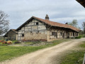
(3) Turn left, heading east, onto the Chemin des Villards until you reach the Ferme de Pérignat (with its Saracen-style chimney), situated to the south of the T-junction.
(4) Turn left again, heading north, onto the Route de Pérignat, then east onto the Chemin de Haute Serve. After 2 km, at the 182-metre mark, turn left, heading north, onto the Route des Trois Moulins and cross the Reyssouze at the Moulin de Haute Serve.
(5) Leave the Route des Trois Moulins 60 metres after the river and take the path on the right, running alongside the ditch.
Follow this path eastwards, then northwards, until you reach the D46.
(6) Take this road to the right for 150 metres, cross a leat at the edge of a wood and turn left, heading north, onto a path that leads into the wood.
This path turns right, heading east, skirting the Colombier farm, then reaches a junction marked by a cross.
(7) Turn left, heading north, towards Montmain, then immediately right onto the Route des Teppes. Continue north on the Route de Paluat until you reach the edge of the pond.
(8) Turn west onto the embankment between the pond and the Paluat Mill. After 300 m, turn left, heading south, onto the Route de Grange Félix.
(9) Turn right, heading west, onto the first track.
Follow this track, which becomes a road, passing L’Étang de Champ du Molard, then the farms known as L’Orme, Les Curveurs, Les Darbonnets, Les Nugons and La Cunière. After several kilometres, you’ll reach Le Mulfier at a crossroads.
(10) Turn left, heading south, onto the Route de la Gare.
At the next junction, turn right and carry on straight ahead to return to the car park near the cemetery (S/E).

 Visorando Member
 Easy
Easy 
 Local authority