Country:
 City:
City:


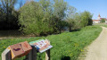
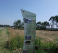
There is a car park near the playground. A sign showing the two ‘Balades Vertes’ routes in the village marks the starting point of the walk.
(S/E) From the playground, turn right and, after 80 metres, take the gravel path on the left. Follow this path, which will take you to the town hall. In front of the town hall, turn right and continue to the next junction. Cross the D13 departmental road with care and take Impasse des Vernes on the left.
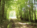
(1) The cul-de-sac soon turns into a stony track. Carry on to the next tarmac road. Turn left and continue for 1.2 km until you reach the next tarmac road on the right, Chemin de la Ronge.
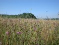
(2) Turn onto this track and continue for 300 m until you reachthe first stony track on the right. Continue along this stony track for 1 km until you reach the next tarmac road. You are now in the midst of cultivated fields and some pastureland. It is not uncommon to spot roe deer and perhaps traces of wild boar.
(3) Turn left onto Chemin de la Guitenière and continue to the D13 county road.
(4) Turn left and walk carefully alongside this road for 50 metres, then turn onto thefirst road on the right, the Curtil Maizeux/Rue des Chizes. Continue to the next junction, where you turn right again. Continue until you reach thefirst gravel track on the right.
(5) Turn right and take this track, which leads you through cereal fields and some wooded areas. It is 1 km before you reach a farm and a tarmac road.
(6) Turn right onto the tarmac road, then immediately left onto the gravel track. Follow this track as it goes round the pasture. The pasture should remain on your right at all times.
(7) At the end of the track, turn left onto the tarmac road towards Bas-de-Vincelles and head for the car park near the playground (S/E).


 Tourist office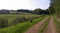


 Moderate