Île de la Motte in Saint-Bénigne

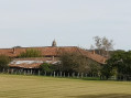
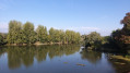
On this route, you’ll discover the vast floodplain of the Saône, stretching as far as the eye can see. Once you reach the banks of the Saône, you can see Île de la Motte, which has been designated a Sensitive Natural Area.

Île de la Motte is home to colonies of herons: the little bittern, the little egret and the cattle egret, which can sometimes be sensitive to disturbance during the breeding season. The island’s presence on the river also helps to maintain fish diversity. Sediments carried by the Saône have been deposited and accumulated at La Motte, gradually creating small islets and secondary channels. Together, these form a mosaic of natural habitats that is home to an exceptional diversity of species.
Beavers are present on the site and, indeed, contribute to its management by cutting branches from willows and poplars to eat their bark.

Details

45303883
Creation:
Last update:
Last review:
  • Walking
    Activity: Walking
  • ↔
    Distance: 9.23 mi
  • ◔
    Average duration: 4h 20 
  • ▲
    Difficulty: Moderate

  • ⚐
    Back to start: Yes
  • ↗
    Ascent: + 112 ft
  • ↘
    Descent: - 112 ft

  • ▲
    Highest point: 676 ft
  • ▼
    Lowest point: 564 ft

Description of the walk

The walk starts at the car park in front of Saint-Bénigne Town Hall.

(S/E) With your back to the town hall, turn left. Walk past the school and ignore a path on the left to reach the junction with the Route des Rippettes. Follow it to the right. Ignore a Fork in the road to leave the village.

(1) Continue left along the track. At the Fork in the road, turn left until you reach the road.

(2) Turn left, then right at the junction. Carry on straight ahead. Pass through Les Vernettes, ignore the tarmac path on the left and then another on the right to reach the departmental road.

(3) Cross with care, turn left and then keep right three times to pass through a hamlet. Ignore a track on the right to reach a Fork in the road.

(4) Keep right and follow the road until it turns into a track. Carry on straight ahead along this track before crossing a stream on the right. Follow the stream until you have crossed a second one. Carry on until you reach a bend.

(5) Turn left towards the river. Once on the banks of the Saône, follow the riverbank southwards along a slope. Pass in front of the Île de la Motte.

(6) Carry on straight ahead. Cross the Leat de Longely and keep going until you reach the building on the left.

(7) Leave the path along the Saône and take the track. At the end of the track, follow the tarmac road opposite until you reach the small wood.

(8) Take the track on the left. At the end of the track, turn right and head back to the junction you passed on the way out.

(4) Return to the starting point by following the route in reverse. (S/E)

Waypoints

  1. S/E : mi 0 - alt. 676 ft - Saint-Bénigne Town Hall
  2. 1 : mi 0.3 - alt. 663 ft - Leaving the village
  3. 2 : mi 0.74 - alt. 640 ft - Route
  4. 3 : mi 1.49 - alt. 646 ft - D933
  5. 4 : mi 2.17 - alt. 571 ft - Junction of the circular loop
  6. 5 : mi 4.02 - alt. 564 ft - Bend
  7. 6 : mi 4.66 - alt. 564 ft - Île de la Motte - Ile de la Motte
  8. 7 : mi 5.26 - alt. 568 ft - Building
  9. 8 : mi 6.51 - alt. 568 ft - Wood
  10. S/E : mi 9.23 - alt. 676 ft - Saint-Bénigne Town Hall

Worth a visit

Other walks in the area

For more walks, use our search engine .

The GPS track and description are the property of this route's author. Please do not copy them without permission.