


Refine your search for walks in Le Lieu
Le Lieu walks


 Les Charbonnières - Col du Machairuz
 Visorando Member
 12.99 mi
 +2,703 ft
 -1,266 ft
 8h 20
8h 20
 Difficult
 Departure from Le Lieu (Vaud)
On this fifth stage, you will reach the highest point of the Swiss Jura and also of this 6-day route: Mont Tendre. This summit offers a splendid view of the canton of Vaud, Lake Geneva and the Alps.You’ll also see the numerous piles of stone gathered from fields stretching for kilometres. These are stone walls built to mark out plots of land or enclose areas for grazing livestock.
Le Pont - Ballaigues
 11.56 mi
+2,398 ft
-2,612 ft
7h 25
Difficult
Departure from Le Lieu (Vaud)
11.56 mi
+2,398 ft
-2,612 ft
7h 25
Difficult
Departure from Le Lieu (Vaud)
Stage 3: From Les Rousses to Lake Constance via the Jura ridges. From the beach at Lake Joux to Le Pont, you reach Vallorbe via the Dent de Vaulion (1,483 m) before following and crossing the River Orbe. Since the Middle Ages, Vallorbe has been an important centre for the iron industry thanks to its iron ore deposits and wood reserves. At the Vallorbe Iron and Railway Museum, you leave the town following the shore of Lake Day. The route then passes close to the Day Viaduct, a beautiful arch bridge built in 1925, before arriving at the Day Dam, which holds back the waters of the Orbe, and then Ballaigues, located on the southern slope of the knoll, above the course of the Orbe
Around Lake Brenet
 2.84 mi
+56 ft
-56 ft
1h 20
2.84 mi
+56 ft
-56 ft
1h 20
 Easy
Departure from L'Abbaye (Vaud)
Easy
Departure from L'Abbaye (Vaud)
This route around Lake Brenet, near Lake Joux, is peaceful, presents no difficulty and is well worth a visit. It is ideal for a family walk, even with young children.
Mont d'Orzeires from the bridge
 6.49 mi
+974 ft
-991 ft
3h 50
6.49 mi
+974 ft
-991 ft
3h 50
 Moderate
Departure from L'Abbaye (Vaud)
Moderate
Departure from L'Abbaye (Vaud)
Start from the car park at Pont station at the far end of Lac de Joux.
Mostly on small tarmac roads. There is just one slightly technical section, but it is well signposted and secured by a cable for the more cautious.
Tour of Lake Joux from Le Pont
14.08 mi
+545 ft
-531 ft
6h 55
Difficult
Departure from L'Abbaye (Vaud)
A beautiful but long walk around Lac de Joux with no difficulty apart from a short climb to go round a small cliff plunging into the lake. You walk along exceptionally well-maintained paths, with the verges mown. You cross the protected wetlands on raised boardwalks. Benches placed at regular intervals along the path, and magnificent log-built picnic tables surrounded by barbecues, invite you to take a break and admire the view. After a short climb and a walk through a small housing estate, the scenery changes as you cross summer pastures and spruce forests, where you may encounter various groups of chamois, which are not shy provided you remain quiet and unobtrusive.
The Mont Tendre circular walk starting from Lac de Joux
 16.40 mi
+2,516 ft
-2,516 ft
9h 45
Difficult
Departure from L'Abbaye (Vaud)
16.40 mi
+2,516 ft
-2,516 ft
9h 45
Difficult
Departure from L'Abbaye (Vaud)
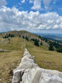
Mont Tendre is the highest peak in the Swiss Jura, in the canton of Vaud, at an altitude of 1,679 m. It is situated within the municipality of Montricher.From its summit, you can enjoy a magnificent 360-degree panorama. You can admire the Alps from the Eiger to Mont Pourri (the Vanoise massif), Lake Geneva and Lake Neuchâtel, as well as the majestic Mont Blanc massif. A leisurely return via Lake Joux.
The Dent de Vaulion via Vallorbe
 11.33 mi
+2,671 ft
-2,667 ft
7h 30
Moderate
Departure from L'Abbaye (Vaud)
11.33 mi
+2,671 ft
-2,667 ft
7h 30
Moderate
Departure from L'Abbaye (Vaud)
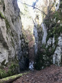
The Dent de Vaulion, the iconic mountain of the Vallée de Joux and Vallorbe. A majestic peak overlooking the village of Le Pont, it rises to an altitude of 1,482 metres.
A 360° panorama unfolds before you once you reach the summit. On a clear day, you can admire up to eight distinct lakes: the lakes of Neuchâtel, Biel and Murten, Lake Geneva, Lakes Brenet and Ter, Lake Joux and Lake Rousses. The Alps, and in particular the Mont Blanc massif, complete this idyllic landscape.
 Dent de Vaulion
 Association / Club / Walk leader
 4.43 mi
+1,145 ft
-1,152 ft
4 hrs
Moderate
Departure from L'Abbaye (Vaud)
4.43 mi
+1,145 ft
-1,152 ft
4 hrs
Moderate
Departure from L'Abbaye (Vaud)
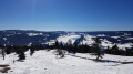
A superb snowshoe hike takes you to the summit of Dent de Vaulion with a 360° panoramic view of the Alps.
Good weather is really a must for this walk if you want to enjoy the exceptional view of the Alps in particular, not to mention the three lakes: Léman, Joux and Brenet.
La Dent de Vaulion via the Grotte aux Fées
 12.25 mi
+2,989 ft
-2,969 ft
8h 15
12.25 mi
+2,989 ft
-2,969 ft
8h 15
 Very difficult
Departure from Vallorbe (Vaud)
Very difficult
Departure from Vallorbe (Vaud)
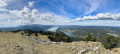
La Dent de Vaulion is the iconic mountain of the Vallée de Joux and Vallorbe, offering a magnificent 360° panorama. A majestic peak overlooking the village of Le Pont, it rises to an altitude of 1,483 metres. Its distinctive shape and location at the far end of Lake Joux earn it a prominent place in many photographs of the region. On a clear day, it is possible to see up to eight distinct lakes: the lakes of Neuchâtel, Biel and Murten, Lake Geneva, Lakes Brenet and Ter, Lake Joux and Lake des Rousses in neighbouring France. The Alps, and in particular the Mont Blanc massif, complete this idyllic landscape.
Chez Liadet - CAF Gros Morond Refuge
 12.78 mi
+1,998 ft
-1,266 ft
7h 35
Difficult
Departure from Mouthe (Doubs)
12.78 mi
+1,998 ft
-1,266 ft
7h 35
Difficult
Departure from Mouthe (Doubs)
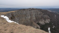
This third stage leads to Mont d'Or, from where the view stretches across the French and Swiss Alps. The route passes by the source of the Doubs, winds through forests and mountain pastures, and climbs to the summit of Mont d'Or before descending to the CAF refuge at Gros Morond.
Country walk around Chez Mimi
 3.50 mi
+253 ft
-253 ft
1h 50
Easy
Departure from Mouthe (Doubs)
3.50 mi
+253 ft
-253 ft
1h 50
Easy
Departure from Mouthe (Doubs)
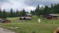
This pleasant, easy hike combines valleys, meadows, woods and forests, taking you on a journey through a rural landscape dotted with chalets. You are in the heart of a site classified as a Sensitive Natural Area by the Doubs department for its remarkable landscape, wildlife, flora and geology.
Source of the Doubs and frog pond
 2.88 mi
+23 ft
-23 ft
1h 20
Easy
Departure from Mouthe (Doubs)
2.88 mi
+23 ft
-23 ft
1h 20
Easy
Departure from Mouthe (Doubs)
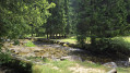
A short, very easy walk with a nice mix of mountain forest, peat bog and the banks of the Doubs.
Flat, easy to access, done with a pregnant woman and a 2.5-year-old child...
The source of the Doubs
 3.25 mi
+223 ft
-207 ft
1h 40
Easy
Departure from Mouthe (Doubs)
3.25 mi
+223 ft
-207 ft
1h 40
Easy
Departure from Mouthe (Doubs)
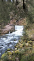
Starting from Mouthe, a small village nestled in the heart of a wide valley bathed by the first meanders of the Doubs, this walk invites passers-by to discover the resurgence of this river, which is listed in the department's inventory of natural sites, and then the Moutat peat bog.
Chalets on Mont d'Or
 8.19 mi
+1,365 ft
-1,335 ft
4h 55
Easy
Departure from Rochejean (Doubs)
8.19 mi
+1,365 ft
-1,335 ft
4h 55
Easy
Departure from Rochejean (Doubs)
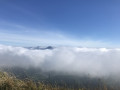
This hike will take you from one alpine chalet to another on Mont d'Or.
Belvédère des Deux Lacs from Le Brey
 3.25 mi
+413 ft
-410 ft
1h 45
Easy
Departure from Brey-et-Maison-du-Bois (Doubs)
3.25 mi
+413 ft
-410 ft
1h 45
Easy
Departure from Brey-et-Maison-du-Bois (Doubs)
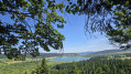
This varied route has a special charm, taking in very different environments: lakes, marshes, peat bogs, rivers, meadows and forests. The highlight is the Belvédère des Deux Lacs, which offers a unique view of the Lac de Remoray National Nature Reserve and its natural environments.
Vallorbe - Les Charbonnières: Lakes Joux and Brenet
 8.19 mi
+2,398 ft
-1,552 ft
5h 50
Moderate
Departure from Vallorbe (Vaud)
8.19 mi
+2,398 ft
-1,552 ft
5h 50
Moderate
Departure from Vallorbe (Vaud)
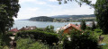
For this fourth stage, after a good hour's walk, you will reach the highest point of the day: the Dent de Vaulion. The lakes of Joux and Brenet will be at your feet. The water from these two lakes flows underground, shaping the karst cave of the Orbe, near Vallorbe. On a clear day, you can see up to eight lakes.
On the ridges of Mont d'Or
 4.12 mi
+755 ft
-738 ft
2h 35
Easy
Departure from Longevilles-Mont-d'Or (Doubs)
4.12 mi
+755 ft
-738 ft
2h 35
Easy
Departure from Longevilles-Mont-d'Or (Doubs)
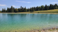
An easy walk to do on a clear day to be sure of seeing the Mont Blanc massif. The elevation gain is reasonable. There are some slightly steep but short climbs, panoramic views, and the pleasure of reaching the Morond and admiring the landscape from the Mont d’Or.Please note that you may have to cross meadows where cows graze freely.
 Circular Col du Maraichuz – La Rionde loop
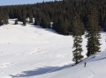 9.12 mi
+988 ft
-971 ft
4 hrs
Moderate
Departure from Le Chenit (Vaud)
9.12 mi
+988 ft
-971 ft
4 hrs
Moderate
Departure from Le Chenit (Vaud)
Winter backcountry ski route, half on groomed trails and half off-piste in remote countryside. Also suitable for snowshoeing.
The Mont-d’Or ridges and alpine farms
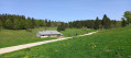 10.40 mi
+1,539 ft
-1,516 ft
6h 05
Moderate
Departure from Longevilles-Mont-d'Or (Doubs)
10.40 mi
+1,539 ft
-1,516 ft
6h 05
Moderate
Departure from Longevilles-Mont-d'Or (Doubs)
A circular route with no major difficulties, which runs along the cliffs of Mont-d’Or and its viewpoints over Lake Geneva, the Alps and Mont Blanc, before reaching the typical alpine farms of the Haut-Doubs.
From the Belvédère des Deux Lacs to the meadows of Remoray
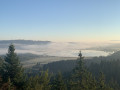 6.29 mi
+689 ft
-666 ft
3h 30
Moderate
Departure from Brey-et-Maison-du-Bois (Doubs)
6.29 mi
+689 ft
-666 ft
3h 30
Moderate
Departure from Brey-et-Maison-du-Bois (Doubs)
This walk starts at the superb viewpoint overlooking the two lakes of Saint-Point and Remoray. It then alternates between alpine meadows and spruce forests between Le Brey, Bougeons and Remoray. It thus offers an excellent overview of the Jura landscapes.