


 Country:

 City:
City:


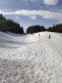
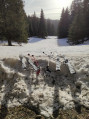
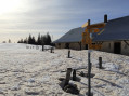
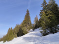
Preliminary note: this route was completed on backcountry skis (see ‘Cross-country skiing is like mountain biking’), but can also be done on snowshoes. The outward journey follows the cross-country ski trail, which helps you warm up. The return journey, which is more challenging, is mostly off-piste.
PS: if you’re doing it on snowshoes, when the route follows the cross-country ski trail, you’ll need to either walk alongside the trail or take the snowshoe trail and then join the main route.
Park near the cross-country ski ticket office in Le Brassus, where you can buy a day pass for 10 CHF.
(S/E) Follow the main cross-country ski trail, ignoring the trail that branches off to the right towards La Sèche de Gimel and, a few metres further on, the one that climbs to the left. Head towards Les Ambrunex.
(1) Keep the almost flat cross-country ski trail straight ahead; in the Combe d’Ambrunex, it continues until it reaches a junction marked by a sign: the hamlet of Les Riondaz. Carry on along this trail until you reach a gate painted pine green.
(2) Leave the trail by turning left, then climb over the low wall to enter the field sloping down to the left. Go round the large hollow on the right, passing under the fir trees, then head back up towards the Rionde-Dessous farm, following a small stream for the final stretch.
(3) Leave the Rionde-Dessous farm on your left. Carry on straight ahead towards the north-east and head up the valley above the farm. Stick to a path on the left that’s slightly higher up, as the valley floor is marshy.
(4) At the top of the valley, pass a historic low wall blocking the way (there is a gap). Continue along the hillside, climbing slightly. Pass a line of trees on your right and, further down, some livestock enclosures, until you reach a small, solitary fir tree with a large yellow arrow painted on it.
(5) Now pay close attention and look out for the start of the path that climbs to the right towards La Neuve. It is cut into the slope at the edge of the forest. It begins shortly after you have left the cattle pens below on your left. Head towards the Neuve summer farm; ignore the path leading uphill to the right and turn sharply left to take the path that descends very gently across the field towards the north-east. A yellow signpost indicates the direction of the Col du Marchairuz. Follow this path which, after entering the woods, features a few fairly challenging descents – at least on backcountry skis.
(6) Carry on straight ahead, climbing slightly, and ignore the turn-off to the left which leads back to the cross-country ski trail in the valley. Continue just below the ridge to reach the Amburnex turn-off.
(7) Carry on straight ahead to reach a cross-country ski trail.
(8) Take this and carry on straight ahead towards the north-east. Further on, deep in the woods, a yellow arrow with no signpost points to the right towards the barely visible path to the Col du Marchairuz. Ignore it and stay on the trail. This then descends via the toboggan run, which you should follow. At the bottom of this, carry on to the Brassus cross-country ski car park (S/E).
 /A: Round off the evening at the Marchairuz restaurant and hotel with a baked Vacherin du Mont d’Or, a speciality of the Joux Valley.
 Association / Club / Walk leader
 Easy
Easy 
