


Refine your search for walks in Lac de Joux
Lac de Joux walks


 La Dent de Vaulion via the Grotte aux Fées
 Visorando Member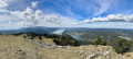
 12.25 mi
 +2,989 ft
 -2,969 ft
 8h 15
8h 15
 Very difficult
 Departure from Vallorbe (Vaud)
La Dent de Vaulion is the iconic mountain of the Vallée de Joux and Vallorbe, offering a magnificent 360° panorama. A majestic peak overlooking the village of Le Pont, it rises to an altitude of 1,483 metres. Its distinctive shape and location at the far end of Lake Joux earn it a prominent place in many photographs of the region. On a clear day, it is possible to see up to eight distinct lakes: the lakes of Neuchâtel, Biel and Murten, Lake Geneva, Lakes Brenet and Ter, Lake Joux and Lake des Rousses in neighbouring France. The Alps, and in particular the Mont Blanc massif, complete this idyllic landscape.
The Mont Tendre circular walk starting from Lac de Joux
 16.40 mi
+2,516 ft
-2,516 ft
9h 45
16.40 mi
+2,516 ft
-2,516 ft
9h 45
 Difficult
Departure from L'Abbaye (Vaud)
Difficult
Departure from L'Abbaye (Vaud)
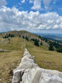
Mont Tendre is the highest peak in the Swiss Jura, in the canton of Vaud, at an altitude of 1,679 m. It is situated within the municipality of Montricher.From its summit, you can enjoy a magnificent 360-degree panorama. You can admire the Alps from the Eiger to Mont Pourri (the Vanoise massif), Lake Geneva and Lake Neuchâtel, as well as the majestic Mont Blanc massif. A leisurely return via Lake Joux.
Walks near Lac de Joux
Les Charbonnières - Col du Machairuz
 12.99 mi
+2,703 ft
-1,266 ft
8h 20
Difficult
Departure from Le Lieu (Vaud)
12.99 mi
+2,703 ft
-1,266 ft
8h 20
Difficult
Departure from Le Lieu (Vaud)
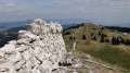
On this fifth stage, you will reach the highest point of the Swiss Jura and also of this 6-day route: Mont Tendre. This summit offers a splendid view of the canton of Vaud, Lake Geneva and the Alps.You’ll also see the numerous piles of stone gathered from fields stretching for kilometres. These are stone walls built to mark out plots of land or enclose areas for grazing livestock.
Le Pont - Ballaigues
 11.56 mi
+2,398 ft
-2,612 ft
7h 25
Difficult
Departure from Le Lieu (Vaud)
11.56 mi
+2,398 ft
-2,612 ft
7h 25
Difficult
Departure from Le Lieu (Vaud)
Stage 3: From Les Rousses to Lake Constance via the Jura ridges. From the beach at Lake Joux to Le Pont, you reach Vallorbe via the Dent de Vaulion (1,483 m) before following and crossing the River Orbe. Since the Middle Ages, Vallorbe has been an important centre for the iron industry thanks to its iron ore deposits and wood reserves. At the Vallorbe Iron and Railway Museum, you leave the town following the shore of Lake Day. The route then passes close to the Day Viaduct, a beautiful arch bridge built in 1925, before arriving at the Day Dam, which holds back the waters of the Orbe, and then Ballaigues, located on the southern slope of the knoll, above the course of the Orbe
Chez Liadet - CAF Gros Morond Refuge
 12.78 mi
+1,998 ft
-1,266 ft
7h 35
Difficult
Departure from Mouthe (Doubs)
12.78 mi
+1,998 ft
-1,266 ft
7h 35
Difficult
Departure from Mouthe (Doubs)
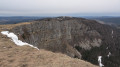
This third stage leads to Mont d'Or, from where the view stretches across the French and Swiss Alps. The route passes by the source of the Doubs, winds through forests and mountain pastures, and climbs to the summit of Mont d'Or before descending to the CAF refuge at Gros Morond.
Vallorbe - Les Charbonnières: Lakes Joux and Brenet
 8.19 mi
+2,398 ft
-1,552 ft
5h 50
8.19 mi
+2,398 ft
-1,552 ft
5h 50
 Moderate
Departure from Vallorbe (Vaud)
Moderate
Departure from Vallorbe (Vaud)
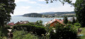
For this fourth stage, after a good hour's walk, you will reach the highest point of the day: the Dent de Vaulion. The lakes of Joux and Brenet will be at your feet. The water from these two lakes flows underground, shaping the karst cave of the Orbe, near Vallorbe. On a clear day, you can see up to eight lakes.
Col du Marchairuz - Le Pont
 13.43 mi
+1,496 ft
-2,953 ft
7h 30
Difficult
Departure from Le Chenit (Vaud)
13.43 mi
+1,496 ft
-2,953 ft
7h 30
Difficult
Departure from Le Chenit (Vaud)
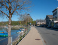
Second stage From Les Rousses to Lake Constance via the Jura ridges. Mont Tendre, at an altitude of 1,679 metres, dominates the peaks of the Vaud Jura. The climb from Col du Marchairuz to Col du Mont Tendre crosses a landscape that resembles a park. From the summit of Mont Tendre, the view is stunning. Discover Savoie, the Bernese Alps, the Vosges and La Dôle. Shortly after the summit is the Chalet du Mont Tendre. From the terrace, the panoramic view of Lake Geneva and the Alps is magnificent. The food here is delicious. Then the descent begins to the shores of Lake Joux. To reach the lake, there are a few descents to conquer. The portions are rustic, varied and very generous.
Col du Marchairuz - Saint Cergue
 10.55 mi
+840 ft
-2,159 ft
5h 35
Moderate
Departure from Le Chenit (Vaud)
10.55 mi
+840 ft
-2,159 ft
5h 35
Moderate
Departure from Le Chenit (Vaud)
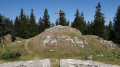
This last stage also offers a panoramic viewpoint at Crêt de la Neuve (1,493 m). At your feet, you can admire Lake Geneva, Geneva, the Alps and even Mont Blanc. On the way down, stop off at the ruins of the Oujon convent, a former Carthusian monastery.
The Orbe Gorges from Le Day to Orbe via Les Clées
 8.39 mi
+620 ft
-1,650 ft
4h 25
Moderate
Departure from Vallorbe (Vaud)
8.39 mi
+620 ft
-1,650 ft
4h 25
Moderate
Departure from Vallorbe (Vaud)
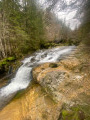
The Gorges de l’Orbe offer magnificent scenery in all seasons. This route, on the left bank, is better suited to the wetter months than the one on the right bank. There are no major difficulties, but some downhill sections can be tricky if you’re walking after rain, with mud and a risk of slipping. Walking poles are not a bad idea, which is why I’ve classified the route as of medium difficulty
This route partly overlaps with the Gorges de l'Orbe route featured on the website.
Ballaigues - Sainte-Croix
 12.53 mi
+3,038 ft
-2,428 ft
8h 25
Difficult
Departure from Ballaigues (Vaud)
12.53 mi
+3,038 ft
-2,428 ft
8h 25
Difficult
Departure from Ballaigues (Vaud)
Stage 4 From Les Rousses to Lake Constance, via the Jura ridges.
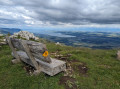
From the southern slopes of the Knoll, above L'Orbe, the climb to the ridge offers a magnificent panorama: Lake Neuchâtel, the plain and the Alps in the background. The trail crosses the peaceful pastures of the Jura before reaching the Col de l'Aiguillon, close to the French border, marked by anti-tank obstacles and bunkers. The hike continues along the Crête des Aiguilles de Baulmes, lined with 80-metre cliffs, with breathtaking views of Mont Blanc, Lake Geneva, La Dôle and Chasseral. The descent leads to Sainte-Croix, renowned for its music boxes and automatons.
From the Amont Woods to Cernillet through Mount Sala
9.57 mi
+2,047 ft
-1,778 ft
6h 10
Difficult
Departure from Bois-d'Amont (Jura)
Surrounded by Sala and Noiremont summits, this hike that allows you to explore Swiss forests and pastures. You'll need two cars for this straight route hike.
From Foncine-le-Haut to Bellefontaine
 12.87 mi
+1,575 ft
-994 ft
7h 15
Difficult
Departure from Foncine-le-Haut (Jura)
12.87 mi
+1,575 ft
-994 ft
7h 15
Difficult
Departure from Foncine-le-Haut (Jura)
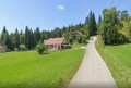
Thirteenth stage of the Échappée Jurassienne: discover the Jura Mountains on this stage between Haut-Jura and Haut-Doubs. Explore the cross-country ski trails of the Mont Noir massif, which are transformed into superb hiking trails in summer. Immerse yourself in a peaceful, unspoilt environment, where alpine flowers bloom alongside the woody scents of fir and spruce trees. Between the woods, valleys and ridges, enjoy the fresh air while admiring the picturesque landscapes.
This stage will also take you along the Bellefontaine and Mortes lakes, known for their peat bogs, which are home to remarkable flora and fauna.