


Refine your search for walks in La Chapelle-près-Sées
La Chapelle-près-Sées walks


 The Écouves Forest
 Visorando Member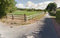
 12.12 mi
 +653 ft
 -669 ft
 6h 10
6h 10
 Moderate
 Departure from La Chapelle-près-Sées (Orne)
Hike in the Sées region offering panoramic views of Sées Cathedral, then continuing along the Écouves Forest. Pass through typical villages and enjoy some lovely surprises for animal lovers (donkey farm, animal park).
Around the Signal d’Écouves
 Local authority
 4.44 mi
+348 ft
-338 ft
2h 20
4.44 mi
+348 ft
-338 ft
2h 20
 Easy
Departure from Le Bouillon (Orne)
Easy
Departure from Le Bouillon (Orne)
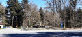
Starting from the Croix-Médavy crossroads, this route follows mainly forest paths. You’ll discover the highest point in Normandy (the Signal d’Ecouves – 413 m), situated in the commune of L’Orée d’Écouves. Picnic tables and a barbecue are available for walkers at the Croix de Médavy crossroads (start and finish).
Circular discovery loop in the Écouves Forest
 3.03 mi
+377 ft
-387 ft
1h 45
Easy
Departure from Saint-Nicolas-des-Bois (Orne) (Orne)
3.03 mi
+377 ft
-387 ft
1h 45
Easy
Departure from Saint-Nicolas-des-Bois (Orne) (Orne)
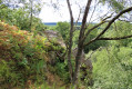
This short route is ideal for those who want to explore the Écouves Forest without undertaking a long hike.
This route does not present any particular difficulties. It crosses part of the fitness trail before reaching the Verdier crossroads and continuing on to the top of the Rocher du Vignage.
Cécile Crossroads and Fontenai Ponds
 5.12 mi
+390 ft
-410 ft
2h 40
Easy
Departure from Fontenai-les-Louvets (Orne)
5.12 mi
+390 ft
-410 ft
2h 40
Easy
Departure from Fontenai-les-Louvets (Orne)
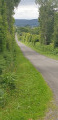
This route, suitable for everyone, offers beautiful views of the countryside around Fontenai-les-Louvets, including the Écouves Forest and the Fontenai Ponds, and also features some interesting sites: a bread oven restored by the Foksa association, and a section ofthe GR®36 trail.
Circular nature trail around Lignières-la-Carelle
 5.24 mi
+46 ft
-46 ft
2h 25
Easy
Departure from Lignières-la-Carelle (Sarthe)
5.24 mi
+46 ft
-46 ft
2h 25
Easy
Departure from Lignières-la-Carelle (Sarthe)
This beautiful walk is accessible to all and can be enjoyed with the family. You will be enchanted by its natural beauty as you follow the paths through the commune (90% dirt tracks and 10% tarmac). You can admire the Manoir de la Juisselerie and many other points of interest. It is not uncommon to encounter squirrels, foxes, deer and other animals.
Best done between April and October as it gets wet when it rains heavily.
Fontaine Saint-André à L'Orée-d'Écouves
 3.24 mi
+299 ft
-289 ft
1h 45
Easy
Departure from Saint-Nicolas-des-Bois (Orne) (Orne)
3.24 mi
+299 ft
-289 ft
1h 45
Easy
Departure from Saint-Nicolas-des-Bois (Orne) (Orne)
Ce circuit en forêt d'Écouves sur les GR®36 et GR®22, accessible à tous, offre une belle vue sur la Butte Chaumont à partir du Carrefour des Arcis. Il propose aussi un détour par la Fontaine Saint-André.
Circular path in the Perseigne forest.
7.49 mi
+906 ft
-912 ft
4h 15
Moderate
Departure from La Fresnaye-sur-Chédouet (Sarthe)
Circular route passing through the Belvédère de Perseigne, the highest point in this forest.
Exploring Perseigne
6.82 mi
+331 ft
-335 ft
3h 25
Easy
Departure from Saint-Rigomer-des-Bois (Sarthe)
Discover the charm of the Perseigne National Forest on the edge of the "Maine Normand".
From Héloup to Saint-Germain-du-Corbéis
 6.56 mi
+223 ft
-253 ft
3h 15
Easy
Departure from Héloup (Orne)
6.56 mi
+223 ft
-253 ft
3h 15
Easy
Departure from Héloup (Orne)
A lovely Sunday stroll, starting along the edge of the forest with views of the valley.
Around Ancinnes in the southern Perseigne Forest
2.92 mi
+200 ft
-200 ft
1h 30
Easy
Departure from Ancinnes (Sarthe)
This lovely walk is a real pleasure, allowing you to explore the Perseigne Forest on the outskirts of Ancinnes and admire some beautiful, simple, old country houses.
Walk from Mahéru to Château de Fay
3.23 mi
+299 ft
-318 ft
1h 45
Easy
Departure from Mahéru (Orne)
A walk offering a wide variety of environments and terrain (woodland, country lanes, sandy paths, etc.) as well as some steep climbs, rewarded with beautiful views.
Around Mahéru
 10.60 mi
+945 ft
-945 ft
5h 40
Moderate
Departure from Mahéru (Orne)
10.60 mi
+945 ft
-945 ft
5h 40
Moderate
Departure from Mahéru (Orne)
A lovely, unpretentious walk through charming, rolling countryside. There are many old houses, often beautifully restored.
The route follows very narrow tarmac roads and wide paths through fields or woods. In places, however, it consists of simple, narrow footpaths.
Tour of the water sources in Mahéru
 3.78 mi
+397 ft
-413 ft
2h 05
Easy
Departure from Mahéru (Orne)
3.78 mi
+397 ft
-413 ft
2h 05
Easy
Departure from Mahéru (Orne)
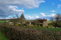
A route offering numerous panoramic views, both on roads and footpaths. The bocage in all its splendour and, of course, some lovely lakes.
The Avaloirs viewpoint from the Champfrémont chapel
 8.37 mi
+843 ft
-833 ft
4h 35
Moderate
Departure from Champfrémont (Mayenne)
8.37 mi
+843 ft
-833 ft
4h 35
Moderate
Departure from Champfrémont (Mayenne)
The goal of this hike, which can be done as a circular or round trip, is none other than the highest point in western France, at... 416 metres above sea level. From the viewpoint that has been built there, you can enjoy a 360° panorama and, on a very clear day, you can see the silhouette of Mont Saint-Michel, about a hundred kilometres away.
Through the gates and ramparts of Bourg-le-Roi
 Tourist office
 5.17 mi
+187 ft
-180 ft
2h 30
Easy
Departure from Bourg-le-Roi (Sarthe)
5.17 mi
+187 ft
-180 ft
2h 30
Easy
Departure from Bourg-le-Roi (Sarthe)
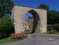
This circular route links Chérisay and Bourg-le-Roi. It will introduce you to both natural heritage and rare architectural heritage.
Loop starting from Gesnes-le-Gandelin
6.69 mi
+220 ft
-217 ft
3h 15
Moderate
Departure from Gesnes-le-Gandelin (Sarthe)
An easy loop in the Pays Gesnois, with 80% of the route on dirt tracks, including some pretty sunken lanes. A few heritage sites to discover: the wash house on Rue de Liberté, the church, Place de la Maréchalerie, the Château de Vaux and the Aune Durand wash house in La Roche.
The Land of the Lady of the Camellias, starting from Gacé
17.32 mi
+1,424 ft
-1,437 ft
9h 10
 Difficult
Departure from Gacé (Orne)
Difficult
Departure from Gacé (Orne)
A circular walk through the beautiful countryside north of Gacé, home of the Lady of the Camellias. The walk mainly follows wide paths, though there are a few sections on minor roads and others on narrower footpaths. The main challenge is the distance. In two places, a small, poorly maintained stream crosses the path, forcing you to perform a bit of a balancing act at the edge or get your feet wet.
From La Perrière to Saint-Germain-de-la-Coudre via Igé
 Association / Club / Walk leader
 17.09 mi
+951 ft
-1,214 ft
8h 40
Difficult
Departure from La Perrière (Orne)
17.09 mi
+951 ft
-1,214 ft
8h 40
Difficult
Departure from La Perrière (Orne)
This walk is one of two variants of the seventh stage of an eight-day, 220-km route, the Tour des Collines du Perche.
After leaving La Perrière, the walk enters the Bellême national forest, emerges to the south into very hilly countryside and arrives in the village of Vaunoise with its Cenomanian cuesta terrain. After Igé, the route continues along quiet country lanes, then some very beautiful sunken paths.
La Perrière – Saint-Germain-de-la-Coudre via Bellême
 18.14 mi
+1,211 ft
-1,453 ft
8 hrs
18.14 mi
+1,211 ft
-1,453 ft
8 hrs
 Very difficult
Departure from La Perrière (Orne)
Very difficult
Departure from La Perrière (Orne)
This walk is one of two variants of the seventh stage of an eight-day, 220 km route, the Tour des Collines du Perche. It will take you along the edge of the Bellême Forest until you reach one of the jewels of the Perche region in the Orne, Bellême, which you’ll certainly want to visit. The route then heads south, passing through La-Chapelle-Souëf and then Saint-Germain-de-la-Coudre.
Circular route from Saint-Léonard-des-Bois to Saint-Céneri-le-Gérei
 9.86 mi
+1,257 ft
-1,253 ft
5h 40
Moderate
Departure from Saint-Léonard-des-Bois (Sarthe)
9.86 mi
+1,257 ft
-1,253 ft
5h 40
Moderate
Departure from Saint-Léonard-des-Bois (Sarthe)
This hilly route between Saint-Léonard-des-Bois and Saint-Céneri-le-Gérei will introduce you to these two typical towns in the Alpes Mancelles, as well as unique landscapes and places.
The meandering Sarthe
 9.94 mi
+1,148 ft
-1,158 ft
5h 35
Difficult
Departure from Saint-Léonard-des-Bois (Sarthe)
9.94 mi
+1,148 ft
-1,158 ft
5h 35
Difficult
Departure from Saint-Léonard-des-Bois (Sarthe)
The meandering Sarthe route takes you through the Alpes Mancelles from Saint-Léonard-des-Bois via Saint-Céneri-le-Gérei, listed as one of the most beautiful villages in France.
The Montaigu Ferryman
 4.97 mi
+285 ft
-295 ft
2h 30
Moderate
Departure from Saint-Léonard-des-Bois (Sarthe)
4.97 mi
+285 ft
-295 ft
2h 30
Moderate
Departure from Saint-Léonard-des-Bois (Sarthe)
In the heart of the Alpes Mancelles, discover this hike in an exceptional natural setting: the Canyon des Toyères. Between Sarthe and Mayenne, discover landscapes where nature reigns supreme.
Misère Valley and Narbonne Plateau Route
 3.56 mi
+423 ft
-404 ft
2h 00
Easy
Departure from Saint-Léonard-des-Bois (Sarthe)
3.56 mi
+423 ft
-404 ft
2h 00
Easy
Departure from Saint-Léonard-des-Bois (Sarthe)
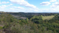
From the banks of the Sarthe to the animal park on the Narbonne Plateau, this route offers all the charm of a mountain hike. Its steep paths, scree slopes, the small stream winding its way through the valley, the panoramic views... The Misère Valley, Haut-Fourché, Manoir de l'Linthe and the village of Saint-Léonard-des-Bois confirm this impression.
A visit to the church and two typical houses rounds off this route, 98% of which is on dirt tracks.
Le Haut Fourché
 1.97 mi
+364 ft
-364 ft
1h 15
Easy
Departure from Saint-Léonard-des-Bois (Sarthe)
1.97 mi
+364 ft
-364 ft
1h 15
Easy
Departure from Saint-Léonard-des-Bois (Sarthe)
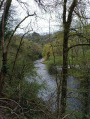
This short route, in the heart of the Alpes Mancelles, takes you along a challenging but unspoilt path to one of the finest viewpoints over the Sarthe Valley and the village of Saint-Léonard-des-Bois, nestled at the foot of the Plateau de Narbonne.