Walk from Mahéru to Château de Fay

A walk offering a wide variety of environments and terrain (woodland, country lanes, sandy paths, etc.) as well as some steep climbs, rewarded with beautiful views.

Details

30462273
Creation:
Last update:
Last review:
  • Walking
    Activity: Walking
  • ↔
    Distance: 3.23 mi
  • ◔
    Average duration: 1h 45 
  • ▲
    Difficulty: Easy

  • ⚐
    Back to start: Yes
  • ↗
    Ascent: + 299 ft
  • ↘
    Descent: - 318 ft

  • ▲
    Highest point: 991 ft
  • ▼
    Lowest point: 679 ft
  • ⚐ Country: France
  • ⚐ City: Mahéru (61380)
  • ⚑
    Start/End: N 48.657557° / E 0.432259°
  • ❏
    IGN map(s): Ref. 1815SB
  • Hour-by-hour weather

Description of the walk

Start at the Mahéru car park. You can park a little further down at the church car park if there are no spaces left.

(S/E) Take the D676 up towards the town hall and, shortly afterwards, you’ll come to a fork in the road.

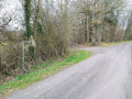
(1) Turn left onto the street. Head towards Les Aulnays and continue along the road to the place-name indicated.

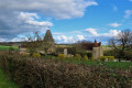
(2) At the hamlet, turn right onto a tree-lined path that climbs uphill and head for the hamlet of Frévent, which consists of a building on the right and a dilapidated building on the left.

(3) Turn left and continue along a forest track until you reach a sandy path

(4) Follow it straight ahead, enjoying a 360° view. At the end of this path, you’ll come to a wayside cross.

(5) Take the D676 road to the left, which slopes gently downwards. Pass through the hamlet of Les Sorans and continue to the hamlet of Le Buisson de Fay.

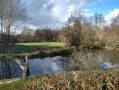
(6) About halfway through the hamlet, take the gravel path on the left, which turns into a forest track a little further on. Pass between the pond and a managed woodland (trees planted in straight rows, a hunting lodge) and arrive at the hamlet known as Le Coudray. Follow the road uphill to the village of Mahéru (S/E).

Waypoints

  1. S/E : mi 0 - alt. 801 ft - Mahéru car park
  2. 1 : mi 0.12 - alt. 827 ft - Junction towards “Les Aunays”
  3. 2 : mi 0.84 - alt. 784 ft - Les Aunais
  4. 3 : mi 1.11 - alt. 991 ft - Frévent
  5. 4 : mi 1.48 - alt. 899 ft - Sandy path
  6. 5 : mi 1.86 - alt. 830 ft - D676
  7. 6 : mi 2.42 - alt. 764 ft - Le Buisson de Fay
  8. S/E : mi 3.23 - alt. 801 ft - Mahéru car park

Notes

Suitable for dogs off the lead that respond well to the ‘come’ command and have a good natural tendency to follow.

Reviews and comments

4.6 / 5
Based on 3 reviews

Reliability of the description
4.3 / 5
Ease of following the route
4.3 / 5
Route interest
5 / 5
User 20332374

Overall rating : 5 / 5

Date of your route : May 18, 2026
Reliability of the description : ★★★★★ Very good
Ease of following the route : ★★★★★ Very good
Route interest : ★★★★★ Very good
Very busy route : No

An easy walk with some stunning views. There are plenty of quiet roads, but the open landscape is truly remarkable.

Machine-translated

Diggin
Diggin

Overall rating : 5 / 5

Date of your route : Dec 29, 2025
Reliability of the description : ★★★★★ Very good
Ease of following the route : ★★★★★ Very good
Route interest : ★★★★★ Very good
Very busy route : No

A magnificent, easy hike with beautiful scenery, ideal for children or elderly people.

Machine-translated

Michèle R.
Michèle R.

Overall rating : 3.7 / 5

Date of your route : May 22, 2023
Reliability of the description : ★★★☆☆ Average
Ease of following the route : ★★★☆☆ Average
Route interest : ★★★★★ Very good
Very busy route : No

It is clear that the description of the walk is out of date: some of the paths on the route are now so overgrown that we actually missed the start of one of them.
But the route is well worth preserving: the scenery is absolutely stunning.

Machine-translated

Larandopassansmonchien
• Edited:

A peaceful walk with beautiful scenery.

Machine-translated

Other walks in the area

For more walks, use our search engine .

The GPS track and description are the property of this route's author. Please do not copy them without permission.