Country:

 City:
City:


Start from the main square in La Perrière, opposite the town hall.
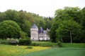
(S) Follow the GR®22. Take the small street heading north between the town hall and the terrace of the Relais d’Horbé. Continue for 100 metres and take the first small road on the right, which then becomes a dirt track. There’s a lovely view to the left over the countryside of La Perrière and, opposite, of Montimer Castle with its dovecote in the foreground (15th century).
(1) At the end of the track, take the road straight ahead, and 100 metres further on, the D210 towards Bellavilliers. Walk alongside Montimer Castle and, 250 metres further on, take a small path on the right at the edge of the forest and follow it for 500 metres until you reach a forest track, which you take to the right to climb up to the Rond de Montimer. Cross the small tarmac road and head straight on towards the Chêne de l’École, a remarkable tree which you’ll see on your left 700 m further on. Continue straight on for 150 m.
(2) At the crossroads, turn left onto the blocked track. Marker 169 is on your left. After about 1.5 km on this gravel track, as you leave plot 165, you’ll come to the Route Forestière de L’Hôtel au Franc.
(3) Leave the GR®22 and continue along the Igé variant, heading towards L’Hôtel au Franc, taking a narrower path on your right which climbs steeply for about a hundred metres. At this point, leave the Bellême variant from stage 7 of the TCP, which continues along the GR®22 and follows a forest track climbing up to your left.
(4) On the steep climb, at a slight levelling-off, leave the path that continues straight up (dead end) and take the track on the right, heading towards the houses you can see, to rejoin the small road to the Hôtel au Franc. There’s a lovely view to the right over the very rugged countryside of Origny-le-Butin.
(5) Cross the small road linking Les Batailles to La Perrière and take the path opposite that climbs towards the hamlet of l’Érable. There’s a lovely view to the left over the hamlet of Les Batailles. Carry on straight ahead. When you reach the Hôtel Beaumont, the path joins the small road linking Les Batailles to Origny-le-Butin. Turn left and walk for about a hundred metres.
(6) Take the first path on the right at La Cointaudière: a long and very scenic path with splendid views. The path leads onto a small tarmac road; turn right until you reach the D955, a very busy main road in the Perche region, which you should cross immediately as visibility is good on both sides – but do so with caution!
(7) Once on the other side, BE CAREFUL as you walk alongside the D955 to the left for about fifty metres, then take the grassy path on the right. This lovely path crosses a wetland; a small, worm-eaten wooden bridge is best avoided – take the bypass path instead. Then head straight up towards La Pinardière.
(8) Cross the farmyard. Take note of the exceptionally large holly tree on the left and stop for a moment to enjoy the magnificent 360° view. Continue straight on along the tarmac road which enters the woods. 600 metres further on, turn left onto the small road linking Vaunoise to Gué de la Chaine for 130 metres.
(9) Turn right onto the path that heads deep into the woods at the hamlet of Le Pavillon. On the plateau, there is a lovely view of Bellême and the Château des Chaises on the right; carry on straight ahead across the fields. After about 1 km, the path comes out onto a small tarmac road; turn left onto it and carry on straight ahead until you reach the D274. Cross the road and follow it for 30 m to the left.
(10) Take the path on the right, leaving the small road ahead that heads towards La Bigotière. Follow the path that runs alongside the Bois de la Roche for about 2.2 km. At the Fork in the road, where the tarmac path turns into a gravel track, take the sunken path on the left. There’s a lovely view of the countryside to the right.
(11) At a place called Charbon Blanc, take the first hairpin bend on the left which leads into the Bois de la Roche. After one kilometre, at the top of the hill, you’ll pass the remains of a feudal motte on your left, which are well worth a brief stop. As you leave the woods, continue straight on. The path leads out onto a small tarmac road; turn left and head straight down through the hamlet until you reach the D938, another busy road. Turn left onto the D938 and follow it for 100 metres (towards Igé – centre, which the route does not pass through, but which you can reach in a few strides to stock up on supplies).
(12) Take the first small road on the right just after the bridge crossing La Même. Walk through the lovely avenue leading to Château de Lonné, then, at the wayside shrine, cross the D276.
(13) Opposite, take the small tarmac track leading to the hamlet of La Cordelière. After the hill, at Bel Air, take the small road to the right for 800 m, until you reach the track leading to Enquais.
(14) Continue to the left, pass through Enquais, then go straight on along the track which bends first to the left then right, until you reach a T-junction.
(15) Turn right and pass through the hamlet of La Belle Vacherie. Once on the tarmac road, carry on straight ahead until you reach the D285. Continue left for 200 metres until you reach the next junction.
(16) Turn right towards La Dagrière and head for the next junction.
(17) Go straight on, leaving the lovely lane on your right which leads to the hamlet of Le Village (accommodation available). Continue straight on along a beautiful tree-lined sunken lane, which descends gently to a junction where several paths meet.
(18) Take the path immediately on the right and follow it straight on. The path becomes tarmac-surfaced at La Guérinière and leads to a T-junction with a small road. Turn sharp left. Cross La Garenne and you’ll reach the D277.
(19) Take the D277 on the right (watch out for traffic) for 600 m until you reach the next small junction. If you wish, before continuing, you’re just a stone’s throw from the village of La Chapelle-Souef, on your left, where those in need of a drink will find a bar.
(20) Turn left towards La Billardière.
(21) Leave La Billardière on your right and carry on straight ahead along the lovely tree-lined sunken lane. From this point, the path is shared with the other route for Stage 7, which comes from Bellême.
(22) At Le Chailloué, take the tarmac path on the left towards La Pingauderie and follow the path, which becomes a dirt track, to La Trousseminière. Walk through the small hamlet.
(23) Take the path that climbs to the right after the last house (T-junction). Ignore the first path that climbs to the right, then a second one, and join a third one 20 metres further on.
(24) Follow this third path which climbs to the right (be careful not to carry on straight ahead along the path that goes downhill). Continue along this ascending path towards Le Grand Bois until you reach the D285.
(25) Turn left onto the D285 and follow it for 1.1 km to the village of Saint-Germain-de-la-Coudre. Head to the church. (The crypt is well worth a visit.) (E).


 Association / Club / Walk leader
 Very difficult
 Easy
Easy  Visorando Member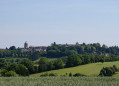
 Moderate