Around the Signal d’Écouves

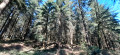
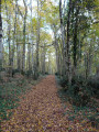
Starting from the Croix-Médavy crossroads, this route follows mainly forest paths. You’ll discover the highest point in Normandy (the Signal d’Ecouves – 413 m), situated in the commune of L’Orée d’Écouves. Picnic tables and a barbecue are available for walkers at the Croix de Médavy crossroads (start and finish).

Details

54786274
Creation:
Last update:
Last review:
  • Walking
    Activity: Walking
  • ↔
    Distance: 4.44 mi
  • ◔
    Average duration: 2h 20 
  • ▲
    Difficulty: Easy

  • ⚐
    Back to start: Yes
  • ↗
    Ascent: + 348 ft
  • ↘
    Descent: - 338 ft

  • ▲
    Highest point: 1,355 ft
  • ▼
    Lowest point: 1,145 ft
  • ⚐ Country: France
  • ⚐ City: Le Bouillon (61500)
  • ⚑
    Start/End: N 48.550223° / E 0.048719°
  • ❏
    IGN map(s): Ref. 1616SB, 1716SB
  • Hour-by-hour weather

Photos

Description of the walk

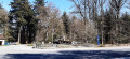
Park in thecar park behind the tank at the Croix-de-Médavy crossroads. 

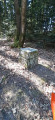
(S/E)Cross the road to join the small trail no. 6. At the junction, continue to your left, still on trail no. 6. When you reach the stone marker, turn right and continue to follow trail no. 6, then turn right to join the Route Forestière de la Sente d’Essay. 

(1) At the road, turn right and carry on to the Carrefour des Quatre Arpents, at the next gate.

(2) Carry on straight ahead to Le Canard, again past a barrier.

(3) At the end of the track, turn right onto the Route Forestière du Canard. You’ll reach the stop sign and the Carrefour de Geoffroy.

 (4) Cross the road and, after a few metres, turn right onto the Route Forestière de Saint-Hilaire. Before the end of the climb, take the path on your right and head into the forest. At the end of the path, turn slightly left and carry on to the Signal d’Écouves.

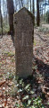
(5) At the top of the climb, you’ll find the marker on your left indicating the highest point in Normandy. Then continue along the path to the Carrefour de la Verrerie.

(6)Take the path on your right. Cross the road and carry on straight ahead. At the Carrefour du Grand Pavillon, turn left to return to your starting point. You will soon see the M4 A2 ‘Valois’ Sherman tank from the2nd Armoured Division (S/E)

Waypoints

  1. S/E : mi 0 - alt. 1,316 ft - Croix-Médavy crossroads
  2. 1 : mi 0.72 - alt. 1,145 ft - Sente d’Essay Forest Road
  3. 2 : mi 1.37 - alt. 1,316 ft - Carrefour des Quatre Arpents
  4. 3 : mi 2.22 - alt. 1,145 ft - Le Canard
  5. 4 : mi 2.58 - alt. 1,214 ft - Geoffroy crossroads
  6. 5 : mi 3.61 - alt. 1,355 ft - Highest point in Normandy - Signal d'Ecouves
  7. 6 : mi 3.72 - alt. 1,342 ft - Verrerie crossroads
  8. S/E : mi 4.44 - alt. 1,316 ft - Croix-Médavy crossroads

Notes

A forest lodge open to the public, equipped with a barbecue, tables and benches, ideal for a meal.

Worth a visit

Signal d’Ecouves (altitude 413 metres, highest point in Normandy)

La Croix-Médavy

Restaurant in Tanville

Reviews and comments

5 / 5
Based on 2 reviews

Reliability of the description
5 / 5
Ease of following the route
5 / 5
Route interest
5 / 5
User 3579779
• Edited:

Overall rating : 5 / 5

Date of your route : Mar 02, 2026
Reliability of the description : Not used / Not applicable
Ease of following the route : Not used / Not applicable
Route interest : ★★★★★ Very good
Very busy route : No

The starting point for the hike was particularly difficult to find! We spent almost 20 minutes going round in circles trying to find it. Better signage is needed!

Machine-translated

Marcus Leroy
Marcus Leroy

Overall rating : 5 / 5

Date of your route : Jul 19, 2025
Reliability of the description : ★★★★★ Very good
Ease of following the route : ★★★★★ Very good
Route interest : ★★★★★ Very good
Very busy route : No

This walk is a must for anyone who enjoys the tranquillity of a forest, its flora and fauna.

Machine-translated

Other walks in the area

For more walks, use our search engine .

The GPS track and description are the property of this route's author. Please do not copy them without permission.