


 Country:
 City:
City:


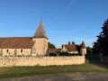
Park in the centre of Mahéru, in a small car park next to the junction, not far from the priory.
(S/E) At the crossroads, take the small road heading south-west. Continue to the end of the tarmac road, to the hamlet of ‘Le Coudray’.
(1) When the road bends to the left, just before the entrance to a farmyard, look for a well-marked path leading down towards the south-west between the trees and follow it. Cross the bottom of the Ruisseau des Aulnais valley and follow the path as it veers south, then west. You’ll reach the hamlet of Le Buisson de Fay.
(2) Take the D676 north-north-west. You’ll come to a Y-junction marked by a large cross. Take the left-hand branch.
(3) After 100 metres, take a well-marked track on the left, heading west. You’ll reach the hamlet of La Blanchonnerie, then a small road which you take to the left (south).
(4) Pass above the Moulin de Raudou and follow the road straight ahead until you come to another small road heading south-west.
(5) Turn right onto this small road (heading south-west). Descend into the valley of the Ruisseau de Fay and climb up the opposite slope. The path joins another small road.
(6) Turn right and leave it almost immediately as it heads west, continuing along a wide track heading north. You’ll reach another small road; turn right onto it, which takes you back to the Moulin de Raudou.
(4) This time, turn left; you’ll retrace the path you’ve already taken for a few hundred metres before returning to La Blanchonnerie. Continue along the road to Fay.
(7) Then follow the road generally northwards for a long stretch, cross the D131 (four-way junction at altitude 302) and join the D31.
(8) Take the D31 to the right, heading north for about a hundred metres, then turn sharply right. You’ll reach Les Maltournes. Once you’ve passed the houses, take a path quite overgrown with vegetation that runs parallel to the road (it’s not well-maintained, but the tracks are clearly visible; it gradually improves). When you reach the forest, look for a clear crossroads and turn right (Note: it is tempting to carry on straight ahead, but this leads to a fence and therefore goes nowhere). Follow this clear track southwards until you reach the D131 again.
(9) Follow it to the left, heading east, until you reach the Green Cross crossroads.
(10) The D131 meets the D676. Take it to the right for a few metres, then turn immediately left onto a small road that continues eastwards. This marks the start of a long stretch that is generally almost level, heading east. The route begins on a short tarmac section but very quickly becomes more natural, initially taking the form of a wide, vehicle-accessible track.
(11) At the junction with a road, cross it and follow the path which starts to the left of the house, heading south-east.
(12) At the road, follow it straight on for a few metres and, at the three-way junction, continue to the left; the path changes in appearance or condition from time to time, but you must keep heading in this direction.
(13) Just before the Ruisseau de la Fontaine, leave the level path and take another one that branches off to the right and descends the slope towards the south-west. It leads to the hamlet of La Vallée.
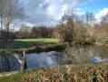
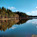
(14) Then take the small road that passes through Les Grilles, La Queurie, and then south of a lovely pond. After the pond, take the first road on the right, then the first road on the left, and return to Mahéru.
Walk past the church and the priory to return to the car park where you started (S/E).


 Visorando Member
 Easy
Easy 
 Association / Club / Walk leader
