Tour of the water sources in Mahéru

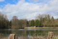
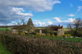
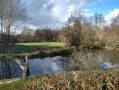
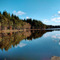
A route offering numerous panoramic views, both on roads and footpaths. The bocage in all its splendour and, of course, some lovely lakes.

Details

30462189
Creation:
Last update:
Last review:
  • Walking
    Activity: Walking
  • ↔
    Distance: 3.78 mi
  • ◔
    Average duration: 2h 05 
  • ▲
    Difficulty: Easy

  • ⚐
    Back to start: Yes
  • ↗
    Ascent: + 397 ft
  • ↘
    Descent: - 413 ft

  • ▲
    Highest point: 968 ft
  • ▼
    Lowest point: 699 ft
  • ⚐ Country: France
  • ⚐ City: Mahéru (61380)
  • ⚑
    Start/End: N 48.658009° / E 0.432174°
  • ❏
    IGN map(s): Ref. 1815SB
  • Hour-by-hour weather

Photos

Description of the walk

Start from the village of Mahéru, at the town hall car park.

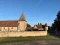
(S/E) From the War Memorial, head down the road leading to the church, pass the church and arrive at the junction just before the pond.

(1) Take the road on the right and continue, passing between the bodies of water. Stay on the road, pass the hamlet of Les Grilles and reach a three-way junction.

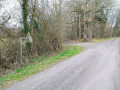
(2) Take the road on the right, heading down towards the hamlet of La Vallée. Walk along its left-hand side between the houses until you reach a muddy path. Follow this tree-lined path, which climbs to the left until it meets the cross-road.

(3) Turn left. Continue along a gravel track which leads onto a road.

(4) Continue up the road and turn off as soon as possible onto the path on the left. The gravel track, road and path together form almost a straight line. Pass in front of the hamlet of Les Vengeries and reach a crossroads.

(5) Turn left at a hairpin bend and head down the footpath until you reach another cross-path.

(6) Look out for a ‘clearing’ in a copse of trees opposite, slightly to the left; take this path.

(7) When you reach the tarmac, head up to the left, walk past the pond you saw at the start of the walk and rejoin the route you have already taken.

(1) Turn right, heading in the opposite direction to the way you came, towards the village of Mahéru (S/E).

Waypoints

  1. S/E : mi 0 - alt. 804 ft - Town hall car park
  2. 1 : mi 0.52 - alt. 745 ft - Junction of the circular loop - Étang de la Queurie
  3. 2 : mi 1.15 - alt. 823 ft - Junction
  4. 3 : mi 1.81 - alt. 935 ft - T-junction
  5. 4 : mi 2.31 - alt. 935 ft - Junction
  6. 5 : mi 2.65 - alt. 968 ft - Crossroads
  7. 6 : mi 3.01 - alt. 758 ft - A gap between the trees
  8. 7 : mi 3.13 - alt. 719 ft - Small road
  9. S/E : mi 3.78 - alt. 804 ft - Town hall car park

Notes

If there are no parking spaces left at the town hall, you can park a little further down in the church car park.

Reviews and comments

3.6 / 5
Based on 4 reviews

Reliability of the description
3.5 / 5
Ease of following the route
3 / 5
Route interest
4.3 / 5
Danic
Danic

Overall rating : 3.3 / 5

Date of your route : Sep 02, 2026
Reliability of the description : ★★★☆☆ Average
Ease of following the route : ★★★☆☆ Average
Route interest : ★★★★☆ Good
Very busy route : No

On paper, a short, easy walk! A pleasant and even picturesque start (Mahéru church, the hamlet in the valley, a stretch past the ponds – which are completely dry this year). After the valley, things get trickier: the “muddy path isn’t actually muddy”, but it’s particularly hard to find. So we follow the edge of the field until we reach what’s likely to be the cross-country path. Sure enough, we spotted it, but the path was impassable and overgrown with brambles. We fell back on what appeared to be the original path, which we’d actually walked alongside without realising it, after once again pushing through the brambles. After following the cross-path – which was also very overgrown – we turned left back onto the road to reach the ponds and then Mahéru.
Parked in the town hall car park, the mayor, who was just coming out, remarked that we’d covered quite a distance.

Machine-translated

Dada28
Dada28

Overall rating : 4.3 / 5

Date of your route : May 26, 2025
Reliability of the description : ★★★★☆ Good
Ease of following the route : ★★★★☆ Good
Route interest : ★★★★★ Very good
Very busy route : No

A lovely, green walk (late May) – an easy route (although there are a few hills along the way!). Beautiful vegetation, panoramic views over a lovely valley, and encounters with cattle… A pleasant walk

Machine-translated

MauvaiseHerbe61
MauvaiseHerbe61

Hello,
It’s true that many of the routes I suggest are easily managed in winter or even in very early spring (March/early April), but they’re much less enjoyable once the grass starts to grow thickly.
Unfortunately, the state of the paths in the region prevents us from enjoying them to the full. Even some of the routes marked out by local councils are virtually impassable. However, I don’t really see the point in sharing walks that are solely on roads.
As for ticks, you should always take precautions when hiking and cover up properly, even if it’s hot.

Machine-translated

WanderSandro
WanderSandro

Overall rating : 3 / 5

Date of your route : Jul 10, 2023
Reliability of the description : ★★★★☆ Good
Ease of following the route : ★★☆☆☆ Disappointing
Route interest : ★★★☆☆ Average
Very busy route : No

A walk to forget: the paths are no longer maintained at all. As a result, you end up walking through very tall grass, brambles and stinging nettles. The start of the walk is very pleasant but is quickly spoiled by sections that are far too difficult. This route is not recommended (unless you enjoy catching ticks).

Machine-translated

Jean-Michel F1.
Jean-Michel F1.

Overall rating : 3.7 / 5

Date of your route : Mar 22, 2023
Reliability of the description : ★★★☆☆ Average
Ease of following the route : ★★★☆☆ Average
Route interest : ★★★★★ Very good
Very busy route : No

Out on the ground, I couldn’t quite work out where point 5 of the route was, so I ended up going straight on without realising it. Once I reached Le Buisson, I took the D676 again to get to Mahéru! (an extra 2 km or so). That said, I really enjoyed the scenery, which is indeed that of a bocage, but a bocage characterised by rugged terrain (hence the charm of the walk).

Machine-translated

Other walks in the area

For more walks, use our search engine .

The GPS track and description are the property of this route's author. Please do not copy them without permission.