Around Ancinnes in the southern Perseigne Forest

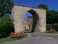
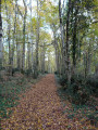
This lovely walk is a real pleasure, allowing you to explore the Perseigne Forest on the outskirts of Ancinnes and admire some beautiful, simple, old country houses.

Details

244322
Creation:
Last update:
Last review:
  • Walking
    Activity: Walking
  • ↔
    Distance: 2.92 mi
  • ◔
    Average duration: 1h 30 
  • ▲
    Difficulty: Easy

  • ⚐
    Back to start: Yes
  • ↗
    Ascent: + 200 ft
  • ↘
    Descent: - 200 ft

  • ▲
    Highest point: 761 ft
  • ▼
    Lowest point: 541 ft
  • ⚐ Country: France
  • ⚐ City: Ancinnes (72610)
  • ⚑
    Start/End: N 48.374444° / E 0.176936°
  • ❏
    IGN map(s): Ref. 1717SB
  • Hour-by-hour weather

Description of the walk

The starting point is at a place called La Louverie, a few hundred metres north of Ancinnes, opposite La Jolivetière (a lovely house with a grey gate).

(S/E) Continue north along the main road towards Le Berry. When you reach the forest, carry on along the road; theGR®22C(marked in white and red) joins the road on the left. Ignore the road on the right leading to Le Berry, enter the forest and, 250 metres further on, leave the road.

(1) Follow theGR® to the right, first through the forest and then along the edge. Leave theGR® at the next junction, staying at the edge of the forest, to reach the hamlet of Petit Châtelet.

(2) Carry on straight ahead, passing a path on your left, and continue until you reach the road to Neufchâtel-en-Saosnois.

(3) Turn right to reach the stop sign on the D19. Turn right again towards Ancinnes and head into the village.

(4) Turn right just before the church, pass the town hall and turn right onto Rue du XXIème Siècle, which leads to Rue de la Forêt.
Turn right to reach La Louverie and the starting point (S/E).

Waypoints

  1. S/E : mi 0 - alt. 682 ft - La Louverie
  2. 1 : mi 0.34 - alt. 761 ft - Leave the road
  3. 2 : mi 1.04 - alt. 643 ft - Le Châtelet
  4. 3 : mi 1.54 - alt. 587 ft - Road to Neufchâtel-en-Saosnois
  5. 4 : mi 2.33 - alt. 564 ft - Water rails
  6. S/E : mi 2.92 - alt. 686 ft - La Louverie

Worth a visit

Plenty of fresh deer tracks from this morning.

Plenty of water but no signs of wild boar

Squirrels

Plenty of rabbits

Always be cautious and plan ahead when you're outdoors. Visorando and the author of this route cannot be held responsible for any accidents occurring on this route.

The GR® and PR® markings are the intellectual property of the Fédération Française de Randonnée Pédestre.

Reviews and comments

3.8 / 5
Based on 5 reviews

Reliability of the description
3.6 / 5
Ease of following the route
4 / 5
Route interest
3.8 / 5
sagot
sagot
• Edited:

Overall rating : 1.7 / 5

Date of your route : Jan 28, 2023
Reliability of the description : ★☆☆☆☆ Very disappointing
Ease of following the route : ★☆☆☆☆ Very disappointing
Route interest : ★★★☆☆ Average
Very busy route : No

Very poorly signposted at the starting point.

There are few signposts along the route.

Follows a fairly busy road.

Machine-translated

Caroju
Caroju

Overall rating : 4.3 / 5

Date of your route : Jul 03, 2022
Reliability of the description : ★★★★★ Very good
Ease of following the route : ★★★★★ Very good
Route interest : ★★★☆☆ Average
Very busy route : No

Perhaps the least interesting of the walks… but we had a stroll

Machine-translated

nicolechauvin
nicolechauvin

Overall rating : 5 / 5

Date of your route : Nov 05, 2021
Reliability of the description : ★★★★★ Very good
Ease of following the route : ★★★★★ Very good
Route interest : ★★★★★ Very good
Very busy route : No

A lovely walk in the woods. THANK YOU

Machine-translated

benoitrando
benoitrando

Overall rating : 4.3 / 5

Date of your route : Nov 13, 2021
Reliability of the description : ★★★★☆ Good
Ease of following the route : ★★★★★ Very good
Route interest : ★★★★☆ Good
Very busy route : No

I don’t understand why this route starts here. The street is quite narrow and there are no parking spaces.
You simply need to carry on up towards the forest; after the ‘village exit’ sign, at the edge of the woods on the left-hand side, there’s plenty of space to park several vehicles and start the walk from there.
The route description at the start and at point 1 is rather disjointed.

A short route to enjoy with the family

Thanks, Saig, for this route

Machine-translated

Jean-Michel F1.
Jean-Michel F1.

Overall rating : 3.7 / 5

Date of your route : Nov 29, 2020
Reliability of the description : ★★★☆☆ Average
Ease of following the route : ★★★★☆ Good
Route interest : ★★★★☆ Good
Very busy route : No

We found it hard to work out where to start, so we had a bit of trouble getting going. Once we were on the right track, though, it was fine. A lovely stretch through the forest (still beautiful in late autumn)

Machine-translated

Other walks in the area

For more walks, use our search engine .

The GPS track and description are the property of this route's author. Please do not copy them without permission.