Cécile Crossroads and Fontenai Ponds

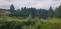
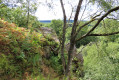
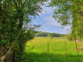
This route, suitable for everyone, offers beautiful views of the countryside around Fontenai-les-Louvets, including the Écouves Forest and the Fontenai Ponds, and also features some interesting sites: a bread oven restored by the Foksa association, and a section ofthe GR®36 trail.

Details

54706951
Creation:
Last update:
Last review:
  • Walking
    Activity: Walking
  • ↔
    Distance: 5.12 mi
  • ◔
    Average duration: 2h 40 
  • ▲
    Difficulty: Easy

  • ⚐
    Back to start: Yes
  • ↗
    Ascent: + 390 ft
  • ↘
    Descent: - 410 ft

  • ▲
    Highest point: 1,230 ft
  • ▼
    Lowest point: 909 ft

Photos

Description of the walk

The starting point is in the car park of the Fontenai-les-Louvets village hall. Nearby, you’ll find a water tap at the gable end of the hall and some picnic tables.

(S/E) As you leave the car park, turn right and walk along the road for about 200 m. Turn right onto a small, shaded path, passing several wooden barriers (which prevent bicycles from passing).

(1) At the end of the path, when you reach La Bluterie, turn left onto the road. Walk 600 m to reach the junction just past the access road to La Boularderie.

(2) Turn right towards Les Noës. This small tarmac track soon gives way to a grassy path that gradually winds its way into the forest. Pass close to a first small pond before the path splits in two at a place called Pré des Noës.

(3) Do not continue along the track; take a small, damp path on the right. Pass close to a second small pond and then reach a stream. This part of the route is shaded and damp. As you make your way through the ferns, note a patch of deciduous trees on the right and conifers on the left. Continue to the end of the path and reach the Carrefour Cécile.

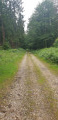
(4) Do not go straight ahead (GR®36), but turn onto the stony path on the right and follow it until you cross the departmental road leading from the Croix Madame junction towards Fontenai. Take the slightly uphill path opposite to the Carrefour des Étangs.

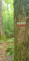
(5) Take the first small path leading down to the far right; do not continue along the stony path: you are on theGR®36. Make your way to the Étangs de Fontenai.

(6) Take care not to miss the footbridge on your right. The view is magnificent. Cross the footbridge separating the two ponds. Then walk up the short hill and join a tarmac path again. Pass through the small hamlet of La Jâle and join the D226 at La Bourrichère.

(7) Cross the D226 carefully and head straight on towards La Corbinière. Continue towards La Raterie along a tarmac road that slopes down slightly; there is little traffic on this road.

(8) Before heading back up towards the Tertre farm, turn almost right-hand way, continuing along this track. You’ll rejoin the D226.

(9) Turn left to reach the houses in Fontenai-les-Louvets and then the car park (S/E).

Waypoints

  1. S/E : mi 0 - alt. 1,053 ft - Car park at the Fontenai hall
  2. 1 : mi 0.31 - alt. 1,017 ft - La Bluterie
  3. 2 : mi 0.69 - alt. 1,027 ft - Three-way junction
  4. 3 : mi 1.1 - alt. 1,112 ft - Pré des Noës
  5. 4 : mi 1.53 - alt. 1,230 ft - Cécile crossroads
  6. 5 : mi 2.13 - alt. 1,201 ft - Étangs Crossroads
  7. 6 : mi 2.83 - alt. 938 ft - Les Étangs de Fontenai (L'Orée-d'Écouves)
  8. 7 : mi 3.44 - alt. 1,007 ft - La Bourrichère, D226
  9. 8 : mi 4.17 - alt. 909 ft - Le Tertre
  10. 9 : mi 4.8 - alt. 1,030 ft - D226
  11. S/E : mi 5.12 - alt. 1,053 ft - Car park at the Fontenai hall

Notes

Picnic table.

Worth a visit

Bread oven.
Fontenai wash house.
Fontenai Ponds Footbridge.
Cécile Crossroads.

Always be cautious and plan ahead when you're outdoors. Visorando and the author of this route cannot be held responsible for any accidents occurring on this route.

The GR® and PR® markings are the intellectual property of the Fédération Française de Randonnée Pédestre.

Reviews and comments

4.8 / 5
Based on 2 reviews

Reliability of the description
5 / 5
Ease of following the route
5 / 5
Route interest
4.5 / 5
User 29445479

Overall rating : 4.7 / 5

Date of your route : Jul 31, 2026
Reliability of the description : ★★★★★ Very good
Ease of following the route : ★★★★★ Very good
Route interest : ★★★★☆ Good
Very busy route : No

A lovely walk – there’s a bit of road on the last stretch, but it’s not very busy. Be careful not to do this in very hot weather as it’s an ‘exposed’ tarmac road. I’ll do it again with my dogs.

Machine-translated

Lynel61
Lynel61

Overall rating : 5 / 5

Date of your route : Oct 26, 2024
Reliability of the description : ★★★★★ Very good
Ease of following the route : ★★★★★ Very good
Route interest : ★★★★★ Very good
Very busy route : No

A very pleasant walk; it was a bit damp to start with after a very rainy spell, but still easy to manage.

Machine-translated

Other walks in the area

For more walks, use our search engine .

The GPS track and description are the property of this route's author. Please do not copy them without permission.