Country:
 City:


Park in the centre of Gacé – there are plenty of options – so you’ll need to adjust the start-of-route description depending on your exact parking spot. For this description, the car park is at the junction with Rue de Rouen.
(S/E) Head due west along this road; it becomes Rue de Lisieux, passes in front of the château and soon joins the D722A (Rue de Vimoutiers)
(1) At this junction, let the main road veer off towards the north-west and turn onto a very narrow road which continues to the right towards the north. You’ll reach the countryside very quickly. Keep to the narrow road on the left at thefirst junction. It becomes a wide track, roughly following the contour line. You’ll reach the D721.
(2) Turn right onto it heading east, then turn left at the Gaspardière junction. Continue to the left, first along a road and then along the track that extends from it, climbing up to a plateau. You’ll reach another road marked with the red and yellowGRP® d’Auge Ornais signposting. Turn left onto it. You’ll come to a T-junction at the edge of a forest.
(3) Turn right at a 90° angle, staying on theGRP®. Follow this route for some time as the path undulates gently, descending to the bottom of a valley. Pass the houses at La Grainerie and then, not far from a mill. Continue uphill towards the church at Mardilly, which comes into view, and reach the crossroads by the cemetery.
(4) Turn right, following the red and yellowGRP® markings. Then leave the path leading to La Mercerie on your right and continue uphill along theGRP® until you reach another road.
(5) Turn left onto this road for a few metres, then turn right off it to join theGRP®. Follow the clearly visible markings. Descend into the valley of the Ruisseau de l’Église and cross it. Climb up the other side to the plateau. You’ll reach a fork in the path near Les Perrés Jariaux.
(6) Do not continue straight on, but follow a path to the right. This rejoins the tarmac road and leads to a small crossroads.
(7) At the junction, follow the signs for La Hachetière. When the road turns left, carry on straight ahead along a path. You’ll reach a junction with signposts for walking routes.
(8) Leave theGRP® here and turn left until you rejoin the small road, which you follow again. Ignore the well-marked path branching off to the right and continue in the same direction. You will then reach the crossroads at La Croix au Jean.
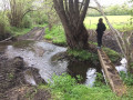
(9) Just before this junction, take the wide path on the left heading south-west. Descend into the valley and reach a ford marked on the IGN map. Be careful: for a few dozen metres, the path is flooded by the stream and you’ll need to make the best of it by using the embankment or tree branches. It’s a rather unpleasant stretch where you’re very likely to get your feet wet. Cross the valley and reach the Vivray crossroads.
(10) Turn right onto the small road. Continue to the D33 and then on to the hamlet of La Halte, which is the northernmost point of the walk.
(11) Turn left, following the sign for Le Bas Manoir along a small road. Continue to the Le Bas Manoir crossroads.
(12) Keep right at the crossroads; the road on the left leads to the private estate of Le Bas Manoir.
Continue for some time heading broadly south, first along a level stretch, then climbing up onto the crest of a rise. After a steep climb, take another level path heading south and reach La Piroudière.
(13) From here, follow a series of small roads and paths down to the vicinity of the Touque stream. Follow it southwards. The path is wide, but here too it is flooded by the stream for a few dozen metres. Then take the small, winding roads to the right to reach the hamlet of La Boissonnière. Continue southwards to join the D979.
(14) Take care here: the D979 is a very busy road and must be crossed with caution.
Then take a wide track that climbs up the hill and then follows the edge of a woodland. Walk through this woodland for some time, ignoring the paths branching off to the right or left, until you reach the tarmac road again. Cross the D299 and continue southwards along the road. Ignore the first path branching off to the left and continue until you reach a Y-junction.
(15) At this junction, turn left into the woodland, then left again when it is no longer possible to continue south. Join a small tarmac road heading south. Follow it for some time, crossing three other small roads in succession. Reach the hamlet of La Poussinière, then arrive at a Y-junction.
(16) Here you have two options:
- turn left, but this would mean finishing the walk on the main D979 road.
- Turn sharply right.
Then turn left onto a wide track which later becomes a small road. You’ll reach Résenlieu.
(17) Turn left onto the D13 to return to Gacé. The rest of the route can be adapted depending on exactly where you left your car and how much of the village you wish to explore (S/E).

 Visorando Member
 Easy

 Moderate
 Association / Club / Walk leader