Country:

 City:
City:


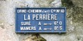
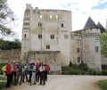
(S) Follow the GR®22, then take the small street heading north between the town hall and the terrace of the Relais d’Horbé. Continue for 100 metres and take the first small road on the right, which then becomes a dirt track. There’s a lovely view to the left over the countryside of La Perrière and, opposite, of Montimer Castle with its dovecote in the foreground (15th century).
(1) At the end of the track, take the road straight ahead, and 100 metres further on, the D210 towards Bellavilliers. Walk alongside Montimer Castle and, 250 metres further on, take a small path on the right at the edge of the forest. Follow it for 500 m until you reach a forest track, which you take to the right, heading up to the Rond de Montimer. Cross the small tarmac road and continue straight ahead for 700 m, until you reach the Chêne de l’École, a remarkable tree. Then continue straight on for 150 m.
(2) At the crossroads, turn left onto the blocked track. Marker 169 is on your left. After about 1.5 km on this stony track, as you leave plot 165, you’ll cross the Route Forestière de l’Hôtel au Franc.
(3) It is at this point that the other variant of stage 7 of the Tour des Collines du Perche – the one passing through Igé – turns right onto a small path that climbs steeply, whilst you will continue on the Bellême variant, following the GR®22 along the wide forest track that climbs to the left. Follow the GR®22 for approximately 2.5 km until you reach the Route Forestière du Carrouge. Opposite plot 160, turn left and then immediately right between plots 159 and 160. 750 m further on, at the road, turn right then immediately left between plots 136 and 137. After 500 m, following another right/left turn, carry on straight ahead, crossing the Route Forestière du Pâty.
(4) Continue for 1 km through the woods and then along the edge of the forest until you reach the Route Forestière du Carrouge, which you’ll come to after crossing a steep hollow.
(5) Leave the GR®22 and take the tarmac road leading out of the woodland and down to the right towards Carrouge. In the hamlet, take the second road on the left and, immediately afterwards, the grassy track that climbs to the right between two hedges (Y-junction). Follow this track straight on until you reach the tarmac road. Turn left onto the small road and follow it for 200 m until you reach the track leading to the Hôtel Chappey forest lodge.
(6) Opposite this sign, take the small path on the right into the woods. It passes behind the Mont Poirier buildings and then in front of the entrance to the Manoir de La Chênaye. Continue straight on to enter Saint-Martin-du-Vieux-Bellême. The dirt track turns into a tarmac road. Carry on along this lane for about 50 metres until you reach a small clearing where four large stones are arranged. Take the lane that climbs up to the left, running alongside a high stone wall towards the church. Halfway up, a fountain flows from the wall.
(7) At the church, take the path to Rue Pierre de Romanet, which you take on the left (D274), then turn left towards the hamlet of La Bruyère. Then keep to the right.
(8) Enter the forest via the small path on the right until you reach the old railway line, then turn right along it until you reach the D938 (very busy, take care), and cross over to the opposite side. Continue along the path towards Bel-Air, then turn right.
(9) After Bel-Air, take the tarmac path on the left.
(10) Cross to the other side to rejoin the old railway line, then turn left onto the tarmac road and head uphill towards Bellême.
(11) At the entrance to Bellême, turn left and follow Rue Haut Guinière until you reach Rue Boucicaut.
(12) Continue to the right onto Boulevard Bansard des Bois. Opposite the swan pond, cross the road and take the small street that runs behind the Tourist Office and leads down towards the Chapelle Saint-Santin. A glance to your right will reveal the feudal motte of Saint-Santin, a mound on which Bellême’s first castle was built, but which is now crowned by the Saint-Santin Chapel.
Head south, always following the path with the steepest gradient. Pass through Le Val and Les Sablons, then head back up towards Bellême Golf Club. (From the town’s outskirts, this route follows the course of the ancient Evreux–Le Mans road). As you approach the golf course buildings, keep to the left and pass under a porch. Above the car park, take the dirt track opposite, which becomes a very beautiful covered path. Cross the D938 with care, then join the D955.
(13) Cross it with care (embankments, ditches). Then follow the sunken path straight ahead. Cross the first junction with a tarmac road, then reach the second junction.
(14) Turn left onto the small tarmac track (yellow markings for route No. 4). Follow this marked track until you reach the D285.
(15) Turn right onto it, then take the first road on the left towards the hamlet of Pavée. Pass a well shaped like a small tower. Follow the road as it bends to the right. A few metres further on, take the stony track which soon turns left. Continue along the track, which quickly becomes shaded. Enjoy the beautiful views in all directions. Pass the first signposted path on your right and carry on straight ahead for about 100 metres.
(16) At the junction, do not go straight on, but take the grassy path on the right, flanked by a beautiful, long hedge. At the next crossroads, continue along the path opposite, which passes close to the headwaters of the Coudre. 400 metres further on, at Vallée Aubry, you’ll reach a short private lane about 80 metres long.
(17) Continue along this track (access kindly granted to pedestrians and mountain bikers). At the D7, take care: cross immediately and walk for 120 metres to the right behind the concrete safety barrier.
(18) Leave the D7 via the grassy track on the left. 200 m further on, take the sunken track that climbs up to the left.
(19) At the fence, take the path on the right which runs down alongside it and follow this very beautiful path straight on towards the south for about 1 km. This path, which is sometimes earthen, sometimes stony and sometimes tarmacked, is lined with pollarded trees (living stumps nearly 2 metres high, regularly pollarded for firewood, characteristic of the hedgerows in the Perche countryside). It passes close to the hamlet known as Le Jarrier and then runs along the rear of the grounds of the Château des Feugerets. You can visit it, provided you make a quick 200-metre round trip along the road that branches off to the right just before the start of a high stone boundary wall. This long, straight path eventually ends near a wayside cross.
(20) Then continue along the path on the right which leads back down to the D7 (take care at the entrance to La-Chapelle-Souëf). Cross La-Chapelle-Souëf following the D7 (take care). Once you’ve left the village, head up to the left along the small tarmac road towards the hamlet of La Galzandière.
(21) Turn right and carry on straight ahead along the grassy path leading downwards before rejoining the D7. Cross the road towards Maison Lierrue and Le Moulin Neuf. Then turn right onto a small tarmac road towards La Béraudière, then La Mitière.
(22) The road turns into a sunken, shaded dirt track. After La Mitière, reach the T-junction (where the route joins the alternative route via Igé). After La Mitière, reach the T-junction (where the route joins the alternative route via Igé)
(23) Leave La Billardière on your right and continue left along a lovely tree-lined sunken path. At the road, turn left for 150 m, and at the next junction, take the road on the right.
(24) At Chailloué, follow the tarmac road on the left towards La Pingauderie and continue along the path, which turns to a dirt track, as far as La Trousseminière.
(25) Walk through the small hamlet and take the path that climbs to the right after the last house (T-junction). Ignore the first path that climbs to the right, then the second, and 20 metres after the second, take the third path that climbs to the right. Be careful not to carry on straight ahead along the path that goes downhill. Continue along this path towards Le Grand Bois until you reach the D285.
(26) Turn left onto the D285 and follow it for 1.1 km to the village of Saint-Germain-de-la-Coudre; whilst you’re there, do take the opportunity to visit the church crypt (E).



 Association / Club / Walk leader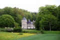
 Difficult
 Easy
Easy  Visorando Member
 Moderate