


Refine your search for walks in Hagondange
Hagondange walks


 26ème marche populaire de Talange
 Association / Club / Walk leader
 13.41 mi
 +49 ft
 -49 ft
 6h 15
6h 15
 Moderate
 Departure from Talange (Moselle)
Route along the Moselle canals.This easy, popular walk will take you along the canal and the Moselle, passing by the Argancy dam, then back via Ennery and Ay-sur-Moselle, along the Moselle.
The woods and Lake Amnéville as seen from Hagondange
 Visorando Member5.48 mi
+236 ft
-207 ft
2h 45
Visorando Member5.48 mi
+236 ft
-207 ft
2h 45
 Easy
Departure from Hagondange (Moselle)
Easy
Departure from Hagondange (Moselle)
A walk that winds through this lovely woodland and avoids the spa centre.
Talange Blue Circular
2.06 mi
+397 ft
-394 ft
1h 20
Easy
Departure from Talange (Moselle)
Between the canal and the Moselle, today's route is a short 3 km circular. There is a car park right next to the starting point, which is convenient. You can always extend the hike by continuing along the canal, either north or south. This towpath offers many kilometres of safe walking.
Talange Circular Route + 1 kilometre variant
 2.86 mi
+253 ft
-253 ft
1h 30
Easy
Departure from Talange (Moselle)
2.86 mi
+253 ft
-253 ft
1h 30
Easy
Departure from Talange (Moselle)
This hike takes you along the iron mine canal. It is marked in red and is not difficult.
The 1-kilometre variant is between points 2 and 3, around the Mancourt pond, where there are two signposts.
Tour de Drince, starting from Pierrevillers
 2.97 mi
+554 ft
-551 ft
1h 50
Easy
Departure from Pierrevillers (Moselle)
2.97 mi
+554 ft
-551 ft
1h 50
Easy
Departure from Pierrevillers (Moselle)
A circular route leading to the Tour de Drince (viewpoint), starting from the car park at the Pierrevillers community hall. Please note: the route is very muddy in winter.
History and prehistory above Rombas
 5.56 mi
+722 ft
-732 ft
3h 10
Easy
Departure from Rombas (Moselle)
5.56 mi
+722 ft
-732 ft
3h 10
Easy
Departure from Rombas (Moselle)
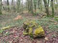
A circular route starting from Fond Saint-Martin, passing a geological site, a grave from the 1870 war, a viewpoint and sites linked to prehistory. There is a slight elevation gain on this route.
The Drince Tower from Fond-Saint-Martin
 4.75 mi
+846 ft
-843 ft
2h 55
Easy
Departure from Rombas (Moselle)
4.75 mi
+846 ft
-843 ft
2h 55
Easy
Departure from Rombas (Moselle)
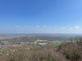
Hilly hike on the Côte de Drince with the Drince Tower and its spectacular view as the main attraction.
Circular walk around Fond Saint-Martin
2.24 mi
+358 ft
-361 ft
1h 20
Easy
Departure from Rombas (Moselle)
An easy, short walk, suitable for children aged 6 and over or as a gentle stroll, through the woodland around Fond Saint-Martin in Rombas.
Malroy - Argency via the right bank of the Moselle
3.45 mi
+75 ft
-98 ft
1h 40
Easy
Departure from Argancy (Moselle)
A short, easy family walk to explore the banks of the Moselle, the village of Argency and the Malroy ponds. If you wish, you can cross the dam at the Argency hydroelectric power station. You may also spot water birds such as ducks, herons, coots, etc.
Grand Tour of Norroy-le-Veneur
3.57 mi
+541 ft
-528 ft
2h 05
Easy
Departure from Norroy-le-Veneur (Moselle)
A fairly varied route passing through fields and gardens, with long stretches through the forest and then through the village.
Exploring the woods of Woippy and Plesnois
7.07 mi
+607 ft
-607 ft
3h 45
Moderate
Departure from Norroy-le-Veneur (Moselle)
This varied walk will allow you to discover, in particular, the Bois du Nord de Woippy, the Parc de la Gentière (a former private wildlife park that has become a forest), the limestone meadow with its unique view of Saulny, and a beautiful descent through the Bois de Plesnois.
A history of water in Norroy-le-Veneur
 3.78 mi
+322 ft
-344 ft
2h 00
Easy
Departure from Norroy-le-Veneur (Moselle)
3.78 mi
+322 ft
-344 ft
2h 00
Easy
Departure from Norroy-le-Veneur (Moselle)
Water is everywhere in Norroy-le-Veneur: wash houses, the Fontaine aux Chênes, and the Moulin aux Prés. The fortified church and the Highland cattle are also well worth a visit.
Circular forest loop to the north-west of Metz
 10.24 mi
+725 ft
-719 ft
5h 20
Easy
Departure from Norroy-le-Veneur (Moselle)
10.24 mi
+725 ft
-719 ft
5h 20
Easy
Departure from Norroy-le-Veneur (Moselle)
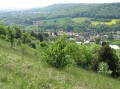
A stroll through fields and woodsBeautiful views as you pass through Saulny, Plesnois, Norroy-le-Veneur and Semécourt.
The large greenhouses and ponds of Saint-Rémy
5.12 mi
+20 ft
-20 ft
2h 20
Easy
Departure from La Maxe (Moselle)
Circular passing along the Saint-Rémy ponds, the La Maxe greenhouses and the EDF thermal power plant.
Saulny Village route
2.42 mi
+207 ft
-200 ft
1h 20
Easy
Departure from Saulny (Moselle)
An easy route starting from the village centre, allowing you to see different aspects of this village of 1,500 inhabitants located about 10 km west of the city of Metz. Through narrow streets and paths, you can enjoy an unobstructed view of Saint-Brice Church, cross a market garden area and then walk along the Saulny Stream.
Walk around Marspich, located near the steelworks
7.82 mi
+961 ft
-945 ft
4h 25
Moderate
Departure from Hayange (Moselle)
A lovely walk passing through Volkrange, Beuvange-sous-Saint-Michel and back via Nilvange along shaded paths. A few steep climbs for experienced walkers.
Route de Vigneulles à Saulny
2.92 mi
+243 ft
-236 ft
1h 35
Easy
Departure from Saulny (Moselle)
This circular route, through the paths and lanes of the village of Saulny, will give you a better understanding of this village, situated 7 km west of the city of Metz. A varied route through woods, farmland and urban streets.
Route panoramique de Saulny
 6.20 mi
+804 ft
-791 ft
3h 35
Easy
Departure from Saulny (Moselle)
6.20 mi
+804 ft
-791 ft
3h 35
Easy
Departure from Saulny (Moselle)
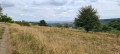
A fairly easy circular route which, starting from the village of Saulny, takes you up onto the limestone plateau, offering a panoramic view – in good weather – of the village of Lorry-lès-Metz and the city of Metz. This panoramic view also takes in Saint-Étienne Cathedral and the Centre Pompidou (museum) with its white sail. A walk through the limestone grasslands and the surrounding woods.
Around Saulny, Plesnois and Norroy-le-Veneur
 6.91 mi
+902 ft
-876 ft
4h 00
Moderate
Departure from Saulny (Moselle)
6.91 mi
+902 ft
-876 ft
4h 00
Moderate
Departure from Saulny (Moselle)
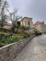
Ten kilometres from Metz, enjoy this walk along the banks of the Moselle through woods, orchards and vineyards.
Route de Saulny Bas in Saulny
2.58 mi
+164 ft
-164 ft
1h 20
Easy
Departure from Saulny (Moselle)
This easy route takes you through the streets and alleys of the village, allowing you to enjoy a pleasant, effortless walk with dry feet and get to know this village near Metz better.
Fort de Plappeville
6.82 mi
+682 ft
-679 ft
3h 45
Moderate
Departure from Saulny (Moselle)
Starting from Saulny, cross through Lorry-lès-Metz, walk around Fort de Plappeville, a fortified structure dating from the 1870 war, and return via the limestone plateau and the Bois des Prussiens.
Towards the Iron Mining Museum in Hayange
6.53 mi
+604 ft
-597 ft
3h 30
Moderate
Departure from Hayange (Moselle)
History of Northern Lorraine.
From Hayange, the "Cradle of Iron," to Neufchef, the Iron Mines Museum
Circular 10 km loop through the forests overlooking the "Fensch Valley".
Around the old Failly-Nouilly railway line
3.82 mi
+210 ft
-210 ft
1h 55
Easy
Departure from Servigny-lès-Sainte-Barbe (Moselle)
Circular route through fields that passes close to the old railway line (partly destroyed and partly underground – disused tunnel near Nouilly) and can be completed with a visit to the site of the old station in Nouilly, now converted for private use.
More walks in Hagondange
Select a point of interest below: