Grand Tour of Norroy-le-Veneur

A fairly varied route passing through fields and gardens, with long stretches through the forest and then through the village.

Details

19441641
Creation:
Last update:
Last review:
  • Walking
    Activity: Walking
  • ↔
    Distance: 3.57 mi
  • ◔
    Average duration: 2h 05 
  • ▲
    Difficulty: Easy

  • ⚐
    Back to start: Yes
  • ↗
    Ascent: + 541 ft
  • ↘
    Descent: - 528 ft

  • ▲
    Highest point: 1,079 ft
  • ▼
    Lowest point: 722 ft

Description of the walk

Park at the car park of the Albert Bourson Multipurpose Hall, 27 Rue de Charrau, 57140 Norroy-le-Veneur.

(S/E) From the car park, take the wide path slightly to the left, crossing the road, and follow it until it joins a cross-path.

(1) Leave the main path and take the path that climbs to the right, staying on it until you reach the Aumont neighbourhood at the top.

(2) When you reach the road, head between the two houses almost directly opposite (slightly to the left) to rejoin the path that winds its way up towards the D112B.

(3) Before reaching this road, don’t miss this fork and follow the path that branches off to the left.

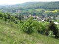
(4) After going round the small field, which offers a lovely view over the valley, take the path that goes down to the left, then turn right at the T-junction at the bottom and stay on the path that climbs into the forest a little further on.

(5) After passing several hunters’ huts, take the hairpin bend onto the path leading down to the left towards the village, then stay on the main road until the next junction onto Rue de Snorroy.

(6) Turn onto the path that runs between two houses again, cross the Ruisseau de Norroy and then head up through a meadow to reach the village at the top. Then walk through the village.

(7) Walk past Saint-Pierre Church to return to the starting point and head back to the car park at the Salle Polyvalente Albert Bourson (S/E).

Waypoints

  1. S/E : mi 0 - alt. 732 ft - Car park at the Albert Bourson Multipurpose Hall
  2. 1 : mi 0.38 - alt. 735 ft - Junction on a sloping path
  3. 2 : mi 0.64 - alt. 899 ft - Aumont district
  4. 3 : mi 0.92 - alt. 1,066 ft - Important junction
  5. 4 : mi 1.41 - alt. 925 ft - T-junction
  6. 5 : mi 2.11 - alt. 1,079 ft - Hairpin bend
  7. 6 : mi 2.71 - alt. 823 ft - Junction between houses
  8. 7 : mi 3.26 - alt. 820 ft - Église Saint-Pierre (Norroy-le-Veneur)
  9. S/E : mi 3.57 - alt. 738 ft - Car park at the Albert Bourson Multipurpose Hall

Worth a visit

On your return to the starting point, visit or walk around Saint-Pierre Church (15th century), which stands next to the walking trail in the village.

Reviews and comments

4 / 5
Based on 1 review

Reliability of the description
4 / 5
Ease of following the route
4 / 5
Route interest
4 / 5
Alamaya
Alamaya

Overall rating : 4 / 5

Date of your route : Dec 27, 2024
Reliability of the description : ★★★★☆ Good
Ease of following the route : ★★★★☆ Good
Route interest : ★★★★☆ Good
Very busy route : Yes

An easy route with lovely paths through the woods and fields
Lovely view over the valley

Machine-translated

Other walks in the area

For more walks, use our search engine .

The GPS track and description are the property of this route's author. Please do not copy them without permission.