


Refine your search for walks in Fontenelle (Côte-d'Or)
Fontenelle (Côte-d'Or) walks


 In the Vingeanne region, the Château de Rosières
 Visorando Member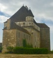
 7.12 mi
 +66 ft
 -66 ft
 3h 20
3h 20
 Moderate
 Departure from Fontenelle (Côte-d'Or) (Côte-d'Or)
This easy hike will take you between Vingeanne and the canal to the Château de Rosières, a 15th-century fortified manor house that is still inhabited and operates as a bed and breakfast. It is open to visitors.
In the footsteps of Henry IV at Fontaine-Française
6.42 mi
+79 ft
-98 ft
3h 00
 Easy
Departure from Fontaine-Française (Côte-d'Or)
Easy
Departure from Fontaine-Française (Côte-d'Or)
In the Vingeanne valley, a walk amongst ponds, springs, canals, streams and the river, exploring the châteaux of Fontaine-Française and Rosières, the ruins of an old blast furnace, and observing resident birds (such as the reed warbler) or migratory birds in a reed bed or meadow.
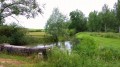
In the Pays de Vingeanne around Dampierre-et-Fley
 8.57 mi
+262 ft
-266 ft
4h 10
Moderate
Departure from Dampierre-et-Flée (Côte-d'Or)
8.57 mi
+262 ft
-266 ft
4h 10
Moderate
Departure from Dampierre-et-Flée (Côte-d'Or)
A beautiful hike that will take you from the banks of the Vingeanne and the Champagne-Burgundy Canal to the forests of the Val de Vingeanne.
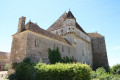
Route around Rosières Castle
 9.42 mi
+217 ft
-194 ft
4h 30
Moderate
Departure from Autrey-lès-Gray (Haute-Saône)
9.42 mi
+217 ft
-194 ft
4h 30
Moderate
Departure from Autrey-lès-Gray (Haute-Saône)
This walk will take you around the Château de Rosières, passing through Verfontaine and Saint-Seine-la-Tour, alongside two ponds where you can see plenty of birds and ducks. The Château de Rosières, currently run as a guesthouse, is open to visitors.
Avoid this route in very hot weather as a large part of it is in the open.
See the reviews; some sections of the trail are difficult to navigate.
The Velours Forest and its picturesque surroundings
11.68 mi
+420 ft
-423 ft
5h 45
Moderate
Departure from Bourberain (Côte-d'Or)
A circular walk starting from Bourberain, passing near the Étang de Bessey, leading to a visit to Bèze (spring and caves) and a partial traverse of the Forêt de Velours, including the Creux du Diable and its star-shaped junctions.
Circular in Vingeanne starting from Chevigny
11.29 mi
+466 ft
-436 ft
5h 35
Moderate
Departure from Bèze (Côte-d'Or)
A walk through woodland and along the canal, passing through charming villages – a pleasant family outing with no difficulty.
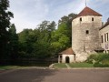
Around Bèze
 5.84 mi
+220 ft
-213 ft
2h 55
Easy
Departure from Bèze (Côte-d'Or)
5.84 mi
+220 ft
-213 ft
2h 55
Easy
Departure from Bèze (Côte-d'Or)
Superb village around the Bèze resurgence and its cave, which can be visited by boat.
In the footsteps of Brunehaut around Renève
 11.57 mi
+249 ft
-223 ft
5h 30
Moderate
Departure from Renève (Côte-d'Or)
11.57 mi
+249 ft
-223 ft
5h 30
Moderate
Departure from Renève (Côte-d'Or)
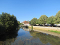
This route will take you to Oisilly. You will see a beautiful viaduct, which you can detour to see
, the Mirebeau Forest, Cheuge and its drawbridge, famous for the filming of the film "La Veuve Couderc", the Renève Forest and the village, its castle, its two very pretty wash houses, and its rather unusual war memorial. You can also visit the Halte Brunehaut to discover the history of Queen Brunehaut and the exhibition of Gallo-Roman remains found around Renève.
From Sacquenay to the Canal between Champagne and Burgundy
 10.04 mi
+312 ft
-312 ft
4h 55
Moderate
Departure from Sacquenay (Côte-d'Or)
10.04 mi
+312 ft
-312 ft
4h 55
Moderate
Departure from Sacquenay (Côte-d'Or)
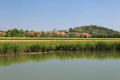
A walk in the Vingeanne area that will take you to discover the 15th-century fountains in Sacquenay as well as the canal between Champagne and Burgundy. Diverse landscapes and a well-preserved environment.
The banks of the Tille and the Perte de la Venelle in Lux
 5.35 mi
+62 ft
-62 ft
2h 30
Easy
Departure from Lux (Côte-d'Or)
5.35 mi
+62 ft
-62 ft
2h 30
Easy
Departure from Lux (Côte-d'Or)
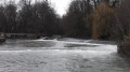
This circular walk will take you around the charming village of Lux, its dam, the banks of the Tille, its fountains, its church, its park along the Tille, and the peaceful spot known as the Perte de la Venelle.
Why not combine a walk with a picnic by the water (the Tille) in Lux, perhaps in the landscaped park?
Circular walk between Tille, the Romanesque church and the Templars’ site, starting from Lux
9.24 mi
+262 ft
-243 ft
4h 30
Easy
Departure from Lux (Côte-d'Or)
Starting from Lux-sur-la-Tille, a nearly entirely flat circular route along dirt tracks to explore the Tille valley, the River Ignon and the leats of Tilchâtel. The walk takes you past the Ferme de Fontenotte, a former Templar commandery, and the beautiful Church of Saint-Florent in Tilchâtel, a Romanesque church adorned with fine capitals and bearing an inscription on its portal.
From Mirebeau-sur-Bèze to Noiron-sur-Bèze via the national forest
 10.46 mi
+92 ft
-92 ft
4h 55
Moderate
Departure from Mirebeau-sur-Bèze (Côte-d'Or)
10.46 mi
+92 ft
-92 ft
4h 55
Moderate
Departure from Mirebeau-sur-Bèze (Côte-d'Or)
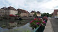
This walk through the national forest will take you past the castle, Noiron and Blagny.
It follows a path once used by horses and pack animals to carry timber, charcoal and large game out of the forests, or to bring in woodcutters, charcoal burners and their equipment.
We will visit the villages of Mirebeau-sur-Bèze and Noiron-sur-Bèze, through which the River Béze flows.
Circular walk starting from Viévigne via Bèze
12.34 mi
+433 ft
-453 ft
6h 05
 Difficult
Departure from Viévigne (Côte-d'Or)
Difficult
Departure from Viévigne (Côte-d'Or)
A circular walk starting from Viévigne that leads to Bèze through fields and woods. Enjoyable scenery throughout the walk and a close-up view of the beautiful Dame Alix ponds.
Between the Saône and the forest, starting from Essertenne-et-Cecey
 12.37 mi
+243 ft
-220 ft
5h 55
Moderate
Departure from Essertenne-et-Cecey (Haute-Saône)
12.37 mi
+243 ft
-220 ft
5h 55
Moderate
Departure from Essertenne-et-Cecey (Haute-Saône)
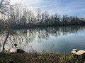
A hike with no technical difficulties or elevation changes, along roads, paths and trails between the Apremont woods, the Mantoche woods and the right bank of the Saône, passing through:- Essertenne and its church with its external bells,- the old forges of Echalonge and its pond,- Mantoche,- the Saône, the blue route, stroll along the river,- the chalets of Grand Gué and Maison Rouge.Note: parts of the route are exposed to the sun, so take precautions in hot weather.
From Beire-le-Châtel to Spoy and back
 5.56 mi
+72 ft
-79 ft
2h 35
Easy
Departure from Beire-le-Châtel (Côte-d'Or)
5.56 mi
+72 ft
-79 ft
2h 35
Easy
Departure from Beire-le-Châtel (Côte-d'Or)
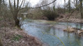
Beire-le-Châtel: canton of Saint-Apollinaire (formerly canton of Mirebeau).
The village takes its name from the Gaulish word "Beire", meaning "plain". The discovery of a temple dedicated to Januaria recalls the position of Beire-le-Châtel in Gallo-Roman times, at the crossroads of ancient roads where the remains of two Roman roads can be found. In addition, six Gallo-Roman burials were found in 2019.
La Pâturie, Le Prélot and the “Sentier des Pierres sèches” in Champlitte
 6.79 mi
+413 ft
-390 ft
3h 30
Moderate
Departure from Champlitte (Haute-Saône)
6.79 mi
+413 ft
-390 ft
3h 30
Moderate
Departure from Champlitte (Haute-Saône)
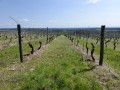
A pleasant little walk through the vineyards and the heritage of Franche-Comté.
A circular walk starting from Talmay
5.20 mi
+39 ft
-36 ft
2h 25
Easy
Departure from Talmay (Côte-d'Or)
As well as a visit to the village and its famous castle, this walk will take you into the Bois de Charmois, where, like me, you might be lucky enough to spot some deer – outside of hunting season, of course.
From Boussenois to Vernois-lès-Vesvres in the Chamberceau Forest
 10.09 mi
+787 ft
-791 ft
5h 20
Moderate
Departure from Boussenois (Côte-d'Or)
10.09 mi
+787 ft
-791 ft
5h 20
Moderate
Departure from Boussenois (Côte-d'Or)
A circular walk starting from Boussenois and heading to Vernois through the woods.
Between Boussenois and Rivière-les-Fosses
 9.41 mi
+787 ft
-758 ft
5h 00
Difficult
Departure from Boussenois (Côte-d'Or)
9.41 mi
+787 ft
-758 ft
5h 00
Difficult
Departure from Boussenois (Côte-d'Or)
A walk between Boussenois and Rivière-les-Fosses via La Montagne and the woods of Grand Maisonnais
Foncegrive and Selongey as seen from Boussenois
 10.98 mi
+869 ft
-866 ft
5h 50
Moderate
Departure from Boussenois (Côte-d'Or)
10.98 mi
+869 ft
-866 ft
5h 50
Moderate
Departure from Boussenois (Côte-d'Or)
From Boussenois, head towards Foncegrive, partly through the woods; pass through Foncegrive and continue to Selongey, also via a small woodland path; pass through Selongey and head back up via the Sainte-Anne Chapel to return to Boussenois.