Route around Rosières Castle

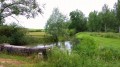
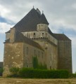
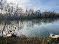
This walk will take you around the Château de Rosières, passing through Verfontaine and Saint-Seine-la-Tour, alongside two ponds where you can see plenty of birds and ducks. The Château de Rosières, currently run as a guesthouse, is open to visitors.
Avoid this route in very hot weather as a large part of it is in the open.
See the reviews; some sections of the trail are difficult to navigate.

Details

1327449
Creation:
Last update:
Last review:
  • Walking
    Activity: Walking
  • ↔
    Distance: 9.42 mi
  • ◔
    Average duration: 4h 30 
  • ▲
    Difficulty: Moderate

  • ⚐
    Back to start: Yes
  • ↗
    Ascent: + 217 ft
  • ↘
    Descent: - 194 ft

  • ▲
    Highest point: 892 ft
  • ▼
    Lowest point: 715 ft
  • ⚐ Country: France
  • ⚐ City: Autrey-lès-Gray (70100)
  • ⚑
    Start/End: N 47.477419° / E 5.436722°
  • ❏
    IGN map(s): Ref. 3121SB, 3122SB, 3221SB, 3222O
  • Hour-by-hour weather

Photos

Description of the walk

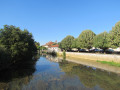
Park in the car park near the Verfontaine wash house, taking care not to obstruct any farm vehicles that may be parked there and need to leave.

(S/E) Take the dirt track that runs alongside the farm opposite the wash house. Follow this track to a T-junction. Turn left until you reach the junction with the small tarmac road.

(1) Take the road on the right for a few metres, then leave it and turn right onto the dirt track, continuing straight on until you reach a junction. Turn left and then immediately right, following the edge of a large copse until you reach the next T-junction.

(2) Turn left and go straight on, crossing a small wood whilst ignoring a track on the right, and continue to the entrance to the village of Saint-Seine-la-Tour via the Voi aux Chèvres.

(3) Cross the D30f, continue straight on along Rue de Belle Charme, then cross the D30. Go down the steps to the right of the bus stop to reach Rue Basse. Continue to the junction with Rue de la Grande Borne.

(4) Turn left onto Rue de la Grande Borne and, a few steps further on, turn left again onto Rue de la Tour. Leave the village and continue along the unpaved track. Ignore the path on the left. Carry on along this track, skirting the Étang du Pré Haut (hidden behind a hedge), until you reach the junction with the D30 opposite the Château de Rosières (well worth a visit).

(5) Cross the D30 and turn right. Walk alongside the road, then take a path on the left which runs alongside the château grounds. Follow this path to the edge of the woods.
Turn right onto the path leading into the woods. Ignore the path on the left which runs alongside a marshy area. You will then see a white marker on the left-hand side. Continue straight on until you reach the star-shaped junction.

(6) Take the second path on the right until you reach the edge of the woods. At this point, there is no longer a maintained path; you must walk along the field and continue through the grass at the edge of the Étang de Cassevosse. Keep straight on along the dirt track. At the Y-junction, turn left until you reach the junction with a white track. Turn left until you reach the edge of the woodland.

(7) Keep to the right on this path which runs alongside the woods. Ignore the tracks leading into the woods on the left. At the edge of the copse on the right, turn left onto the track leading into the woods. Carry on, ignoring the tracks on both the left and right, until you reach the junction with another track.

(8) Turn left, carry on straight ahead, leave the woods and continue to the village entrance. Turn right and follow the main road to the wash house, a parking spot (S/E).

Waypoints

  1. S/E : mi 0 - alt. 755 ft - Car park at the wash house
  2. 1 : mi 1.41 - alt. 801 ft - Tarmac road
  3. 2 : mi 2.71 - alt. 863 ft - Les Bras
  4. 3 : mi 3.85 - alt. 817 ft - Cross the D30f
  5. 4 : mi 4.11 - alt. 745 ft - Saint-Seine La Tour. Near the - Vingeanne (rivière)
  6. 5 : mi 5.88 - alt. 741 ft - Château de Rosières (Saint-Seine-sur-Vingeanne)
  7. 6 : mi 6.57 - alt. 741 ft - Star-shaped junction
  8. 7 : mi 7.45 - alt. 738 ft - Bois des Envions
  9. 8 : mi 8.49 - alt. 804 ft - Loeuilley Wood
  10. S/E : mi 9.42 - alt. 755 ft - Car park by the wash house

Notes

You can have a picnic in the shelter or shade of the tall trees and top up your water supplies at Rosières Castle, provided you ask the owners in advance. They are very welcoming, so there’s no need to worry.

Worth a visit

Reviews and comments

3.8 / 5
Based on 3 reviews

Reliability of the description
3.7 / 5
Ease of following the route
3.7 / 5
Route interest
4 / 5
-Philippe-
-Philippe-

Overall rating : 2 / 5

Date of your route : May 18, 2023
Reliability of the description : ★★★☆☆ Average
Ease of following the route : ★☆☆☆☆ Very disappointing
Route interest : ★★☆☆☆ Disappointing
Very busy route : No

Hello
There’s a major problem with this walk: between points 5 and 6 in the description, there’s no longer a passable path, and there’s even a risk of injury in the woods behind the castle. You can find your way using a GPS, but what’s the point of walking like that? What’s more, this walk is very monotonous: you can hardly see the ponds at all, or only from a great distance, and you see even less wildlife (as the description says, the first pond is behind a large copse and isn’t visible). Only the castle is really worth seeing – provided, that is, you include a visit to it as part of the walk; the owners are very welcoming. To round it off, the walk begins with about 1 km of walking in a straight line between a field of wheat and alfalfa – ‘intensively farmed’ – which isn’t particularly interesting, and this pattern repeats itself… Unfortunately, this assessment fairly sums up what you should take away from this walk.
Have a nice day

Machine-translated

70rando70
70rando70

Overall rating : 4.3 / 5

Date of your route : Apr 25, 2021
Reliability of the description : ★★★☆☆ Average
Ease of following the route : ★★★★★ Very good
Route interest : ★★★★★ Very good
Very busy route : No

Hello,
I’ve encountered a few difficulties at level 5.
The path to the left after the castle grounds no longer exists; you have to walk alongside the grounds across the meadow.
Then, forestry work has obscured the path you’re supposed to take on the right; you can find it again using GPS after stepping over tree trunks and branches.
After that, the route is straightforward.

Machine-translated

PITOISET
PITOISET

Overall rating : 5 / 5

Date of your route : Feb 25, 2019
Reliability of the description : ★★★★★ Very good
Ease of following the route : ★★★★★ Very good
Route interest : ★★★★★ Very good

:lol(mdr)lol:

Machine-translated

Other walks in the area

For more walks, use our search engine .

The GPS track and description are the property of this route's author. Please do not copy them without permission.