A circular walk starting from Talmay

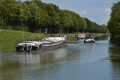
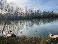
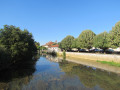
As well as a visit to the village and its famous castle, this walk will take you into the Bois de Charmois, where, like me, you might be lucky enough to spot some deer – outside of hunting season, of course.

Details

1649255
Creation:
Last update:
Last review:
  • Walking
    Activity: Walking
  • ↔
    Distance: 5.20 mi
  • ◔
    Average duration: 2h 25 
  • ▲
    Difficulty: Easy

  • ⚐
    Back to start: Yes
  • ↗
    Ascent: + 39 ft
  • ↘
    Descent: - 36 ft

  • ▲
    Highest point: 673 ft
  • ▼
    Lowest point: 610 ft
  • ⚐ Country: France
  • ⚐ City: Talmay (21270)
  • ⚑
    Start/End: N 47.355602° / E 5.437592°
  • ❏
    IGN map(s): Ref. 3222O
  • Hour-by-hour weather

Description of the walk

Park in the car park at Talmay Town Hall.

(S/E) Walk past the church and continue along Rue Saint-Vallier.

(1) At the three-way junction (fibre-optic cabinet), turn left and continue to the crossroads with a central traffic island lined with pine woods. Here, take the Chemin Charmois on the left, then cross the railway line.
Stay on this path until you reach a crossroads at the edge of the Bois de Charmois.

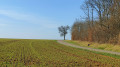
(2) Turn left onto the stony farm track. Follow this track along the edge of the woodland. You’ll reach a junction with a path leading into the woodland.

(3) Cross the ditch over the concrete post and take the forest track opposite until you reach the forest road.

(4) At the barrier on the forest road, turn left for about 200 metres, then turn left onto the first track to cross the woods again.

(5) On emerging from the woods, cross the ditch over another concrete post, then follow the farm track straight ahead which runs alongside the woods. You’ll come to a small road.

(6) Turn left; further on, cross the railway line. You’ll reach a three-way junction marked by a wayside cross.

(7) Turn left and continue towards the village. Pass the farm building on your left.

(8) Turn right onto Chemin de la Cart (note: there is no street sign) and continue to Route de Gray. At this junction, there is a care home. Head down towards the village until you reach the wayside cross on the right, then turn right onto Route de Renève. Follow this road for about 150m (house with blue shutters on the corner) and turn left onto Rue du Loup, which leads to Talmay Castle. Walk up Rue du Château and turn right towards the town hall to return to the car park (S/E).

Waypoints

  1. S/E : mi 0 - alt. 633 ft - Town hall car park
  2. 1 : mi 0.13 - alt. 627 ft - Three-way junction, fibre-optic cabinet. Near the - Vingeanne (rivière)
  3. 2 : mi 1 - alt. 617 ft - Gravel farm track
  4. 3 : mi 1.8 - alt. 614 ft - Cross the ditch via the concrete post
  5. 4 : mi 2.39 - alt. 614 ft - Barrier on the forest road
  6. 5 : mi 3.07 - alt. 614 ft - Exit from the woods with a concrete post by the ditch
  7. 6 : mi 3.37 - alt. 640 ft - Turn left onto the small road
  8. 7 : mi 4.23 - alt. 666 ft - Three-way junction with a wayside cross
  9. 8 : mi 4.63 - alt. 656 ft - Corner of Rue du Velay and Chemin de la Cart
  10. S/E : mi 5.2 - alt. 636 ft - Town hall car park

Notes

An easy walk, but there are two sections where you have to step over concrete posts.

Worth a visit

Talmay Church and Castle
Near (6) La Chapelle du Fresne; to reach it, take a round trip, setting off to the right.

Reviews and comments

3 / 5
Based on 1 review

Reliability of the description
2 / 5
Ease of following the route
4 / 5
Route interest
3 / 5
MD1000pattes
MD1000pattes

Hello
To earn all these points, all you need to do is log the reconnaissance walk you’re doing with Visorando – that’s all
where there are fewer points, it’s because after the recce I deleted part of the track and redrew the route I wanted to take
The time is often ‘skewed’ by the time taken for the recce
Visorando does the rest
But it’s true that sometimes the elevation gain drifts for no apparent reason
For that, Visorando has a ‘recalculate elevation gain’ function which I forgot to use

I only use Visorando; I don’t use any other system

I’m the manager of the hiking club, which is indeed affiliated with the CDRP

If you’d like, please give me your phone number

Kind regards

Machine-translated

Daniel 21
Daniel 21

Hello,
Don’t worry, I fully understand. I’m just trying to make sense of this track, which has caught my attention.
To me, the track shown looks like it comes from a GPS. The evidence for this is the data it contains:
774 WAYPOINTS (which is rare in a manual) and the fact that these are consistent. They clearly show all the longitudes and latitudes, as well as the route to follow between each point. Added to this is the date 29/11/18, the departure time 13:22:09 for each point, and an arrival time of 15:17:47 – give or take 2 hours, depending on the device’s clock. Finally, the duration at each WPT, the altitude and the speed. When I say ‘disappointing’, it is not directed at you but at Visorando.
I’d be happy to speak to you on the phone to clarify things further. I used to be a GPS trainer, which is why I’m so keen to understand.
From your signature, I gather that your club is very close to Dijon and that it is affiliated to CDRP 21. If this is the case, please let me know, and I will get in touch with the contact person for your section, Michel D.
I look forward to meeting you and send you my warmest regards. Daniel

Machine-translated

MD1000pattes
MD1000pattes

Hello
Sorry, but I don’t have a sat-nav as you might think; it was Visorando that marked 500m, and it’s true, I didn’t recalculate the altitude
I should have done so
It’s been corrected
Thank you for your understanding

Machine-translated

Daniel 21
Daniel 21

Overall rating : 3 / 5

Date of your route : Dec 14, 2018
Reliability of the description : ★★☆☆☆ Disappointing
Ease of following the route : ★★★★☆ Good
Route interest : ★★★☆☆ Average

How on earth did the person who mapped this route manage to come up with an elevation gain of over 500 metres? It’s flat countryside… 50 metres would have been enough. This isn’t a decimal point error; it’s more a case of an inability to use a GPS and mindlessly copying data without thinking.
Disappointing.
DS21

Machine-translated

Other walks in the area

For more walks, use our search engine .

The GPS track and description are the property of this route's author. Please do not copy them without permission.