


Refine your search for walks in Ercé
Ercé walks
 Mirabat Castle
 Visorando Member
 4.40 mi
 +1,713 ft
 -1,699 ft
 3h 30
3h 30
 Moderate
 Departure from Oust (Ariège)
Climb up to the ruined Mirabat Castle, where you can enjoy a beautiful view of the Couserans mountain range with Mont Valier and the plain in the foreground.
Ajéou plateau
 4.43 mi
+797 ft
-791 ft
2h 45
4.43 mi
+797 ft
-791 ft
2h 45
 Easy
Departure from Ustou (Ariège)
Easy
Departure from Ustou (Ariège)
Discover the Ajéou plateau with its chasm, sinkholes, summer pastures and numerous barns, some of which are bird-proof. In several places, you can enjoy views of the Ariège mountain range.
Mont Valier and the Ariège peaks seen from Buleix and Boussan
 4.61 mi
+1,063 ft
-1,050 ft
3h 05
Moderate
Departure from Soulan (Ariège)
4.61 mi
+1,063 ft
-1,050 ft
3h 05
Moderate
Departure from Soulan (Ariège)
This easy hike allows you to admire all the peaks of the Ariège, including Mont Valier. From the road (first third of the route) to the end, this majestic landscape unfolds throughout the walk.
This route can also be done by mountain bike.
Souliou Plateau from Aulus-les-Bains
 4.33 mi
+1,886 ft
-1,870 ft
3h 40
Moderate
Departure from Aulus-les-Bains (Ariège)
4.33 mi
+1,886 ft
-1,870 ft
3h 40
Moderate
Departure from Aulus-les-Bains (Ariège)
A lovely walk through the woods starting from Aulus-les-Bains, passing through the Plateau de Souliou.
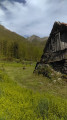
Col de la Lau
 5.53 mi
+2,592 ft
-2,592 ft
4h 50
Moderate
Departure from Aulus-les-Bains (Ariège)
5.53 mi
+2,592 ft
-2,592 ft
4h 50
Moderate
Departure from Aulus-les-Bains (Ariège)
A lovely, shaded climb between Aulus and the foot of Mont Béas, culminating in a beautiful view of the neighbouring peaks.
On the hillsides of Soueix
 3.37 mi
+577 ft
-597 ft
2h 05
Easy
Departure from Soueix-Rogalle (Ariège)
3.37 mi
+577 ft
-597 ft
2h 05
Easy
Departure from Soueix-Rogalle (Ariège)
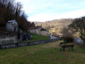
Walk through the hillsides of the village of Soueix with panoramic views of Le Vallier, the Col d'Ayens and Mirabat Castle. Architectural highlights include the churches of Saint-Sernin and Vic d'Oust, and the railway bridge.
Ars waterfall and Guzet lake
 8.20 mi
+2,992 ft
-3,018 ft
6h 25
8.20 mi
+2,992 ft
-3,018 ft
6h 25
 Difficult
Departure from Aulus-les-Bains (Ariège)
Difficult
Departure from Aulus-les-Bains (Ariège)
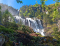
Loop starting from Alus-Les-Bains with varied landscapes. Hike to be undertaken after the snow has completely disappeared (check in advance). Several passages through peat, in the middle of streams and avalanche corridors.Please note: look carefully for markings and signposts, which are not always very visible.
The Guzet Neige viewpoint
 7.31 mi
+1,598 ft
-1,604 ft
4h 45
Moderate
Departure from Ustou (Ariège)
7.31 mi
+1,598 ft
-1,604 ft
4h 45
Moderate
Departure from Ustou (Ariège)
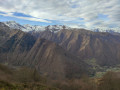
A tour of the resort, with views stretching from Valier to Mont Béas, passing through summer pastures and beech and fir forests.
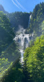
The Ars Waterfall
 6.54 mi
+2,726 ft
-2,726 ft
5h 25
Moderate
Departure from Aulus-les-Bains (Ariège)
6.54 mi
+2,726 ft
-2,726 ft
5h 25
Moderate
Departure from Aulus-les-Bains (Ariège)
A fantastic getaway leading to one of the most beautiful and largest waterfalls in the Pyrenees.
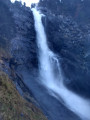
Cascade d'Ars et cascade du Fouillet
 8.87 mi
+3,530 ft
-3,501 ft
7h 10
Difficult
Departure from Aulus-les-Bains (Ariège)
8.87 mi
+3,530 ft
-3,501 ft
7h 10
Difficult
Departure from Aulus-les-Bains (Ariège)
A circular walk starting from Aulus-Les-Bains towards the Ars waterfall and returning via the Fouillet waterfall.A very pleasant walk, through woodland for almost the entire route, with two magnificent waterfalls as a reward.The majestic Ars waterfall is 246 metres high, cascading in three stages, with the middle section 60 metres wide.The Fouillet Waterfall, though smaller in scale, is just as beautiful and impressive.
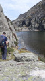
Ars waterfall and valley
 9.80 mi
+3,379 ft
-3,379 ft
7h 25
Difficult
Departure from Aulus-les-Bains (Ariège)
9.80 mi
+3,379 ft
-3,379 ft
7h 25
Difficult
Departure from Aulus-les-Bains (Ariège)
An easy path leads to the Ars waterfall. A slightly more challenging trail climbs up the Ars valley to admire its ponds.
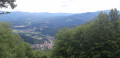
Le Cos and the banks of the Salat
 5.39 mi
+1,693 ft
-1,683 ft
3h 55
Moderate
Departure from Seix (Ariège)
5.39 mi
+1,693 ft
-1,683 ft
3h 55
Moderate
Departure from Seix (Ariège)
A steady climb to the summit of Cos with two beautiful viewpoints, the Salat valley and the Garbet valley and the Vallier massif on the other side, and a return to the banks of the Salat River with its turbulent, turquoise-blue waters.
The waterfalls on the Chemin d'Espagne
 Association / Club / Walk leader
 5.76 mi
+1,417 ft
-1,421 ft
3h 55
Moderate
Departure from Ustou (Ariège)
5.76 mi
+1,417 ft
-1,421 ft
3h 55
Moderate
Departure from Ustou (Ariège)
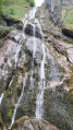
A beautiful hike in the Uustou Valley, which passes through the hamlets of L'Echart and Ossèse, with numerous waterfalls (especially in spring). As a bonus, you can see the superb Lastien waterfall. A very beautiful hike with no difficulty. Most of the route is covered by vegetation (pleasant in strong sunlight).
The Couserans mountains seen from Saint-Pierre de Soulan
2.17 mi
+423 ft
-423 ft
1h 20
Easy
Departure from Soulan (Ariège)
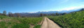
A short family walk offering 180° views of the Couserans mountains, including Vallier, for almost the entire route. Most of the walk is along a very quiet road. It is best to do this walk in the morning to avoid the mountains being in silhouette.
The Couserans Mountains as seen from Saint-Pierre-de-Soulan
 2.64 mi
+459 ft
-463 ft
1h 35
Easy
Departure from Soulan (Ariège)
2.64 mi
+459 ft
-463 ft
1h 35
Easy
Departure from Soulan (Ariège)
A short family walk offering 180° views of the Couserans mountains, including the Vallier, for almost the entire duration of the walk. Most of the route follows a very quiet road.
Col Dret, Tuc du Laguel and Courtal de Cougniet
 4.56 mi
+1,460 ft
-1,522 ft
3h 20
Moderate
Departure from Le Port (Ariège)
4.56 mi
+1,460 ft
-1,522 ft
3h 20
Moderate
Departure from Le Port (Ariège)
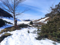
At the foot of Mont Béas, a lovely climb towards Col Dret offers stunning panoramic views of the Couserans peaks, the Pic des Trois Seigneurs massif and, if the weather is clear, the Roc Blanc in the background behind Port de Lers. The descent takes you through the Courtal de Cougneit, former shepherds’ huts, before continuing through a beautiful fir forest.
Guzet viewpoint from Guzet Neige
 8.03 mi
+1,490 ft
-2,641 ft
5h 00
Moderate
Departure from Ustou (Ariège)
8.03 mi
+1,490 ft
-2,641 ft
5h 00
Moderate
Departure from Ustou (Ariège)
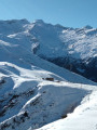
A hike best undertaken in July–August, when the chairlifts from Guzet Neige are operating, for a touch of originality. The first section (from the start (S) at the top of the chairlift to (1) and back) is optional and shortens the walk by an hour, but it’s a shame to miss it as the view over the Cirque de Cagateille is well worth it!
A varied walk without any major difficulties, offering magnificent views, with some sections in the open and others in the shade, and a steady alternation of descents and ascents.
The Goutets irises
 5.96 mi
+1,749 ft
-1,729 ft
4h 15
Moderate
Departure from Le Port (Ariège)
5.96 mi
+1,749 ft
-1,729 ft
4h 15
Moderate
Departure from Le Port (Ariège)
This circuit provides access to the dry stone hamlet of Les Orris. It is a magnificent pastoral village, used for summer grazing, set in lush green surroundings opposite the Pic des Trois Seigneurs. The hamlet of Les Goutets was used from the 1800s until around 1950.
Fouillet Valley from the Col d'Escots
 4.38 mi
+1,939 ft
-1,926 ft
3h 40
Moderate
Departure from Ustou (Ariège)
4.38 mi
+1,939 ft
-1,926 ft
3h 40
Moderate
Departure from Ustou (Ariège)
Explore the Fouillet Valley, starting with a descent offering a beautiful panorama of Mont Béas, the Pic des Trois Seigneurs and Mont Ceint, with the Dent d’Aubé also coming into view. The lush green Fouillet Valley contrasts with the rocky terrain at the last bridge at Casièrens. Please note that the start is poorly signposted; the return route follows theGR®®.The GPX track may prove very useful in places.
Pic de Freychet as seen from the Col d’Escots
 3.60 mi
+1,378 ft
-1,381 ft
2h 50
Moderate
Departure from Ustou (Ariège)
3.60 mi
+1,378 ft
-1,381 ft
2h 50
Moderate
Departure from Ustou (Ariège)
This route is particularly lovely in fine weather and offers superb views of the Ariège Pyrenees, including a view of the Lower Pyrenees and, in particular, a 360° panorama from the Pic de Freychet.
Tuc de Peyre Mensongère from Rouzé d’en Bas
 4.88 mi
+2,520 ft
-2,520 ft
4h 25
Moderate
Departure from Ustou (Ariège)
4.88 mi
+2,520 ft
-2,520 ft
4h 25
Moderate
Departure from Ustou (Ariège)
A relatively short walk that takes you to a summit from which the view stretches from the Pic des Trois Seigneurs to the Valier.
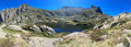
Cirque de Cagateille, Étang de La Hilette and Étang d'Alet from Ustou
 6.79 mi
+3,681 ft
-3,701 ft
7 hrs
6.79 mi
+3,681 ft
-3,701 ft
7 hrs
 Very difficult
Departure from Ustou (Ariège)
Very difficult
Departure from Ustou (Ariège)
A magnificent route in the mid- and high-mountain range, with water features in the first part, then vast horizons opening up before your eyes.
This circuit requires a good level of fitness but is well worth the effort.
N.B. Please take into account the difficult sections at (3) and (6).
Only to be attempted in very good weather: from (4) very difficult orientation in foggy weather and from (7) exposure to thunderstorms.
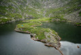
Cirque de Cagateille and Étang de la Hillette
 5.28 mi
+2,694 ft
-2,694 ft
6 hrs
Very difficult
Departure from Ustou (Ariège)
5.28 mi
+2,694 ft
-2,694 ft
6 hrs
Very difficult
Departure from Ustou (Ariège)
This hike, which presents no difficulty until you reach the foot of the Cirque de Cagateille, will make you sweat to reach the Étang de la Hillette.
But it's well worth the effort to discover this little Pyrenean fjord!
Roc de Peyre Caussile and Cap de Campets circular walk
 7.32 mi
+1,660 ft
-1,647 ft
4h 45
Moderate
Departure from Boussenac (Ariège)
7.32 mi
+1,660 ft
-1,647 ft
4h 45
Moderate
Departure from Boussenac (Ariège)
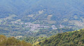
This signposted walk in the Massif de l’Arize is well worth exploring. The Roc de Peyre Caussile (1,339 m) and the Cap de Campets (1,504 m) are two peaks linked to the pastoral history of the Couserans and the ancient paths connecting the valleys. On this heavily wooded route, you’ll enjoy views of Massat, the Séronais, the Arize and, on a clear day, as far as the Toulouse plains, the Corbières and the Aude. At Cap de Campets, the 360° view is magnificent, stretching from Cap Carmil to Mont Valier and taking in the entire Couserans massif.
We would like to extend our warmest thanks to all those who, year after year, maintain these paths with such passion – whether they are local authority staff, enthusiasts or hunters.
Girantes plateau via Étang de Labant
 3.44 mi
+886 ft
-886 ft
2h 20
Easy
Departure from Aulus-les-Bains (Ariège)
3.44 mi
+886 ft
-886 ft
2h 20
Easy
Departure from Aulus-les-Bains (Ariège)
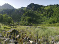
Circular around Coumebière with beautiful views of the surrounding peaks. It will allow you to discover the Étang de Labant, an old mine and the Girantes plateau, which is not as flat as its name might suggest, all at the foot of the 1,975 m Mont Ceint.
Circular route via the Port de Saleix and the Pic de Girantès
5.23 mi
+2,247 ft
-2,244 ft
4h 20
Moderate
Departure from Aulus-les-Bains (Ariège)
This route offers a very pretty circular route providing access to a superb viewpoint over the entire massif. The Coumebière Plateau is a stunning grassy meadow leading to the Pas du Roc canyon. What’s more, vultures are often seen circling above the Pic de Girantès to take advantage of the updrafts, providing a great opportunity to take some magnificent photographs.
Refuge de Bassiès via Port de Saleix
7.09 mi
+2,677 ft
-2,657 ft
5h 35
Moderate
Departure from Aulus-les-Bains (Ariège)
A magnificent hike through varied landscapes along the entire route. The climb to Port de Bassiès is steady and not too difficult. Unfortunately, there is a 280 m descent to the refuge, which you will have to climb back up.
Take advantage of the view of the lakes and the Pique Rouge cirque to rest for a while.
Bassiès Refuge via the Port de Saleix and Bassiès
 7.00 mi
+2,969 ft
-2,969 ft
5h 50
Difficult
Departure from Aulus-les-Bains (Ariège)
7.00 mi
+2,969 ft
-2,969 ft
5h 50
Difficult
Departure from Aulus-les-Bains (Ariège)
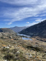
This lovely circular walk takes you to the Refuge de Bassiès, over mountain passes, and past lakes and an old mine on the way back.
Alate pond
 4.28 mi
+1,650 ft
-1,631 ft
3h 25
Moderate
Departure from Aulus-les-Bains (Ariège)
4.28 mi
+1,650 ft
-1,631 ft
3h 25
Moderate
Departure from Aulus-les-Bains (Ariège)
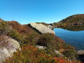
A beautiful blue pond at the foot of the granite Mont Garias with a beautiful view of Mont Valier during the ascent
Pic de Cabanatous - Étang d'Alate
 5.80 mi
+2,297 ft
-2,277 ft
4h 40
Moderate
Departure from Aulus-les-Bains (Ariège)
5.80 mi
+2,297 ft
-2,277 ft
4h 40
Moderate
Departure from Aulus-les-Bains (Ariège)
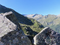
This hike, accessible to all, offers a taste of the high mountains. After the Étang de Labant, the route leads to the Pic de Cabanatous, a marvellous lookout point over the Étangs de Bassiès and beyond to the great summits of the Ariège. On the way back, the Étang d'Alate is the perfect place to stop for a break before heading back to the Port de Saleix, a very important ancient communication route that facilitated trade between the Couserans and Vicdessos regions.
Pique Rouge de Bassiès
 9.11 mi
+4,295 ft
-4,288 ft
7h 55
Difficult
Departure from Aulus-les-Bains (Ariège)
9.11 mi
+4,295 ft
-4,288 ft
7h 55
Difficult
Departure from Aulus-les-Bains (Ariège)
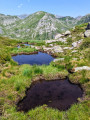
A very beautiful hike that follows a ridge line and offers magnificent views of the entire massif. This is a hike with a significant elevation gain, reserved for experienced hikers.
Mont Ceint or Pic de Gérentos
 5.59 mi
+2,234 ft
-2,234 ft
4h 30
Moderate
Departure from Aulus-les-Bains (Ariège)
5.59 mi
+2,234 ft
-2,234 ft
4h 30
Moderate
Departure from Aulus-les-Bains (Ariège)
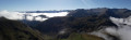
This is a fairly short hike that takes you to a summit steeped in history and offering superb panoramic views.
The Étang du Garbet via the Étang de Labant
 5.51 mi
+1,926 ft
-1,919 ft
4h 15
Moderate
Departure from Aulus-les-Bains (Ariège)
5.51 mi
+1,926 ft
-1,919 ft
4h 15
Moderate
Departure from Aulus-les-Bains (Ariège)
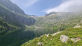
This route is more exposed than the direct ascent via Agneserre.
Few people use this route.
It can also form the return leg of a circular route starting from Agneserre. See the alternative route in the practical information section.
Please read the route description and practical information carefully before setting out on this hike.
The Lafont Tower and Cap de Campets
 3.77 mi
+584 ft
-591 ft
2h 15
Easy
Departure from Boussenac (Ariège)
3.77 mi
+584 ft
-591 ft
2h 15
Easy
Departure from Boussenac (Ariège)
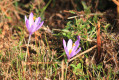
This short hike will allow you to see the Lafont Tower and enjoy a superb 360° view from the summit of Cap de Campets.
Col d'Ayens and Col de Bès
 2.21 mi
+305 ft
-295 ft
1h 15
Easy
Departure from Soulan (Ariège)
2.21 mi
+305 ft
-295 ft
1h 15
Easy
Departure from Soulan (Ariège)
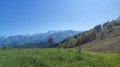
Easy walk with beautiful views of the Pyrenees.
Circular walk around the Col d’Ayens
2.89 mi
+689 ft
-705 ft
1h 55
Easy
Departure from Soulan (Ariège)
A family walk with no major difficulties.
Cirque de Garbettou and Étang du Garbet
 4.40 mi
+1,831 ft
-1,798 ft
3h 35
Moderate
Departure from Aulus-les-Bains (Ariège)
4.40 mi
+1,831 ft
-1,798 ft
3h 35
Moderate
Departure from Aulus-les-Bains (Ariège)
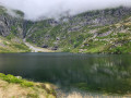
The ascent is divided into two sections: the Cirque de Garbettou, which is easy to access, with its waterfall and streams; and the steeper, rockier climb towards the Étang du Garbet, with its turquoise-blue reflections, waterfall and occasional snowfields.
Please note that some sections are quite steep; crossing a scree slope may be difficult for those unaccustomed to this type of terrain. Allow an average of 4½ hours to complete this walk, according to reviews.
Cirque de Garbettou, Étang du Garbet and Étang Bleu
 6.81 mi
+3,035 ft
-3,025 ft
5h 45
Difficult
Departure from Aulus-les-Bains (Ariège)
6.81 mi
+3,035 ft
-3,025 ft
5h 45
Difficult
Departure from Aulus-les-Bains (Ariège)
A very scenic walk through the Garbet Valley, offering views of the magnificent Cirque de Garbettou, Étang du Garbet and the wilder Étang Bleu, all three accompanied by their superb waterfalls.
The Cirque d'Anglade and the Saubé Hut
6.48 mi
+3,238 ft
-3,225 ft
5h 50
Difficult
Departure from Couflens (Ariège)
This hike offers a variety of landscapes, with woods giving way to mountain pastures as you climb higher, and the beautiful Cirque d'Anglade site to discover.Visorando app recommended.