Country:

 City:
City:


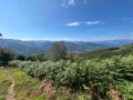
The start point is on the D17, between the Col des Caougnous and the Col de Péguère. You can park easily at the foot of the forest track, which is easy to spot 1 km after the Col de Péguère, on the right-hand side of the road (on the left if coming from the Col des Caougnous).
The trail is marked with yellow trail markers and signs.
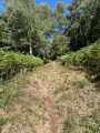
(S/E) Follow the forest track north-westwards; the going is fairly level.
(1) At a fork in the road, take the path on the left. Stay on the main signposted path, which descends gently, and ignore any side paths. Cross a few gullies and streams.
(2) Turn right at a 90° angle and begin the climb towards the Roc de Peyre Caussile. Keep heading north-west across terrain that gradually opens out. You’ll reach a ridge.
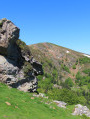
(3) Turn right, open a gate (close it behind you) and enter a summer pasture. At the Fork in the road that appears immediately, take the left-hand path. Climb north-eastwards and pass directly below the Roc de Peyre Caussille. The path turns north and remains below the ridge, which is on your right.
(4) Take a cattle track to leave the mountain pasture. Continue straight on towards the gate and the small refuge (close the gate behind you). You will then reach the Col de Portel.
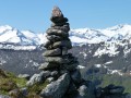
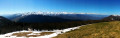
(5) Follow the D72 to the right and, after about a hundred metres, leave it to join a footpath. Turn left straight away onto this path and climb Cap de Campets, the highest point of the walk (superb views).
(6) Turn left (north-east) and follow the path along the fence as it descends towards the forest.
(7) Return to the D72 road and immediately take a path branching off to the right. Continue downhill.
(8) Take the sharp left-hand bend and follow the forest track to a junction you passed at the start of the walk.
(1) Follow the track as it continues and head back up to the starting point (S/E).

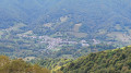
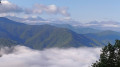
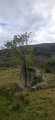
 I stopped at point 3 on the little rocky outcrop for a snack, where I met a group of walkers. Thanks for the chocolate cake! A shame about the view – the clouds are starting to roll in… but you can see Massat clearly down below. Back into the woods for the rest of the route to the Col de Portel. Another climb through the fields to the Cap de Campets. Don’t take the little path on the left (marked in purple on the map). A lovely 360° view… but more clouds
  . We start the descent. The final stretch along the forest track isn’t particularly interesting and seems to go on forever…. But anyway, all in all, a nice walk with varied scenery. I could have done with a bit more sunshine!! Just so you know, the path is well signposted.
 Visorando Member
 Easy
Easy 
 Very difficult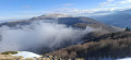
 Association / Club / Walk leader