Circular route via the Port de Saleix and the Pic de Girantès

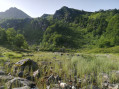
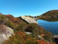
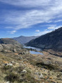
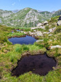
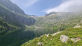
This route offers a very pretty circular route providing access to a superb viewpoint over the entire massif. The Coumebière Plateau is a stunning grassy meadow leading to the Pas du Roc canyon. What’s more, vultures are often seen circling above the Pic de Girantès to take advantage of the updrafts, providing a great opportunity to take some magnificent photographs.

Details

36189300
Creation:
Last update:
Last review:
  • Walking
    Activity: Walking
  • ↔
    Distance: 5.23 mi
  • ◔
    Average duration: 4h 20 
  • ▲
    Difficulty: Moderate

  • ⚐
    Back to start: Yes
  • ↗
    Ascent: + 2,247 ft
  • ↘
    Descent: - 2,244 ft

  • ▲
    Highest point: 6,831 ft
  • ▼
    Lowest point: 4,583 ft

Description of the walk

Start from the Coumebière car park.

(S/E) Follow theGR® path which climbs to the Port de Saleix. The gradient is never too steep.

(1) You’ll pass the Fontaine du Port. The path climbs gently in hairpin bends. The markings on the final few circular bends are less obvious and require a bit of care. You’ll arrive at Port de Saleix, where the sun is shining.

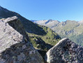
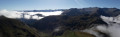
(2) You then take a ridge path, signpostedGRP®, heading due north, which becomes much steeper towards the end. Take care not to stray from the path as the slopes to the right and left are quite steep. You reach the summit, which offers a magnificent 360° view of the entire massif.

(3) Wildlife photographers will spend several hours here. We head down, still heading north, following the GRP®.

(4) At a signpost – in more or less good condition – turn left, heading west, onto a poorly marked path that descends to the Coumebière Plateau. Be careful: the tracks left by sheep are sometimes more clearly visible than the path itself. The path continues to descend towards the valley.

(5) On the Coumebière Plateau, look out for a sign at the far right and continue down towards the Pas du Roc.

(6) You enter the Pas du Roc gorge and descend via a series of hairpin bends on the left until you reach a meadow, which you cross. Then, continuing straight on, you reach the road.

(7) Follow the road to the left to reach the Coumebière car park (S/E).

Waypoints

  1. S/E : mi 0 - alt. 4,583 ft - Coumebière car park
  2. 1 : mi 0.63 - alt. 4,938 ft - Fontaine du Port
  3. 2 : mi 2.12 - alt. 5,879 ft - Port de Saleix (1794m)
  4. 3 : mi 2.78 - alt. 6,831 ft - Pic de Girantès or Mont Ceint
  5. 4 : mi 3.2 - alt. 6,371 ft - Junction
  6. 5 : mi 4.22 - alt. 5,085 ft - Signpost
  7. 6 : mi 4.31 - alt. 5,089 ft - Pas du Roc
  8. 7 : mi 4.79 - alt. 4,675 ft - D8 road
  9. S/E : mi 5.23 - alt. 4,587 ft - Coumebière car park

Notes

Set off early to enjoy a climb in the shade up to the Port de Saleix.
There are no water sources except at the start.
Bring a small mat to sit on and put your rucksack down on, as there is sometimes a lot of goat droppings at the summit.
Furthermore, the wind can sometimes be quite chilly at the summit. Make sure to pack a fleece and a windbreaker.

Worth a visit

Vultures and, occasionally, bearded vultures are often seen at the summit, which is a treat for photographers. From this modest summit, the view of the mountain range is nevertheless spectacular.

Always be cautious and plan ahead when you're outdoors. Visorando and the author of this route cannot be held responsible for any accidents occurring on this route.

The GR® and PR® markings are the intellectual property of the Fédération Française de Randonnée Pédestre.

Reviews and comments

4.4 / 5
Based on 3 reviews

Reliability of the description
4.7 / 5
Ease of following the route
4 / 5
Route interest
4.7 / 5
Trebob
Trebob

Overall rating : 4.3 / 5

Date of your route : Oct 14, 2024
Reliability of the description : ★★★★★ Very good
Ease of following the route : ★★★★☆ Good
Route interest : ★★★★☆ Good
Very busy route : Yes

Hello, an enjoyable walk overall. As mentioned earlier, it was quite busy all the way to the port of Saleix, but much less so on Mont Ceint (or Pic de Girantes); the climb to the summit wasn’t very long but quite tough in my opinion (and for my legs…), though there was a superb 360-degree view from the top.Otherwise, it was a lovely sunny day; I did the walk with my little Yorkie, Jogi, who absolutely loved it – 8 km for me, and another 2 or 3 for him!!!

Machine-translated

Sev11
Sev11

Overall rating : 4.3 / 5

Date of your route : Aug 08, 2024
Reliability of the description : ★★★★☆ Good
Ease of following the route : ★★★★☆ Good
Route interest : ★★★★★ Very good
Very busy route : No

A lovely, quiet circular walk. We were in the clouds all the way to the port of Saleix; the wet path required a bit of care as it was quite slippery. We lost the GRP trail after the peak, but found it again by heading north just before the signpost (point 4); then we fumbled our way a bit between points 4 and 5 (there were markers but also lots of other tracks), but we were in no rush – it was good fun. Birds of prey circling the peak, beautiful views. We were completely on our own for the rest of the walk from the Port de Saleix, right in the middle of August (most people seemed to be heading for the Étang d’Alate). No water and no shade on almost the entire circular route.

Machine-translated

Mariejecheu
Mariejecheu

Overall rating : 4.7 / 5

Date of your route : Jun 28, 2024
Reliability of the description : ★★★★★ Very good
Ease of following the route : ★★★★☆ Good
Route interest : ★★★★★ Very good
Very busy route : No

A truly beautiful walk from start to finish, with ‘moderate’ intensity, difficulty and duration. We spotted a flock of vultures flying just above the Pic de Girantes, just as promised! We made our way back via the Coumebière plateau using a free location app, as it’s actually quite easy to lose track of the path. Thank you for this exciting suggestion!

Machine-translated

Other walks in the area

For more walks, use our search engine .

The GPS track and description are the property of this route's author. Please do not copy them without permission.