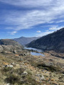
The Étang du Garbet via the Étang de Labant

This route is more exposed than the direct ascent via Agneserre.
Few people use this route.
It can also form the return leg of a circular route starting from Agneserre. See the alternative route in the practical information section.
Please read the route description and practical information carefully before setting out on this hike.

Details

3922297
Creation:
Last update:
Last review:
  • Walking
    Activity: Walking
  • ↔
    Distance: 5.51 mi
  • ◔
    Average duration: 4h 15 
  • ▲
    Difficulty: Moderate

  • ⚐
    Back to start: Yes
  • ↗
    Ascent: + 1,926 ft
  • ↘
    Descent: - 1,919 ft

  • ▲
    Highest point: 5,669 ft
  • ▼
    Lowest point: 4,596 ft

Photos

Description of the walk

Start from the Coumebière plateau (altitude 1,400).

(S) The route starts heading due east along theGR®10, which you will then leave.

(1) At the fork (altitude 1,442), follow the path opposite, the “Chemin de l’Étang de Labant” (yellow markings).

(2) At the next fork, turn right, heading due south.

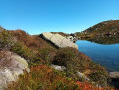
(3) Continue climbing, leaving the Étang de Labant on your left.

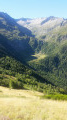
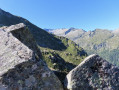
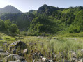
(4) On emerging from the forest (elevation 1648), you’ll see the Cirque de Grabettou to the south and the glacial dam holding back the Étang du Garbet, which are the destination of the walk.
Leave the yellow markings and take a small grassy path to the right for a few metres.
Then turn left, heading due south. From here, the path is not very well marked (a few cairns and very old red (pinkish) markings, and more recently small ‘G’ labels for the trail).
Under no circumstances should you venture onto this path if the ground is wet, as some sections are vertiginous.

(5) You’ll reach the Ravin de la Coume, where you can have a refreshing dip (on the way back, for example). Generally speaking, although it’s never flat, you’ll stay at the same altitude. Some sections are a bit of a challenge.

(6)You pass over the rocky outcrops.

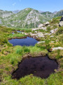
(7) You arrive just above the Étang du Garbet.
The return journey follows the same route back to the Coumebière car park (S/E).
Alternative route: see practical information.

Waypoints

  1. S/E : mi 0 - alt. 4,596 ft - Coumebière car park
  2. 1 : mi 0.25 - alt. 4,754 ft - Junction. Turn right
  3. 2 : mi 0.64 - alt. 5,180 ft - Junction. Turn right
  4. 3 : mi 0.77 - alt. 5,233 ft - Etang de labant
  5. 4 : mi 0.9 - alt. 5,397 ft - Exit from the forest. Markings cease here.
  6. 5 : mi 1.37 - alt. 5,200 ft - Ravin de la Coume
  7. 6 : mi 2.18 - alt. 5,630 ft - Rocky outcrops. Towards the - Étang du Garbet
  8. 7 : mi 2.75 - alt. 5,535 ft - Étang du - Garbet (rivière)
  9. S/E : mi 5.51 - alt. 4,596 ft - Coumebière car park

Notes

Suitable only for those already experienced in the mountains (exposed sections and high steps). Not recommended in wet weather.

Alternative route:
By leaving a second vehicle behind, it is possible to set off from Agneserre and descend due north along a track to the hairpin bend on the D8f.

Worth a visit

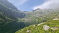
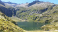
A lovely hike offering, for most of the route, a magnificent view of the Cirque de Garbettou (do take care to watch your step, though).

Always be cautious and plan ahead when you're outdoors. Visorando and the author of this route cannot be held responsible for any accidents occurring on this route.

The GR® and PR® markings are the intellectual property of the Fédération Française de Randonnée Pédestre.

Reviews and comments

4.2 / 5
Based on 3 reviews

Reliability of the description
4.3 / 5
Ease of following the route
3.3 / 5
Route interest
5 / 5
Piot39
Piot39

Overall rating : 4.3 / 5

Date of your route : Jul 01, 2025
Reliability of the description : ★★★★★ Very good
Ease of following the route : ★★★☆☆ Average
Route interest : ★★★★★ Very good
Very busy route : No

As the author of this hike says: "Read the description and practical information carefully before setting off on this hike."
I did it in dry weather and can't imagine what it must be like when it's wet! The trail was difficult to find after the Patous sign and a few times during the hike (tall grass). I disagree with Lou Gary 31's comment, there were no yellow markings
Otherwise, the scenery is magnificent, but you need to watch where you put your feet! The path is quite challenging and often sloping. In terms of time and distance, I don't have the same figures. As an average walker, it took me 6 hours in total (including breaks and meals) and my two pedometers showed an average of 10 km.
The Garbet pond with its waterfall in the background is definitely worth the effort. Make sure you wear warm clothing and bring plenty of water as it is often in direct sunlight. Avoid shorts, tall grass, vegetation and narrow paths.

Machine-translated

Laulo22
Laulo22
• Edited:

Overall rating : 4 / 5

Date of your route : Jul 22, 2024
Reliability of the description : ★★★★☆ Good
Ease of following the route : ★★★☆☆ Average
Route interest : ★★★★★ Very good
Very busy route : No

An easy walk to the fork in the path after Étang Labant. From there, follow the barely visible path to the right of the ‘patous’ sign. The path runs along the mountainside and leads to Étang Garbet Rando, from where the walk can be extended to Étang Bleu. A little-used path.

Machine-translated

Lou Gary 31
Lou Gary 31

Overall rating : 4.3 / 5

Date of your route : Jun 27, 2022
Reliability of the description : ★★★★☆ Good
Ease of following the route : ★★★★☆ Good
Route interest : ★★★★★ Very good
Very busy route : No

It’s easy to find your way round as the walk is now fully signposted in yellow.
The scenery is magnificent.
It’s a real reward after the effort, as the very stony path is quite tiring, but it’s definitely worth it!!!

Machine-translated

Other walks in the area

For more walks, use our search engine .

The GPS track and description are the property of this route's author. Please do not copy them without permission.