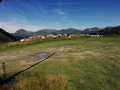
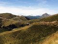
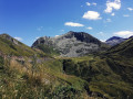
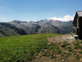
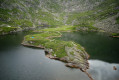
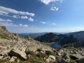
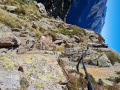
Pic de Freychet as seen from the Col d’Escots

This route is particularly lovely in fine weather and offers superb views of the Ariège Pyrenees, including a view of the Lower Pyrenees and, in particular, a 360° panorama from the Pic de Freychet.

Details

3665962
Creation:
Last update:
Last review:
  • Walking
    Activity: Walking
  • ↔
    Distance: 3.60 mi
  • ◔
    Average duration: 2h 50 
  • ▲
    Difficulty: Moderate

  • ⚐
    Back to start: Yes
  • ↗
    Ascent: + 1,378 ft
  • ↘
    Descent: - 1,381 ft

  • ▲
    Highest point: 6,719 ft
  • ▼
    Lowest point: 5,335 ft

Photos

Description of the walk

To reach the start, take the track at the top of Guzet Neige (1,600 m) and continue to Cap de Guzet. Descend to the Col d’Escots, where you’ll find the Chalet de Beauregard (a first-aid post in winter and a mountain restaurant).

(S/E) Set off from the Chalet de Beauregard and, 100 m further on, take the path that climbs and runs alongside a fence. Do not take the path that descends (GR®®10towards Aulus-les-Bains) but climb up the mountainside towards the Tuc de l’Abibardis.

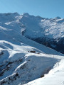
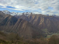
(1) Halfway up, the slope becomes steeper. Throughout the ascent, look back to take in the scenery to the north; from east to west, you’ll be treated to superb views and, in very clear weather, you can see as far as the Lower Pyrenees.

(2) Once at the Tuc de l’Abibardis, continue along the track to the right which leads to the Pic de Freychet, where you can stop for a picnic amidst a magnificent panorama: the Cirque de Cagateille, the Cirque de Gérac, the Pic de Seron (to the south), and so on.

(3) To head back down, take the track which winds through a series of bends.

(4) At the third hairpin bend on the left, cut straight across the slope to rejoin the track further down.

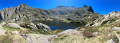
(5) Follow this road to the right until you reach the viewpoint overlooking the Cirque de Cagateille and the Cirque de Gérac.

(6) Continue along the road to return to the starting point at the Chalet de Beauregard (S/E).

Waypoints

  1. S/E : mi 0 - alt. 5,341 ft - Chalet de Beauregard - Col d'Escots (1623m)
  2. 1 : mi 0.55 - alt. 5,791 ft - Steep section
  3. 2 : mi 0.78 - alt. 6,352 ft - Tuc de l’Abibardis
  4. 3 : mi 1.12 - alt. 6,657 ft - Pic de Freychet (2061m)
  5. 4 : mi 1.68 - alt. 6,184 ft - Shortened start
  6. 5 : mi 1.82 - alt. 5,902 ft - End of shortcut
  7. 6 : mi 2.51 - alt. 5,686 ft - Viewpoint over the Cagateille and Gérac cirques
  8. S/E : mi 3.6 - alt. 5,338 ft - Chalet de Beauregard

Notes

If you tackle this route in the opposite direction, the level of difficulty may be reduced, but be careful as, in this case, the descent – which is a steep slope (a black run at the resort in winter) – can be slippery after rain or a storm. In this case, at (5), continue straight on to the Cirque de Gérac car park to take the uphill track and reach (4) then (3).

(4) If the shortcut seems too difficult, continue along the track to the Cirque de Gérac car park and carry on to the right until you reach (5).

Please note

  • Be mindful of the altitude if you have young children. The Pic de Freychet is over 2,000 metres high and the elevation gain is significant.
  • This route is entirely in open terrain; if the weather is sunny, make sure you bring plenty of water, as there are no water sources to refresh yourself.
  • The only places to get refreshments are the mountain restaurant at the Col d’Escots (S/E) – which is not open all day – or at the Guzet Neige ski resort.
  • The only shelter offering a bit of shade is the chairlift hut at the top of the Pic de Freychet.

Worth a visit

Do feel free to take breaks, both on the ascent and the descent, to enjoy the scenery around you and the tranquillity of the place.

Always be cautious and plan ahead when you're outdoors. Visorando and the author of this route cannot be held responsible for any accidents occurring on this route.

The GR® and PR® markings are the intellectual property of the Fédération Française de Randonnée Pédestre.

Reviews and comments

4.1 / 5
Based on 3 reviews

Reliability of the description
4.3 / 5
Ease of following the route
4.3 / 5
Route interest
3.7 / 5
brunor248
brunor248
• Edited:

Overall rating : 3 / 5

Date of your route : Aug 01, 2024
Reliability of the description : ★★★☆☆ Average
Ease of following the route : ★★★☆☆ Average
Route interest : ★★★☆☆ Average
Very busy route : No

As hikers who aren’t put off by a ‘difficult’ rating, we agree with Michel Sol’s assessment. Conclusion: this hike should be classified as difficult. All the more so as the slope between points 1 and 2 is extremely steep and a large section of the path shown on the IGN map has disappeared. You end up having to climb through the rhododendrons on a slope that is effectively equivalent to a black run on the ski slopes. Most of the rest of the route is actually a track suitable for vehicles, linked to the ski runs. The view along the ridge from the Pic de l’Abibardis to the Pic de Freychet is splendid, but it is best to set off early in the morning to avoid the frequent fog, even in summer.

Machine-translated

MICHEL.SOL
MICHEL.SOL

Overall rating : 4.7 / 5

Date of your route : Nov 09, 2022
Reliability of the description : ★★★★★ Very good
Ease of following the route : ★★★★★ Very good
Route interest : ★★★★☆ Good
Very busy route : No

"Halfway up, the slope gets steeper." I can confirm that, and I’d say it gets VERY steep indeed! Hang in there!

Machine-translated

halexandre
halexandre
• Edited:

Thank you, Algerard1, for your feedback.
During the high season, the area is much busier than it was when you went on this hike. In the summer, there are a few more people passing through the Col d’Escot, where the hike begins, as it’s on the GR10 route and home to an excellent, well-known mountain restaurant (Chalet de Beauregard).
The only time the Col d’Escot really gets busy is during the ‘Nuits des Étoiles’ (Nights of the Stars) event organised by the Ciel d’Occitanie association, when dozens of telescopes are set up over three days and three nights for visitors to enjoy.

Machine-translated

Algerard1
Algerard1

Overall rating : 4.7 / 5

Date of your route : Sep 13, 2021
Reliability of the description : ★★★★★ Very good
Ease of following the route : ★★★★★ Very good
Route interest : ★★★★☆ Good
Very busy route : No

A route that runs partly along the slopes of a ski resort. During the ascent, the entire left-hand side is magnificent and completely unspoilt. The Cirque de Gérac is also very beautiful. In mid-September we were on our own, but during the season it seems to be a very popular spot. Thanks to the porter.

Machine-translated

Other walks in the area

For more walks, use our search engine .

The GPS track and description are the property of this route's author. Please do not copy them without permission.