Country:

 City:
City:


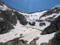
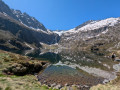
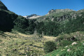
Access to the start: cross through or go round the centre of Aulus-les-Bains, then follow the D8f on leaving the village for 4 km until you reach a wide hairpin bend with a small car park on the right.
(S/E) From the car park, head due south and follow thePR® (yellow) marked trail south-southeast up a very gentle slope through the shaded forest. Cross the first stream over the pebbles and ignore all right-hand turn-offs. Continue south-south-east, cross a second stream and carry on through the forest until you reach an altitude of around 1,280 metres.
(1) Begin a bend to the left. Here the path becomes steeper over wet, well-rounded rocks and boulders, and is not always very clear, but you can always easily spot the yellow markings by looking up. The path curves gently to the right again, with a gentler gradient.
Be careful: throughout this section, you must watch your step carefully on the rocks and in the mud, particularly when crossing the streams flowing down from the left.
(2) On emerging from the forest, there is a magnificent view of the Garbettou cirque and its large waterfall. Continue by skirting the right bank of the Garbet along a very damp path, which is at times completely covered by water so clear that you cannot see it.
(3) Cross the Garbet, turning off to the north, and follow the path which becomes steeper amongst the rocks. You’ll reach the Pic du Garbet (elevation 1,456).
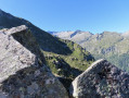
(4) This peak isn’t really a peak as it barely stands out in terms of altitude, but this spot offers a beautiful view over the valley.
Continue along the path through the rocks and back under the trees, passing through a few very steep sections where you’ll need to lift your legs high (heading south-west then south-south-east). Don’t forget to admire the impressive waterfalls opposite on your left! The route isn’t always very clear, but it’s impossible to get lost and you’ll always find the path again quickly.
(5) Shortly after emerging from the forest, enjoy the stunning view of the first bends in the Garbet and a magnificent little waterfall on the left. Continue due south to the Étang du Garbet.
(6) There are plenty of spots for a picnic or a nap. Don’t hesitate to walk off to the left to admire the source of the Garbet (elevation 1,683). There’s a superb waterfall opposite.
To continue towards the Étang Bleu, walk along the left bank of the Étang du Garbet, following a fairly flat path which, however, becomes increasingly sloping and very damp, even muddy. Cross a first stream, then a second just before leaving the bank.
(7) From here, the path climbs steeply in places, zigzagging up a fairly steep slope that remains very sloping.
Take care: the route is sometimes a little unclear, as vegetation is reclaiming this clearly less-used path, but you can find your way by keeping a close eye on natural features (impassable rocky outcrops, overly dense vegetation) and looking for the more visible tracks.
You’ll also come across a few damp, or even dripping, slabs with a very steep incline, bordering on vertiginous. Cracks for your feet or workarounds always allow you to get past, but caution is advised. It’s best to have a sure footing and know how to read the terrain.
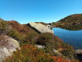
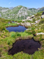
(8) At the end of this section, the path levels out. Take a detour to the left, then cut back to the right before heading due south. The path is now less steep and more clearly marked. Walk naturally southwards , admiring the view of the Étang Bleu. Descend the slope (which is fairly easy going) to reach the shore of the pond.
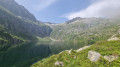
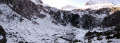
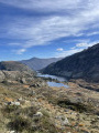
(9) The valley is very steep-sided, set in a wild, rocky landscape. There are some beautiful waterfalls directly opposite, facing due south, carved into the rock.
Turn back and retrace your steps along the same route as on the way there until you reach the car park (S/E). *

 Visorando Member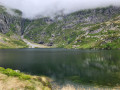

 Moderate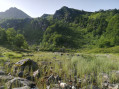
 Easy
Easy