Col de la Lau

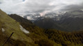
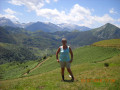
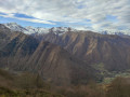
A lovely, shaded climb between Aulus and the foot of Mont Béas, culminating in a beautiful view of the neighbouring peaks.

Details

1104008
Creation:
Last update:
Last review:
  • Walking
    Activity: Walking
  • ↔
    Distance: 5.53 mi
  • ◔
    Average duration: 4h 50 
  • ▲
    Difficulty: Moderate

  • ⚐
    Back to start: Yes
  • ↗
    Ascent: + 2,592 ft
  • ↘
    Descent: - 2,592 ft

  • ▲
    Highest point: 4,984 ft
  • ▼
    Lowest point: 2,425 ft

Photos

Description of the walk

Access by road: in Aulus, park on the banks of the Garbet.

(S/E) From the roundabout, take the road towards the centre, then the second road on the left to reach the area below the church.

(1) Take the road downhill and the path that runs alongside the first house. The path passes through gardens, at the foot of the Fontaine de Curte (on your right). Follow this well-marked path through the woods. It leads to the Crambau valley and the Crambau stream.

(2) Follow this stream and wade through it until the valley narrows.

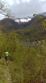
(3) The path runs along the right bank, climbing via two tight hairpin bends, and the steep ascent begins through the forest. Follow theGRP® signs carefully, as the path is poorly marked due to the leaves. The path emerges below Mont Béas into a high-altitude meadow and heads left to reach the ridge just above the Col de la Lau.

(4) Return via the same route to the car park on the banks of the Garbet (S/E).

Waypoints

  1. S/E : mi 0 - alt. 2,425 ft - Car park on the banks of the - Garbet (rivière)
  2. 1 : mi 0.24 - alt. 2,474 ft - Church junction
  3. 2 : mi 1.62 - alt. 3,478 ft - Crambau stream
  4. 3 : mi 1.98 - alt. 3,780 ft - Crossing on the right bank of the stream
  5. 4 : mi 2.77 - alt. 4,954 ft - Col de la Lau
  6. S/E : mi 5.53 - alt. 2,425 ft - Car park on the banks of the Garbet

Notes

The path follows theGRP® Tour du Val du Garbet.
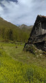
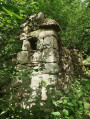
Old barns in varying states of repair, a few springs.
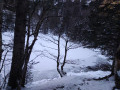
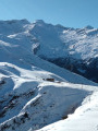
There may be a snowfield in the meadow, depending on the season.
Option to continue along theGRP® to the Col de Dret (views towards the Pic des Trois Seigneurs).
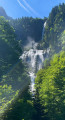
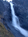
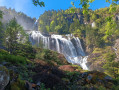
Views of the Ars waterfall (shortly after the village), the Fouillet waterfall and Mont Valier.
Varied flora at the foot of Mont Béas depending on the season (daffodils, thistles, spurge, gentian, milk-vetch, primroses).

Worth a visit

In Aulus:
Thermal baths with access.
Tree-top adventure course.
Tourist Office at the roundabout.
Bread shop, grocery shops.
Ars Waterfall.

Nearby:
Hers Lake.
Seix Castle.

Reviews and comments

4.7 / 5
Based on 3 reviews

Reliability of the description
4.7 / 5
Ease of following the route
4.7 / 5
Route interest
4.7 / 5
Rémy 09
Rémy 09

Overall rating : 4.7 / 5

Date of your route : Feb 19, 2025
Reliability of the description : ★★★★★ Very good
Ease of following the route : ★★★★★ Very good
Route interest : ★★★★☆ Good
Very busy route : No

A pleasant walk; the first hour of walking gives you a chance to warm up before the steep climb through the forest (so take care on the way down!). It is difficult to go much further than the pass due to numerous fallen trees blocking the path and lingering snow. To reach the Col Dret, which was our destination, it is best to set off from Ercé. The route is longer, but the path is wider and more pleasant.

Machine-translated

chespeel
chespeel

Overall rating : 5 / 5

Date of your route : Mar 29, 2023
Reliability of the description : ★★★★★ Very good
Ease of following the route : ★★★★★ Very good
Route interest : ★★★★★ Very good
Very busy route : No

A very pleasant walk up to point 2, which is relatively easy, but once you head into the woods there are lots of leaves, making the path more difficult and slippery in places; however, the view at the end is well worth it – it’s a real feast for the eyes. Best avoided in wet weather.

Machine-translated

Laetyz
Laetyz

Overall rating : 4.3 / 5

Date of your route : Jan 05, 2020
Reliability of the description : ★★★★☆ Good
Ease of following the route : ★★★★☆ Good
Route interest : ★★★★★ Very good

We completed the route in the morning in bright sunshine. The route was very well signposted, despite the leaves. When crossing the meadow before reaching the pass, there were scree and even a bit of ice in some shaded areas. At this point, it was difficult to see the markings; you have to cross this area and you’ll come to a rock where the markings are clearly visible again. At the pass, it was difficult to go any further due to fallen trees blocking the path and snowfields.

Machine-translated

Other walks in the area

For more walks, use our search engine .

The GPS track and description are the property of this route's author. Please do not copy them without permission.