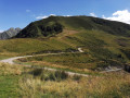
Cascade d'Ars et cascade du Fouillet

A circular walk starting from Aulus-Les-Bains towards the Ars waterfall and returning via the Fouillet waterfall.
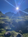
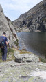
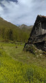
A very pleasant walk, through woodland for almost the entire route, with two magnificent waterfalls as a reward.
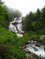
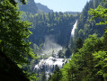
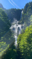
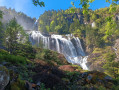
The majestic Ars waterfall is 246 metres high, cascading in three stages, with the middle section 60 metres wide.
The Fouillet Waterfall, though smaller in scale, is just as beautiful and impressive.

Details

4247293
Creation:
Last update:
Last review:
  • Walking
    Activity: Walking
  • ↔
    Distance: 8.87 mi
  • ◔
    Average duration: 7h 10 
  • ▲
    Difficulty: Difficult

  • ⚐
    Back to start: Yes
  • ↗
    Ascent: + 3,530 ft
  • ↘
    Descent: - 3,501 ft

  • ▲
    Highest point: 5,194 ft
  • ▼
    Lowest point: 2,503 ft

Photos

Description of the walk

Access via Aulus-Les-Bains: take the D8F towards Ustou, Col de Latrape and Waterfall d’Ars.
Cross the bridge over the River Garbet. The first car park is on the right after the first bend, followed by a second one at the top of the hill, at the start of the track.

(S/E) With your back to the road, set off south-east along the signposted track until you join the Piste du Fouillet.

(1) At the junction with the Piste du Fouillet, carry on straight ahead until you reach theGR®®10.

(2) Where the trail meets theGR®®10, carry on straight along it to the Pont d’Artigous.

(3) Cross the Pont d’Artigous and follow the right bank of the River Ars upstream to the foot of the middle waterfall.

(4) Viewpoint over the middle waterfall. Continue the climb to the upper waterfall.

(5) Viewpoint overlooking the upper waterfall. Continue the ascent to the top of the waterfall.

(6) Viewpoint overlooking the start of the waterfall. Follow the River Ars upstream to the footbridge.

(7) Cross the footbridge and continue to the right along theGR®®10, through the forest on the mountainside to a summer pasture area and a pass (at around 1,572 m).

(8) Caution: start of an area with avalanche couloirs. Continue along theGR®® 10.

(9) The Guzettou Pass and hut are situated slightly higher up on the left. End of the avalanche-prone area. Continue along theGR®®10to the Étang de Guzet (below on the left) and carry on straight ahead.

(10) Crossroads. Take the path on the left (GR®® 10) to the Plateau de Souliou.

(11) At the fork, continue left on theGR®® 10.

(12) At this other fork, continue left along theGR®®10to the Fouillet waterfall.

(13) Viewpoint over the Fouillet waterfall. Turn back to return to the previous fork.

(12) Leave theGR®®10on your right and carry on straight ahead on theGRP®® Tour du Val de Garbet, following the yellow and red markings. Pass the Cabane de Bazets and continue straight on, still following theGR®® P.

(14) At this crossroads, carry on straight ahead to the Aulus-Les-Bains road (D8F). Then turn right onto this road to reach the car park (S/E).

Waypoints

  1. S/E : mi 0 - alt. 2,503 ft - Car park. Near the - Garbet (rivière)
  2. 1 : mi 1.06 - alt. 3,123 ft - Crossroads at the Piste du Fouillet
  3. 2 : mi 1.23 - alt. 3,176 ft - Junction with the GR10
  4. 3 : mi 1.8 - alt. 3,471 ft - Artigous Bridge - Ars (rivière) - Affluent du Garbet
  5. 4 : mi 2.55 - alt. 4,249 ft - Middle waterfall
  6. 5 : mi 2.81 - alt. 4,511 ft - Upper waterfall
  7. 6 : mi 3.17 - alt. 4,869 ft - Start of the waterfall
  8. 7 : mi 3.25 - alt. 4,885 ft - Footbridge over the River Ars
  9. 8 : mi 3.34 - alt. 4,892 ft - Start of an area with avalanche couloirs
  10. 9 : mi 4.46 - alt. 5,141 ft - Guzettou Pass and Hut (on the left) - Cabanes de Guzet (1580m)
  11. 10 : mi 5.17 - alt. 4,508 ft - Crossroads
  12. 11 : mi 5.54 - alt. 4,216 ft - Souliou Plateau
  13. 12 : mi 6.11 - alt. 3,858 ft - Crossroads. Return journey to the Fouillet waterfall
  14. 13 : mi 6.55 - alt. 4,285 ft - Fouillet Waterfall - Ruisseau du Fouillet (rivière) - Affluent du Garbet
  15. 14 : mi 8.03 - alt. 3,219 ft - Crossroads
  16. S/E : mi 8.87 - alt. 2,503 ft - Car park

Notes

Completed on 24 October 2020 in 8 hours, including breaks, photos and time to enjoy the scenery.

In the mountains, the weather changes quickly. Be careful and plan ahead.

Average gradient of around 20 per cent, with some sections of ascent and descent reaching 50 per cent.

Please note:

  • The road leading to Aulus-Les-Bains via the Col d’Agnès is closed in winter. Check Inforoute31 for opening dates.
  • The path is crossed by countless streams flowing down the mountainsides, which you’ll need to wade across. Sometimes the water flows right alongside the path itself. Some sections may be impassable during the snowmelt. Check before setting off. Waterproof footwear is essential.
  • The path is stony, or covered with a layer of leaves of varying thickness, or muddy, or a combination of all three.
  • There is an avalanche-prone area between points (8) and (9). Check conditions before setting off. There is a sloping rock face to cross, about ten metres long.
  • Take care on the final stretch along the road leading to the car park.

Worth a visit

Always be cautious and plan ahead when you're outdoors. Visorando and the author of this route cannot be held responsible for any accidents occurring on this route.

The GR® and PR® markings are the intellectual property of the Fédération Française de Randonnée Pédestre.

Reviews and comments

4.8 / 5
Based on 13 reviews

Reliability of the description
4.9 / 5
Ease of following the route
4.7 / 5
Route interest
4.9 / 5
JM58
JM58

Hello,
Thank you for all this information.
For my part, I am posting the actual route taken, rather than the theoretical route based on the IGN map, in order to take into account all possible deviations.

Machine-translated

Aquacyclopode
Aquacyclopode

Good evening,
Without wanting to start an argument, and just to be thorough:
- admittedly, starting from Aulus does add a little to the distance. And a short return trip after the Fouillet waterfall as well. But no more than 2 km in my opinion.
- according to my watch, which I started after the Ars waterfall, it was 13.34 km.
- according to my wife's watch, it was 19 km in total.
After that, if no one has noticed any discrepancies with the distance displayed...
Best regards (and thank you for this very user-friendly website)

Machine-translated

Netra
Netra ★
• Edited:

Hello Aquacyclopode,

If you did not follow exactly the same route as the one suggested, you should not be surprised to find a different distance from the one displayed. If I understand your own route to join the GR10 correctly, it is indeed longer.

On Visorando, distances are calculated automatically using reliable software. The difference between the distance displayed and the distance recorded (by a watch, etc.) can therefore have several causes:

  1. The route on the hiking sheet is approximate.
  2. The recording on site contains errors (turns cut off, recording during a return trip off the route, turns around oneself, etc.) and the measuring tool is inaccurate (all measurements are subject to error).

I checked the route on Visorando and, sure enough, it wasn't perfect (quite a few turns were cut off). I adjusted the route manually: the distance went from 13.92 km to 14.27 km (an increase of 7%).

To test hypothesis (2) above, you would need to examine your track from your watch.

Machine-translated

JM58
JM58

Thank you for clarifying this.
Distances are calculated automatically by Visorando. You can contact them to report this discrepancy.

Machine-translated

Aquacyclopode
Aquacyclopode
• Edited:

Overall rating : 4.7 / 5

Date of your route : Aug 11, 2025
Reliability of the description : ★★★★★ Very good
Ease of following the route : ★★★★★ Very good
Route interest : ★★★★☆ Good
Very busy route : No

The advantage of this route is that it is mainly shaded and there are several water points to cool off. The downside is that there are no views of the peaks. In any case, it's a really nice walk.
Please note that the distance shown is much shorter than that recorded by our GPS watches. This is even though we left the village to go directly to the GR10 (the path along the river is nicer than the track).
Finally, there are no signs for access to the Fouillet waterfall (red and white cross on the access path).

Machine-translated

JM58
JM58

Thank you for these details.
I'm glad you enjoyed the walk.

Machine-translated

User 14745195

Overall rating : 4.7 / 5

Date of your route : May 26, 2025
Reliability of the description : ★★★★★ Very good
Ease of following the route : ★★★★☆ Good
Route interest : ★★★★★ Very good
Very busy route : No

Hike completed on 25/05/2025 – a lovely walk with two magnificent waterfalls at this time of year (I actually found the Fouillet waterfall more impressive than the one at Ars!). Between points 9 and 10, don’t hesitate to head down to the Etang de Guzet – it’s just a 5-minute walk away and a great spot for a picnic break. And between points 12 and 13, you need to go quite a way to see the Fouillet waterfall – don’t stop at the first small waterfall!
Elevation gain according to my barometric altimeter: +1,100 m, distance 15 km.

Machine-translated

JM58
JM58

Thank you for your comment. I’m delighted you enjoyed the walk.

Machine-translated

Daniel 81600
Daniel 81600

Overall rating : 5 / 5

Date of your route : May 18, 2025
Reliability of the description : ★★★★★ Very good
Ease of following the route : ★★★★★ Very good
Route interest : ★★★★★ Very good
Very busy route : Yes

A lovely route, easy up to the waterfall, but more challenging after that. Excellent instructions, very good GPS track.
Actual walking time: 6 hours 20 minutes plus a 1-hour break at Guzet Pond.
Elevation gain according to GPS: +1,100 m

Machine-translated

JM58
JM58

You’re welcome. I’m glad you enjoyed the walk.

Machine-translated

jc30150
jc30150

Overall rating : 5 / 5

Date of your route : May 12, 2025
Reliability of the description : ★★★★★ Very good
Ease of following the route : ★★★★★ Very good
Route interest : ★★★★★ Very good
Very busy route : Yes

Absolutely stunning!!!! The waterfall, with its early-spring flow, certainly lives up to its reputation. The rest of the route isn’t quite the same kind of countryside stroll. The path is rugged, typical of mid-mountain terrain, so you’ll need to switch from trainers to mid-cut trainers. I also loved it – it’s definitely for experienced walkers. Thank you for mapping out the route!

Machine-translated

JM58
JM58

Thank you for your comment and for suggesting an alternative.

Machine-translated

BARRABES
BARRABES
• Edited:

Overall rating : 4.7 / 5

Date of your route : Aug 17, 2024
Reliability of the description : ★★★★★ Very good
Ease of following the route : ★★★★☆ Good
Route interest : ★★★★★ Very good
Very busy route : Yes

A lovely walk in fine weather. The shaded route is a real bonus in hot weather. The Ars waterfall is as majestic as ever – we never tire of doing this route. After the Fouillet waterfall, we took a detour: at point 12, we returned to point 11 and made our way back to the car park via the clearly marked yellow trail. There are plenty of water points and springs along the route.

Machine-translated

Laplante cedric
Laplante cedric

Overall rating : 5 / 5

Date of your route : Aug 12, 2024
Reliability of the description : ★★★★★ Very good
Ease of following the route : ★★★★★ Very good
Route interest : ★★★★★ Very good
Very busy route : Yes

A lovely but challenging hike overall
The Ars waterfall is magnificent
And the climb up to the Fouillet Waterfall is very tough – be careful 💪

Machine-translated

JM58
JM58

I’m delighted that you enjoyed the walk and that you had a lovely day.

Machine-translated

Other walks in the area

For more walks, use our search engine .

The GPS track and description are the property of this route's author. Please do not copy them without permission.